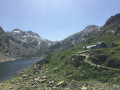
Bouillouses Dam – Refuge d’en-Beys

This is the first stage of the Petit Tour des Pérics. You’ll pass by the Camporells mountain hut and arrive at the En Beys mountain hut to spend the night. Get your cameras ready.

This walk is part of a multi-day hike: Petit tour des Pérics

Details

n°2555441
Creation:
Last update:
Last review:
  • Walking
    Activity: Walking
  • ↔
    Distance: 13.16 mi
  • ◔
    Average duration: 8h 30 
  • ▲
    Difficulty: Difficult

  • ⚐
    Back to start: No
  • ↗
    Ascent: + 2,762 ft
  • ↘
    Descent: - 2,900 ft

  • ▲
    Highest point: 8,540 ft
  • ▼
    Lowest point: 6,145 ft

Photos

Description of the walk

The route is well signposted. It follows a specific path and also utilises the route of several GR® trails.

(S) Take the GR®10, shared with theGRP® Tour des Pérics and Tour du Capcir routes, which runs along the western shore of Lac des Bouillouses. This is a very busy spot. Watch out for exposed roots caused by heavy foot traffic. Reach the far end of the lake. Continue along theGR® route, avoiding the path branching off to the right as the ground is marshy.
Head to the junction at the edge of the marsh.

(1) Leave theGR®10here, which heads off to the left. Keep to the right on theGRP® marked in red and yellow. You’ll come to several footbridges and then the GRP® junction.

(2) As you come off thesecond footbridge, turn left. Continue along the sharedGRP® path until you reach the junction of paths at the Cabane de la Balmeta.

(3) Take the path heading due north, opposite the hut. The climb is fairly gentle. The landscape consists of small woodlands, with numerous small ponds. You’ll reach the largest of these, the Estany de l’Anec.

(4) Continue northwards along theGRP®. After a virtually flat stretch, you’ll reach a series of ponds: the Estany de la Basseta, followed by the Estany del Mig, on the banks of which stands the Camporells Refuge.

(5) Resume the path, walking alongside the ponds. The path climbs gently. You’ll reach a Y-junction marking the split between the two GRP® routes.

(6) Turn left to follow the GRP® Tour des Pérics. The path on the right is the Tour du Capcir. Continue across the grassy areas.

(7) Continue climbing due west, cross the Rec de Peira Escrita stream, and make a wide circular loop to the right to reach the summit of Pic de Mortiers, the highest point of the walk.

(8) Follow the ridge due north to the Puig de Terrers.

(9) Begin the descent to reach the Coll de Terrers.

(10) At the signpost, turn left. Continue the descent, which is steep, long and challenging, but made pleasant by the well-marked zigzagging path down the slope. Pass the Jasses, first the Espagnols and then the Deça. Reach the Jasse de delà hut and its welcome water source.

(11) Stay on theGRP® at all times, crossing the Ruisseau de Grande Porteille. Continue along an almost flat path. Pass the hamlet of Costes de Boulaxes or Passage de Mortés. Further on, you’ll reach a Y-junction where theGRP® joins theGR®7.

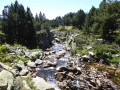
(12) Take the left-hand path, which soon leads to the River Oriège.

(13) Carry on to reach the Étangs d’en Beys and the refuge of the same name (E).

Waypoints

  1. S : mi 0 - alt. 6,558 ft - Refuge des Bouillouses
  2. 1 : mi 2.13 - alt. 6,719 ft - GR-GRP junction
  3. 2 : mi 2.91 - alt. 6,854 ft - Footbridge
  4. 3 : mi 3.45 - alt. 6,942 ft - Refuge de la Balmetta
  5. 4 : mi 4.41 - alt. 7,346 ft - Estany de l'Anec
  6. 5 : mi 6.27 - alt. 7,365 ft - Refuge des Camporells
  7. 6 : mi 7.12 - alt. 7,625 ft - Junction of the two GRP trails
  8. 7 : mi 7.73 - alt. 8,048 ft - Viewpoint
  9. 8 : mi 8.49 - alt. 8,540 ft - Pic de Mortiers
  10. 9 : mi 9.29 - alt. 8,320 ft - Puig de Terrers
  11. 10 : mi 9.56 - alt. 7,881 ft - Col ou Coll de Terrers (2407m)
  12. 11 : mi 11.41 - alt. 6,444 ft - Jasse de delà
  13. 12 : mi 12.63 - alt. 6,227 ft - Junction with the GR7
  14. 13 : mi 12.94 - alt. 6,440 ft - Oriège (rivière)
  15. E : mi 13.16 - alt. 6,447 ft - Refuge d'en Beys

Notes

Equipment for a challenging hike: boots, walking poles. You can limit the amount of water you carry. Replenishing your water supply is not a problem. There are numerous streams and water sources all along the route. However, do bring water purification equipment.
Above all, don’t forget a camera or a pair of binoculars.
A more relaxed option is to set off in the afternoon and spend the night at Camporells, then a second night at En-Beys. This allows you to take more time to admire these beautiful landscapes.
Personally, I preferred to camp. Please be aware of regulation R43. This allowed me to see animals that do not come near the mountain huts.
Half-board accommodation is available at the Camporells and En Beys mountain huts, but you must book your place for meals in advance. Further information is available on the website

Camporells Mountain Hut: 06 82 12 99 22

En Beys Refuge: see dedicated website. Tel: 05 61 64 24 24; Email: info@refuge-enbeys.com
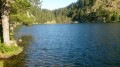
This refuge is quite busy and is situated on the shores of a lake. Anglers often gather there. The warden brought out his binoculars to show us chamois grazing on the opposite slope. It is possible to camp near the refuge, but also further away, at the far end of the lake where grassy meadows provide a place to spend the night.

Camping next to the refuges is possible and recommended.

Other, more basic shelters and huts can be found along the route.

This route passes through a protected area, which may be subject to special regulations:

Worth a visit

R43 Catalan Pyrenees Regional Nature Park. Regulations on camping and wild camping.
Wild camping is prohibited in all nature reserves and designated sites within the Catalan Pyrenees Regional Nature Park.
Bivouacking is permitted around the mountain huts and along theGR® routes. It allows you to get closer to the wildlife near the many small lakes along the route. In the evening, you may come across herds of stags and does coming to drink.
If you keep a sharp eye out, you may spot marmots or chamois on the nearby slopes.

(3) Balmeta Hut: There is a table and benches outside for having a bite to eat.
(5) Camporells Refuge. A warm welcome from the warden. She bakes blueberry tarts. There is a designated area for camping. The view overlooks a lake and the Petit Péric. The landscape really makes you want to stay there.
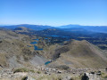
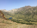
(Between 6 and 8) Don’t hesitate to leave the path to get closer to the ridge and enjoy a magnificent view of the Camporells forest, with the ponds below and the Pérics to the right.
(Between 8 and 9) From the ridge, enjoy a lovely view of the lenticular ‘Diable’ pond on your right.
(9) The Puig de Terrers is dotted with solar panels. Magnificent view over the Orlu valley and the easily recognisable Dent d’Orlu.
There are numerous ponds along the route. Don’t hesitate to take a detour to see them.
The route often runs through open terrain, offering unobstructed views. At the end of June, there is still snow on the route and on the surrounding peaks. This adds to the beauty of the landscape.
However, this snow can also hide the signposts and force you to take detours. This was the case on this hike. That is why my route does not follow the IGN map exactly.

Always be cautious and plan ahead when you're outdoors. Visorando and the author of this route cannot be held responsible for any accidents occurring on this route.

The GR® and PR® markings are the intellectual property of the Fédération Française de Randonnée Pédestre.

Reviews and comments

5 / 5
Based on 1 review

Reliability of the description
5 / 5
Ease of following the route
5 / 5
Route interest
5 / 5
tetram333
tetram333

Overall rating : 5 / 5

Date of your route : Jun 27, 2020
Reliability of the description : ★★★★★ Very good
Ease of following the route : ★★★★★ Very good
Route interest : ★★★★★ Very good
Very busy route : No

Varied scenery, well-signposted trails.
It was brilliant – thanks for the route

Machine-translated

Other walks in the area

For more walks, use our search engine .

The GPS track and description are the property of this route's author. Please do not copy them without permission.