


Refine your search for walks in Refuge de Basse Rua
Refuge de Basse Rua walks


 Val d'Escreins from Guillestre
 Visorando Member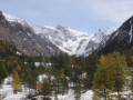
 9.38 mi
 +2,490 ft
 -2,490 ft
 6h 30
6h 30
 Moderate
 Departure from Guillestre (Hautes-Alpes)
A pleasant trail nestled at the bottom of a gorge running alongside the Rif Bel leads to the heart of a valley. Until 1880, this trail was the only direct access between Guillestre and the hamlets of the Val d'Escreins, before the road from Vars was built.
Tour de la Font Sancte
28.82 mi
+12,621 ft
-12,648 ft
3 days
 Difficult
Departure from Ceillac (Hautes-Alpes)
Difficult
Departure from Ceillac (Hautes-Alpes)
Recently created, this 3-day tour connects three valleys well known to all hikers: the Cristillan valley in Queyras, the Rif Bel valley in Val d'Escreins and finally the Ubaye valley.
 Very difficult
 Walks near Refuge de Basse Rua
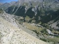
Ceillac - Maljasset
 8.18 mi
+3,694 ft
-2,799 ft
7h 00
Difficult
Departure from Ceillac (Hautes-Alpes)
8.18 mi
+3,694 ft
-2,799 ft
7h 00
Difficult
Departure from Ceillac (Hautes-Alpes)
A stage of the Queyras Alpine crossing to reach the Haute Ubaye Valley, including a section via Lake Sainte-Anne and the Col Girardin.
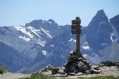
Ceillac - Saint Véran
 7.82 mi
+4,321 ft
-3,045 ft
7h 20
Moderate
Departure from Ceillac (Hautes-Alpes)
7.82 mi
+4,321 ft
-3,045 ft
7h 20
Moderate
Departure from Ceillac (Hautes-Alpes)
The third stage is entirely on theGR®58, heading towards the rising sun.
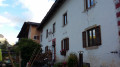
Ceillac – Saint-Véran
 8.54 mi
+4,252 ft
-2,986 ft
7h 40
Difficult
Departure from Ceillac (Hautes-Alpes)
8.54 mi
+4,252 ft
-2,986 ft
7h 40
Difficult
Departure from Ceillac (Hautes-Alpes)
A good warm-up for thisfirst stage. Thefirst pass is the Col des Estronques, followed by a round trip to the nearby summit of the Tête de la Jacquette, where an exceptional panorama awaits you, taking in the Pics de la Font Sancte, the Aiguille de Chambeyron, the Bric de Rubren, the Peouvou and, to the north, the Grand Glaiza and the Rochebrune.
Ceillac - Le Cros
6.30 mi
+3,386 ft
-2,585 ft
5h 50
Difficult
Departure from Ceillac (Hautes-Alpes)
This is the fourth and final stage of this journey between Queyras (05) and Ubaye (04). Passing through the Col des Estronques brings you back to the starting point in the hamlet of Cros.
From Ceillac to Fouillouse
 13.37 mi
+4,452 ft
-4,216 ft
10h 00
Difficult
Departure from Ceillac (Hautes-Alpes)
13.37 mi
+4,452 ft
-4,216 ft
10h 00
Difficult
Departure from Ceillac (Hautes-Alpes)
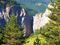
This fifteenth stage crosses the Escreins massif (not to be confused with the Écrins massif) and, via the Ubaye valley, enters the Chambeyron valley. From the Refuge de la Cime, the route—off the GR®5—crosses the Torrent du Mélezet valley and climbs up the Pré Girardin valley via the ski runs; then, on the plateau, it skirts the rocky ridge overlooking Lac Miroir, reaches the lake and rejoins the GR®5. The route climbs up the valley between the shoulder of the Pic des Heuvières and the Crête de Coste Belle, passing the small pass of Sainte-Anne and then the lake of the same name before reaching the Col Girardin. It descends towards a basin, where the Torrent des Séchoirs has its source, and follows it. Clinging to the side of a steep slope, it joins the D25 road in the upper Ubaye valley and continues downstream, alternating between the road and paths close to the river. It leaves the D25 for the Fouillouse road, passes the vertiginous Pont du Châtelet, a tunnel and, via a path, reaches the hamlet of Fouillouse.
Maljasset - Ceillac
9.92 mi
+3,320 ft
-4,242 ft
7h 25
Difficult
Departure from Saint-Paul-sur-Ubaye (Alpes-de-Haute-Provence)
The passage between the two departments of Alpes de Haute Provence and Hautes Alpes is via the famousGR®5, which supports theGRP® of the Tour de la Font Sancte on this section.
Trek around Chambeyron Mountain Range (4) Maljasset - Refuge Campo Base
 9.28 mi
+2,408 ft
-3,304 ft
6h 20
Difficult
Departure from Saint-Paul-sur-Ubaye (Alpes-de-Haute-Provence)
9.28 mi
+2,408 ft
-3,304 ft
6h 20
Difficult
Departure from Saint-Paul-sur-Ubaye (Alpes-de-Haute-Provence)
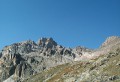
Quite a long stage but a steady route. A climb up to Col de Mary then a long downhill hike all the way to the shelter, in Chiaperra, Italy.
Maljasset - Ceillac
 7.50 mi
+2,808 ft
-3,678 ft
5h 55
Difficult
Departure from Saint-Paul-sur-Ubaye (Alpes-de-Haute-Provence)
7.50 mi
+2,808 ft
-3,678 ft
5h 55
Difficult
Departure from Saint-Paul-sur-Ubaye (Alpes-de-Haute-Provence)
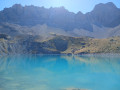
Return to Queyras by crossing the Col Girardin via a path that starts off quite steep but then levels out before ending with large hairpin bends that finish at the pass. This is followed by a long descent past the lakes, which reflect the famous Font Sancte, the highest point in Queyras.
Maljasset - Larche
15.60 mi
+4,199 ft
-4,898 ft
10h 50
Difficult
Departure from Saint-Paul-sur-Ubaye (Alpes-de-Haute-Provence)
Etape de la traversée des Alpes à partir du hameau de Maljasset qui suit la route de la Haute Ubaye avec une vue époustouflante sur les sommets qui bordent le flanc sud du Queyras. Traversée de la Haute Ubaye dans un univers minéral parmi les sommets de plus de 3000m.
Furfande – Souliers
 11.69 mi
+2,339 ft
-3,858 ft
7h 25
Difficult
Departure from Arvieux (Hautes-Alpes)
11.69 mi
+2,339 ft
-3,858 ft
7h 25
Difficult
Departure from Arvieux (Hautes-Alpes)
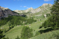
This walk, starting from the Furfande refuge, will take you past the magnificent barns and chalets of Furfande and lead you along a path running along a ridge above the Queyras valley, where the River Guil winds its way through, then on to Souliers via an ascent from the hamlet of Les Moullins in the Arvieux valley.