Avérole refuge - Cabane des Bergers via the Pas de la Mule

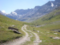
Loop via the Avérole refuge above the hamlet of the same name, then an excursion in the fairly wild Lombarde valley to the Pas de la Mule. From the Cabane des Bergers, the return via the balcony offers a beautiful view of the valley and the refuge.

Details

373188
Creation:
Last update:
Last review:
  • Walking
    Activity: Walking
  • ↔
    Distance: 9.05 mi
  • ◔
    Average duration: 6h 20 
  • ▲
    Difficulty: Difficult

  • ⚐
    Back to start: Yes
  • ↗
    Ascent: + 2,451 ft
  • ↘
    Descent: - 2,425 ft

  • ▲
    Highest point: 7,979 ft
  • ▼
    Lowest point: 5,971 ft

Photos

Description of the walk

From the village of Bessans, take the D902 road towards Bonneval-sur-Arc. At the "La Bessannaise" holiday centre, take the road on the right towards La Goulaz and Les Vincendières. Park in the car park at the entrance to the hamlet of Les Vincendières.

(S/E) Continue towards the hamlet of Les Vincendières. Go about 150 metres past it and leave the road. Take the path on the left, which runs alongside the road and rejoins it further up. The path starts again on the right a little further below, passes in front of an oratory and joins the hamlet of Avérole.

(1) Continue along the track on the right, which starts at the Oratoire Sainte-Thérèse, below the Chapelle Saint-Pierre. Follow it to the Plan du Pré, where the gorge narrows. Climb up the path on the left, which leads to the Refuge d'Avérole.

(2) Descend towards Plan de Revallon via the path that curves to the right. It heads east, then crosses the Ruisseau du Veilet on a footbridge and continues towards the Vallon de la Lombarde. Before the torrent, turn left to climb towards the Pas des Eublats (before the last rocky outcrop).

(3) Follow the path, which climbs a little more to pass another rocky outcrop, then approaches the torrent. Follow the torrent to the footbridge at Pas de la Mule.

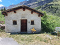
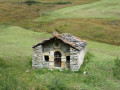
(4) Cross the stream and climb up opposite to reach the Cabane des Bergers.

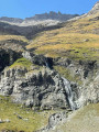
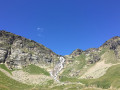
(5) Head back down the valley on the left bank of the stream. The trail gradually descends and passes under the Cascade de la Lombarde waterfall.

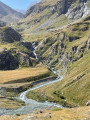
(6) Continue climbing towards the Oratoire Saint-Antoine-de-l'Envers. Enjoy the view of the Refuge de l'Avérole, the valley, the Glacier d'Arnès and the Ouille d'Arbéron.

(7) The descent becomes steeper but is not difficult. Reach the flat area at the bottom of the slope.

(8) Leave the start of the trail to the torrent on your right and head left. The trail overlooks a track that you will join towards the Fenêtre de l'Île (an EDF tunnel with cool air coming out of it).

(9) Follow the path on the left bank of the Torrent d'Avérole. This crosses the various Chalanches (area of serac falls from the Charbonnel Glacier) and then joins a track. Follow it, ignore a path on the right and continue to the next crossroads.

(10) Cross the Torrent d'Avérole on the bridge and rejoin the road you took at the start. Continue downhill for a few metres to reach the Vincendières car park (S/E).

Waypoints

  1. S/E : mi 0 - alt. 5,971 ft - Vincendières car park
  2. 1 : mi 1.48 - alt. 6,535 ft - Hamlet of Avérole
  3. 2 : mi 2.94 - alt. 7,254 ft - Avérole refuge
  4. 3 : mi 3.53 - alt. 7,241 ft - Pas des Eublats
  5. 4 : mi 4.82 - alt. 7,759 ft - Pas de la Mule footbridge
  6. 5 : mi 4.99 - alt. 7,979 ft - Shepherds' hut
  7. 6 : mi 5.8 - alt. 7,310 ft - Lombarde waterfall
  8. 7 : mi 6.18 - alt. 7,497 ft - Oratory of Saint-Antoine-de-l'Envers
  9. 8 : mi 6.77 - alt. 6,831 ft - On the left
  10. 9 : mi 7.09 - alt. 6,677 ft - Window of the Island
  11. 10 : mi 8.87 - alt. 5,991 ft - Bridge over the Torrent d'Avérole
  12. S/E : mi 9.05 - alt. 5,971 ft - Vincendières car park

Notes

(4) Please note that outside the season, the Pas de la Mule footbridge is removed. Information is available from the Haute Maurienne Tourist Office.

At (8), continuing towards the torrent, you can reach the other bank via a footbridge under the Plan du Pré.

Alternative: return trip only to the Refuge d'Avérole, approximately 3 hours.

You can take a shuttle bus (July and August) to the hamlet of Avérole, saving an hour's walk. This is ideal for children as the refuge is then only a 45-minute walk away.

Avérole refuge

I chose to do the hike in this direction because the light is better in the afternoon and so is the view.

Reviews and comments

4.5 / 5
Based on 27 reviews

Reliability of the description
4.4 / 5
Ease of following the route
4.5 / 5
Route interest
4.7 / 5
shapiro
shapiro

Overall rating : 4.3 / 5

Date of your route : Sep 14, 2025
Reliability of the description : ★★★★☆ Good
Ease of following the route : ★★★★☆ Good
Route interest : ★★★★★ Very good
Very busy route : No

A circular hike starting from the village of Avérole, taking 5½ hours at a leisurely pace with stops.
Generally not very difficult, with few steep sections, but with a few tricky passages and quite a few kilometres.
After the point (3), at elevation 2214 on the IGN map, be sure to follow the white-red markings (in particular, a sharp right turn to climb up the rock face, which is quite easy to miss).

Machine-translated

maryvonnefaure
maryvonnefaure

Overall rating : 4.7 / 5

Date of your route : Jul 28, 2025
Reliability of the description : ★★★★★ Very good
Ease of following the route : ★★★★☆ Good
Route interest : ★★★★★ Very good
Very busy route : Yes

Very busy up to the Avérole refuge

Machine-translated

User 21987085

Overall rating : 5 / 5

Date of your route : Jul 10, 2025
Reliability of the description : ★★★★★ Very good
Ease of following the route : ★★★★★ Very good
Route interest : ★★★★★ Very good
Very busy route : No

A very beautiful hike with some magnificent landscapes and beautiful waterfalls. For parking, continue past La Goulaz for about a kilometre. The car park shared with the shuttle bus is on the right. No notable difficulties. On the return trip on the left bank of the stream from the shepherd's hut, the hike crosses La Lombard, where Emmanuelle's herd grazes, watched over by four sheepdogs. The rules to follow are posted at the hut.

Machine-translated

User 7588446

Overall rating : 4.3 / 5

Date of your route : Jun 26, 2025
Reliability of the description : ★★★★★ Very good
Ease of following the route : ★★★★★ Very good
Route interest : ★★★☆☆ Average
Very busy route : No

Easy to park, but stop before the hamlet of Les Vincendières as parking is prohibited for non-residents.
We didn't do the whole loop; we walked along the riverbank on the hamlet side on the way there, climbed up to the refuge and then came back down the same path (before the storm, luckily). For the climb, there is a sign indicating an easy side and a difficult side. We opted for the easy route. On the way back, we took the other bank, which is certainly prettier as it is in the forest with beautiful vegetation. However, there were mudslides last year and there are several relatively tricky sections due to the presence of snowfields. Blue dots have been added to rocks/stones to indicate the route. We sometimes followed them and sometimes didn't to avoid the sloping scree as much as possible. The end of the route isn't very pleasant because the landscape has been destroyed by bad weather.

Machine-translated

Guillaume74
Guillaume74
• Edited:

Overall rating : 5 / 5

Date of your route : Jul 20, 2024
Reliability of the description : ★★★★★ Very good
Ease of following the route : ★★★★★ Very good
Route interest : ★★★★★ Very good
Very busy route : No

Thanks for this review!

Hike completed on 20/07/2024.
Very comprehensive and accurate guide, no risk of error, no technical difficulties.
Very beautiful hike, especially from the Avérole refuge.
A bit crowded up to the refuge, but almost no one after that.
you can fill your water bottle at the refuge.
The footbridge at the Pas de la Mule is still there and in good condition.
A very pleasant hike, accompanied by the whistles of marmots and magnificent views of the torrent throughout the hike, as well as the magnificent waterfall, which was full of water this year.
Towards the end of the loop, the path has been washed away in places by mudslides or flooding, but it is always easy to find the way forward.

Machine-translated

dede53
dede53
• Edited:

Overall rating : 4.3 / 5

Date of your route : Aug 12, 2023
Reliability of the description : ★★★★☆ Good
Ease of following the route : ★★★★☆ Good
Route interest : ★★★★★ Very good
Very busy route : No

A beautiful hike interrupted by a night at the Avérole refuge, which is peaceful and offers good food and a friendly warden who asks you what your plans are. Departure at 8:30 a.m. with a climb that stays in the shade until you reach the footbridge, which is very welcome in summer. The descent sometimes offers several paths that always come together (take the lower ones if in doubt). No vertiginous passages. We enjoyed the magnificent scenery. Thank you

Machine-translated

annasteeljo
annasteeljo

Overall rating : 5 / 5

Date of your route : Aug 24, 2023
Reliability of the description : ★★★★★ Very good
Ease of following the route : ★★★★★ Very good
Route interest : ★★★★★ Very good
Very busy route : No

Hello, and first of all, thank you very much for posting this hike with such precision.
Very beautiful route.
No difficulties in either direction.

Machine-translated

cathycoco
cathycoco

Overall rating : 5 / 5

Date of your route : Jul 02, 2023
Reliability of the description : ★★★★★ Very good
Ease of following the route : ★★★★★ Very good
Route interest : ★★★★★ Very good
Very busy route : No

very nice hike, follow the directions and stay on the left bank
to do

Machine-translated

michel_tissot@orange.fr

we haven't left yet; we'll be going in July.
thank you very much, Michel Tissot

Machine-translated

randonnee 2015
randonnee 2015

Overall rating : 4.3 / 5

Date of your route : Aug 23, 2022
Reliability of the description : ★★★★☆ Good
Ease of following the route : ★★★★☆ Good
Route interest : ★★★★★ Very good
Very busy route : No

We did the loop in the direction of Refuge Aveirole/Pas de la Mule/Cabane du Berger. A bit challenging in places, but a great walk.

Machine-translated

JPC07
JPC07

Overall rating : 4.7 / 5

Date of your route : Jul 26, 2022
Reliability of the description : ★★★★★ Very good
Ease of following the route : ★★★★★ Very good
Route interest : ★★★★☆ Good
Very busy route : Yes

A very beautiful hike, rightly classified as difficult, which should be done in the direction indicated. However, as stated in the practical information at the end of the description, at point 8, return to the right bank. The left bank does offer a beautiful view, albeit somewhat obscured by vegetation, of the hamlet of AVÉROLE, but it is very long, stony, dotted with uphill sections and, moreover, rather poorly signposted.
Otherwise, it was a very nice day!

Machine-translated

Dédé M
Dédé M

Overall rating : 4.3 / 5

Date of your route : Jul 28, 2022
Reliability of the description : ★★★★☆ Good
Ease of following the route : ★★★★☆ Good
Route interest : ★★★★★ Very good
Very busy route : No

Superb walk
I'll be back

Machine-translated

Astrance69
Astrance69

Overall rating : 5 / 5

Date of your route : Jun 23, 2022
Reliability of the description : ★★★★★ Very good
Ease of following the route : ★★★★★ Very good
Route interest : ★★★★★ Very good
Very busy route : No

Very nice hike. 737 m elevation gain - 15.13 km; 3 footbridges in very good condition and securely fastened
Ascent on the right bank and descent on the left bank.
The trail passes by the Avéroles refuge, which had been open for two days. The trail is well marked with GR signs and there are also a few cairns. Very nice trail, no difficulties. Cross the footbridge at the Pas de la Mule, quite a long way from the refuge. After the footbridge, on the left, the GR continues towards the Col Autaret. Avoid this. Head up to the right, following the yellow markings, towards the shepherds' hut. We had rain from there for quite a while. The trail is fairly well marked but you need to stay alert to keep your bearings. There are few yellow markings. After the Saint Antoine oratory, the descent is steeper but not difficult. Magnificent view of the refuge and the valley. At the bottom of the descent, there is a possible fork with a wide footbridge equipped with a guardrail allowing you to return to the right bank if you wish. The descent time to the car park is 50 minutes regardless of whether you choose the right or left bank. The path on the left bank is more varied than the right bank. A final footbridge takes you to the Vincendières car park on the right bank.

NB: Follow the route suggested by the author of this hike for the best views and an easier climb

Machine-translated

fberinger
fberinger
• Edited:

Overall rating : 4.3 / 5

Date of your route : Aug 23, 2021
Reliability of the description : ★★★★☆ Good
Ease of following the route : ★★★★☆ Good
Route interest : ★★★★★ Very good
Very busy route : Yes

The first part is on a dirt track, then you end up on a nicer path.
I've provided a detailed description because we had questions at several points and the description didn't always help us. Without the map, we would have had a hard time:
- to cross the hamlet of Avérole at point 1, as there are too many names that are not necessarily written down on site (there are no signs). It would have been simpler to just say: stay on the path that passes below the church to cross the hamlet.
- at the refuge, follow the signs towards the Pas de la Mule.
- Be careful after crossing the Arnés stream between points 2 and 3: take the path that goes straight ahead (left) towards an uphill section and do not follow the path to the right (easier) that crosses the meadow towards the Révallon plateau (we got a little lost).
At point 3, there is a beautiful path that continues towards the torrent. Be careful, there is a footbridge (no sign) before the Pas de la Mule, do not take it. You know you are at the Pas de la Mule when you see the shepherd's hut above you.
The return journey is straightforward.
One last thing: the hike is closer to 16.5 km than the 14.5 km advertised.

Machine-translated

PHGASSE71
PHGASSE71

Overall rating : 4.3 / 5

Date of your route : Aug 10, 2021
Reliability of the description : ★★★★☆ Good
Ease of following the route : ★★★★☆ Good
Route interest : ★★★★★ Very good
Very busy route : No

We left Bessans in the morning to reach the Avérole refuge. It was quite busy but had a friendly atmosphere. The weather was beautiful. The next day we set off for the Col de L'Autaret. We followed the Lombarde torrent to the footbridge, then to the shepherds' hut where we were warned that we had to go around a herd of 1,500 animals. Climbing up to the Pas de la Mule, we came across a herd on our side of the river, guarded by two rather unfriendly Anatolian shepherds. We took a detour above the torrent, which cost us about an hour. After reaching the Col de l'Autaret, we descended along the torrent, but unfortunately too low, and missed the footbridge and had to cross the torrent. We left one of our rucksacks there, which we managed to retrieve a little further down, soaking wet. The buzzards installed to help cross the torrent need to be better signposted on the descent, as many of us went the wrong way. We went back down below the Pas des Eublats to rejoin the path back along the left bank a little after the waterfall. And we arrived in Bessans. In total, we walked for about 10 hours that day.
It was still a very beautiful hike that we would recommend.

Machine-translated

Other walks in the area

For more walks, use our search engine .

The GPS track and description are the property of this route's author. Please do not copy them without permission.