Country:

 City:
City:


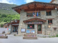
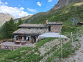
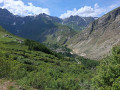
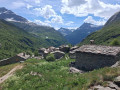
The start of the circular route is at a car park in the village of Bonneval-sur-Arc. To get there, take the D902 towards the Col de l’Iseran, and, at the bend near the Tourist Office and the Post Office, turn right onto the Route du Tralenta. The car park is at the end of the small road, about 500 metres away.
(S/E) Walk back down the Route du Tralenta to the Tourist Office, just before the D902 pass road.
(1) Turn left onto the small road leading downhill, Rue des Moulins. Pass the equipment warehouses and continue over the bridge spanning the Arc.
(2) At the ‘Pont de Pautaz’ signpost, leave the road as it curves to the left and take the path branching off to the right towards the Glières farm buildings. Just before the buildings, turn onto the narrow path that winds its way uphill; take care not to lose it as it is not signposted. This is the most difficult part of the route. Note that there is a slightly tricky section equipped with cables and rungs, but it is not particularly difficult. Afterwards, the path tends to widen and become easier going. There may be a few muddy patches depending on the weather and the presence of livestock. You’ll reach the Andagne chairlift station.
(3) Carry on and you’ll soon reach the Refuge du Criou.
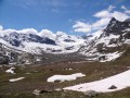
(4) You can have a drink and take a short break here. Walk past the refuge on the right and stay on the track which curves to the south-east. After a left-hand bend, the track heads north-east along the mountainside, almost flat, and leads directly to the hamlet of L’Écot, overlooking the River Arc. You’ll cross numerous streams and, at times, flooded areas – particularly in spring… sometimes you’ll have to get your feet wet!
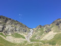
(5) Pass a small waterfall, then reach the signpost at La Roche du Planers.
(6) Ignore the path leading to the Refuge des Évettes and continue straight ahead along the track, which descends and curves to the left, until you reach the Pont Saint-Clair.
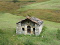
(7) Turn right onto this path and cross the Arc to reach the right bank. Then take the first path on the left and head for the Chapelle Sainte-Marguerite.
(8) You can take a break in the shade of the chapel. Continue downhill, cross the village and carry on along the Sentier des Agneaux to the junction near the Pont de la Lama.
(9) Turn left onto the path to reach the stone bridge and admire the waterfall on one side and, on the other (leaning out carefully), the effects of erosion on the rocks. Access to the riverbanks is strictly prohibited.
(10) Turn back and return to the previous fork in the path.
(9) Continue along the path to the left, cross a scree slope followed by a section through the undergrowth, and head straight to the car park on Route du Tralenta (S/E).

 Visorando Member
 Difficult