


Refine your search for walks in Bayasse
Bayasse walks


 Cime de la Plate and Lacs de la Braissette
 Visorando Member
 9.98 mi
 +4,091 ft
 -4,091 ft
 8h 10
8h 10
 Difficult
 Departure from Uvernet-Fours (Alpes-de-Haute-Provence)
A beautiful hike in a wild environment, with no technical difficulties despite 50% of the route being off-trail. Orientation is not a problem either, despite the few cairns along the route; just follow the contours of the terrain and the streams at the edge of the meadows.The Visorando app may be useful.
Walks near Bayasse
From Restefond to Sestrière via Cime de la Plate and Col de la Braïssa
 8.53 mi
+2,067 ft
-3,399 ft
5h 45
8.53 mi
+2,067 ft
-3,399 ft
5h 45
 Moderate
Departure from Jausiers (Alpes-de-Haute-Provence)
Moderate
Departure from Jausiers (Alpes-de-Haute-Provence)
A very beautiful high-mountain hike at the foot of Cime de la Bonette between the Alpes Maritimes and Alpes de Haute Provence. Very little traffic. Magnificent, rocky landscape. The upper Braissette lake is a very beautiful spot for bivouacking.
Col de la Cayolle – Lac d’Allos Mountain Hut
 4.49 mi
+1,204 ft
-1,312 ft
3h 05
Moderate
Departure from Uvernet-Fours (Alpes-de-Haute-Provence)
4.49 mi
+1,204 ft
-1,312 ft
3h 05
Moderate
Departure from Uvernet-Fours (Alpes-de-Haute-Provence)
A climb to a pass, followed by a descent of roughly the same length, with two beautiful lakes to admire. This walk also gives you the chance to compare the two sides of the mountain, which are quite different.
Mont Pelat - Allos via Le Cimet
 13.63 mi
+2,405 ft
-7,661 ft
8h 20
13.63 mi
+2,405 ft
-7,661 ft
8h 20
 Very difficult
Departure from Allos (Alpes-de-Haute-Provence)
Very difficult
Departure from Allos (Alpes-de-Haute-Provence)
Second part of the circular. This second stage will take you to the village of Allos, starting from Mont Pelat, via the Trou de l'Aigle, the Cimet and its many waterfalls, including the Cascade du Pich and the Bois de Vacheresse.
Refuge de la Cantonnière – Col de la Cayolle
 3.32 mi
+1,677 ft
-351 ft
3h 00
Moderate
Departure from Entraunes (Alpes-Maritimes)
3.32 mi
+1,677 ft
-351 ft
3h 00
Moderate
Departure from Entraunes (Alpes-Maritimes)
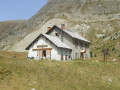
A climb that offers views of different levels of the mountain: meadows, coniferous forest and alpine pastures.
From the Refuge de la Cantonnière to the Refuge de la Cayolle via the Col de la Boucharde
 6.90 mi
+2,874 ft
-1,503 ft
5h 40
Moderate
Departure from Entraunes (Alpes-Maritimes)
6.90 mi
+2,874 ft
-1,503 ft
5h 40
Moderate
Departure from Entraunes (Alpes-Maritimes)
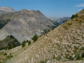
This route from the Refuge de la Cantonnière to the Refuge de la Cayolle via the Col de la Boucharde is the first day of a three-day route in the Haut-Var. After a shaded climb alongside the Ruisseau de Sanguinière, the route ascends the Ravin de la Boucharde before descending to the Bachelard after crossing the pass. You then need to follow the left bank of the Bachelard back up to the Refuge de la Cayolle, where you will spend the night.
Lac d’Allos – Tête de Valplane – La Cluite car park
 4.56 mi
+1,306 ft
-2,707 ft
3h 15
Moderate
Departure from Allos (Alpes-de-Haute-Provence)
4.56 mi
+1,306 ft
-2,707 ft
3h 15
Moderate
Departure from Allos (Alpes-de-Haute-Provence)
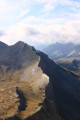
Alternative route to reach the Cluite car park from the Lac d’Allos refuge. The route passes via the Tête de Valplane, which offers breathtaking views of Lac d’Allos, the Cirque de l’Encombrette and the valley leading to Colmars. You are in the Mercantour National Park; there are regulations to be observed, and failure to do so may result in a fine of up to €1,500 – see the practical information.This route takes you off the marked trails; please read the reviews.
Camp des Fourches - Ferrere Refuge
 6.25 mi
+1,381 ft
-2,615 ft
4h 05
Moderate
Departure from Saint-Dalmas-le-Selvage (Alpes-Maritimes)
6.25 mi
+1,381 ft
-2,615 ft
4h 05
Moderate
Departure from Saint-Dalmas-le-Selvage (Alpes-Maritimes)
This first stage of the Tour du Mont Aiga starts from Camp des Fourches on the Bonette road and, via the Col des Fourches, descends into the large Salso Moreno valley, which you climb back up to the Col de Pouriac. From the Col de Pouriac, you quickly reach Bassa di Colombart and then, after a long descent through the mountain pastures, the charming village of Ferrere. You may encounter flocks of sheep in Salso Moreno and, at night, the wolves that prey on them.
Saint-Dalmas-le-Selvage - Roya
13.32 mi
+4,255 ft
-4,203 ft
9h 50
Difficult
Departure from Saint-Dalmas-le-Selvage (Alpes-Maritimes)
Étape de la traversée des Alpes de Saint-Dalmas-le-Selvage jusqu'à Roya. Randonnée offrant un très beau panorama sur la Haute Tinée avec passage de la station de ski d'Auron puis après le Col du Blainon entrée dans le vallon de Roya où le mouton est roi.
Le Pra – Vens Mountain Hut
4.69 mi
+2,792 ft
-417 ft
4h 35
Moderate
Departure from Saint-Dalmas-le-Selvage (Alpes-Maritimes)
A first day to stretch your legs and discover the magnificent natural setting of the Vens lakes.
Note: as this route ends in Saint-Étienne-de-Tinée, it is advisable, if possible, to park a second car in Saint-Étienne-de-Tinée to shuttle back to the starting point. Otherwise, allow around €25 for the taxi journey from Saint-Étienne-de-Tinée to Le Pra, but please note that booking is required a few hours in advance.
Allos - Mont Pelat
 10.09 mi
+5,577 ft
-328 ft
9h 30
Difficult
Departure from Allos (Alpes-de-Haute-Provence)
10.09 mi
+5,577 ft
-328 ft
9h 30
Difficult
Departure from Allos (Alpes-de-Haute-Provence)
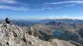
The first part of this two-day circular is challenging and breathtaking, taking you through the heart of Mercantour National Park from the village of Allos, via Lac d'Allos and its refuge, Mont Pelat, Lac du Trou de l'Aigle, Le Cimet and its many waterfalls, including Cascade du Pich and Les Bois de Vacheresse.