The Sources of the Verdon and the Tête de Sestrière

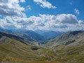
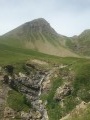
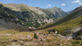
Discover the Sources du Verdon, reaching the summit with a magnificent view of the Grande Séolane.

Details

47320960
Creation:
Last update:
Last review:
  • Walking
    Activity: Walking
  • ↔
    Distance: 5.03 mi
  • ◔
    Average duration: 4h 20 
  • ▲
    Difficulty: Moderate

  • ⚐
    Back to start: Yes
  • ↗
    Ascent: + 2,290 ft
  • ↘
    Descent: - 2,290 ft

  • ▲
    Highest point: 8,432 ft
  • ▼
    Lowest point: 6,142 ft

Photos

Description of the walk

Park in the car park at the first hairpin bend on the Col d’Allos.

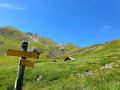
(S/E) The walk begins simply by following the path directly in front of you. You’ll be able to take in the vastness of the Cirque des Sources du Verdon throughout the walk. On your right, you can see the Bergerie (hut) de la Sestrière.

(1) As you walk alongside the Sources du Verdon, you’ll come to a ford, which is very easy to cross.

(2) Cross via a small bridge, then turn right towards the Cabane de la Sestrière.

(3) Take the time to have a picnic and a rest whilst admiring the view. Then continue the climb, keeping to the right twice. Cross the track twice, then follow it to the right before rejoining the path. Cross it twice more; on the third crossing, turn right then left to reach the Col de la Sestrière.

(4) Then continue to the left towards the end of your walk on the Tête de la Sestrière.

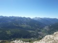
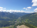
(5) You’ll be rewarded with a superb view at the end of your walk. Then return to the starting point by following the route in reverse. (S/E)


Waypoints

  1. S/E : mi 0 - alt. 6,142 ft - Car park - Verdon (rivière)
  2. 1 : mi 0.14 - alt. 6,217 ft - Shepherd’s hut
  3. 2 : mi 0.54 - alt. 6,457 ft - Small bridge - Verdon (rivière)
  4. 3 : mi 0.99 - alt. 6,824 ft - Sestrière Hut - Verdon (rivière)
  5. 4 : mi 2.12 - alt. 8,051 ft - Col de la Sestrière (2461m)
  6. 5 : mi 2.51 - alt. 8,432 ft - Viewpoint - Tête de la Sestrière (2575m)
  7. S/E : mi 5.03 - alt. 6,142 ft - Val d’Allos-la-Foux

Notes

Bring drinking water and a packed lunch.
At certain times of year, a herd may be present in these pastures.

Worth a visit

In the summer season, come and enjoy the Val d’Allos-La Foux resort centre with its bars and restaurants.
For activities, you can enjoy the Verdon Express toboggan run, the Crazy Park, archery and tennis
and, of course, many other hiking trails.
Information from the Val d’Allos Tourist Office: 04 92 83 02 81

Reviews and comments

4.9 / 5
Based on 3 reviews

Reliability of the description
5 / 5
Ease of following the route
5 / 5
Route interest
4.7 / 5
Val d'Allos
Val d'Allos

Hello User 28567974,

Thank you for your feedback on the Sources du Verdon hike.

Machine-translated

User 28567974

Overall rating : 5 / 5

Date of your route : Aug 04, 2026
Reliability of the description : ★★★★★ Very good
Ease of following the route : ★★★★★ Very good
Route interest : ★★★★★ Very good
Very busy route : Yes

Living in the Haut Var, we were keen to explore the source of the Verdon. A very easy walk. It starts on a track. A gentle climb. At the top, there’s a magnificent view of the Tête de Sestriere.

Machine-translated

Val d'Allos
Val d'Allos

Hello GINOCCHIO,
Thank you for taking the time to give us your feedback on this hike.
Have a lovely day

Machine-translated

GINOCCHIO
GINOCCHIO

Overall rating : 4.7 / 5

Date of your route : Oct 13, 2025
Reliability of the description : ★★★★★ Very good
Ease of following the route : ★★★★★ Very good
Route interest : ★★★★☆ Good
Very busy route : No

A beautiful hike, with a 700-metre elevation gain and splendid views from the pass and then from the summit of La Sestrière. My only regret is that there were no chamois or ibex in this area, but the Cirque des Sources du Verdon is beautiful to behold. As for the Grande Séolane opposite, you never tire of looking at it.

Machine-translated

Val d'Allos
Val d'Allos

Hello JF, thank you for your feedback – it’s always very helpful. Have a lovely day

Machine-translated

JF
JF

Overall rating : 5 / 5

Date of your route : Jul 08, 2024
Reliability of the description : ★★★★★ Very good
Ease of following the route : ★★★★★ Very good
Route interest : ★★★★★ Very good
Very busy route : No

A hike undertaken with friends on the morning of 2 July, starting from the upper car park at the resort, on the edge of the road leading to the Col d’Allos. There were few people on the first section, which followed an easy, gently sloping track on the left bank of the torrent. There were plenty of marmots all the way to the sheepfold (Sestière hut), which we went round to the right of. The path then became a little steeper but was well signposted (red and yellow markings). It was crossed in several places by ski runs. The gradient was a little steeper in the final section before the pass. The path continues along the ridge to the foot of the Grande Séolane cliff (2,620 m), where you can stop for a picnic whilst enjoying magnificent views of the Laverq Valley and the Estrop to the west, and the Agneliers to the east. The descent follows the same route and is straightforward. Total duration (return) 6 hours, taking your time.

Machine-translated

Other walks in the area

For more walks, use our search engine .

The GPS track and description are the property of this route's author. Please do not copy them without permission.