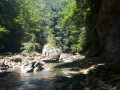
In the depths of the Guiers Vif

A hike off the marked river trails, involving short stretches where you’ll need to wade through the water.

Please note:
* It is impossible to avoid the swimming sections!;
* Once you’ve entered the river, it’s impossible to turn back until you reach the exit of the gorges;
* Do not attempt this hike during high water, periods of heavy rainfall, when there is a risk of thunderstorms, or during the snowmelt season;
* The water in the Guiers Vif is often very cold, even in summer; bring a wetsuit if necessary.

Details

n°1327276
Creation:
Last update:
Last review:
  • Walking
    Activity: Walking
  • ↔
    Distance: 3.23 mi
  • ◔
    Average duration: 2h 10 
  • ▲
    Difficulty: Difficult

  • ⚐
    Back to start: Yes
  • ↗
    Ascent: + 801 ft
  • ↘
    Descent: - 781 ft

  • ▲
    Highest point: 1,900 ft
  • ▼
    Lowest point: 1,329 ft

Photos

Description of the walk

The start is in the hamlet of Le Châtelard in the commune of Saint-Christophe-sur-Guiers, at the junction between the departmental road and Chemin de la Caserne. (There are several places to park in the hamlet).

(S/E) From the junction, leave the Chemin de la Caserne on your left and take the unpaved track on your right. Follow the track as it runs alongside the hamlet of Le Châtelard, then keep left as you leave the hamlet. Continue along this track to the end (the track ends in a dead end)

(1) At the end of the track, look out for a faint path on the right, heading downstream, and take it. The path runs between a small lake on the right and a cliff on the left. The path tends to become overgrown in this section, but you can easily find it again by following the cliff on the left (at the top) until you reach the river.

(2) When you reach the river, follow it downstream (Gorges de l’Échaillon).

Once you’ve entered the Gorges de l’Échaillon, it’s no longer possible to turn back until you reach the exit of the gorges (at Pont Saint-Martin)

The entrance to the gorges is via a narrowing of the river where you have to swim across (that gets you straight into the swing of things!). The route then follows the river, with sections where you have to navigate between the rocks, either on foot through the water or by swimming (three short stretches). The crossing of the gorge takes about 2½ hours. At the end of the gorge, pass under two bridges (an ancient Roman bridge and a more recent one). It is after the second bridge that you must leave the riverbed to reach the right bank.

(3) From the right bank, follow a small path uphill to a track and turn right. Follow the track to the road and turn right. Follow the road and cross one of the two bridges to reach the opposite bank. Just after the bridge, look out for a path leading uphill, marked in yellow, and follow the sign for “Le Châtelard”.

(4) Follow the yellow-marked path, keeping “Le Châtelard” as your destination.

(5) At a small clearing, take the path on the left that goes uphill (path marked in yellow) and not the one straight ahead that goes downhill. Once the path joins a road, turn left (Route des Combes), follow the road to the end and take the path at the end of the hamlet.

(6) Follow the path and take the first path on the right. Continue along the path marked in yellow (the path is somewhat overgrown but remains passable) until you reach the hamlet of Le Châtelard and the starting point (S/E)

Waypoints

  1. S/E : mi 0 - alt. 1,831 ft - Le Châtelard
  2. 1 : mi 0.53 - alt. 1,739 ft - End of the trail
  3. 2 : mi 0.67 - alt. 1,407 ft - Échaillon Gorges - Guiers Vif (rivière)
  4. 3 : mi 1.62 - alt. 1,365 ft - Pont Saint-Martin
  5. 4 : mi 1.73 - alt. 1,365 ft - Return path on the left
  6. 5 : mi 2.32 - alt. 1,670 ft - Clearing
  7. 6 : mi 2.8 - alt. 1,850 ft - Les Combes
  8. S/E : mi 3.23 - alt. 1,831 ft - Le Châtelard

Notes

A water-based hike, mostly in the water, with a few short stretches where you’ll need to swim.

There are no particular difficulties, but you must ensure that the river is at normal levels; do not venture out in the event of flooding, the risk of severe thunderstorms or during periods of snowmelt! Once you’ve entered the Gorges, it is not possible to leave them until the end of the hike.

Please note that the Guiers is cold, even in summer; those who feel the cold may wish to wear a wetsuit.

Bring a waterproof pouch if you want to take your mobile phones, cameras, etc. with you. It is not possible to avoid the sections where you have to swim.

The Visorando estimate suggests a hike of around 2 hours. In reality, progress through the water is slower than on land: allow 30 minutes to reach the Guiers, 2 to 2½ hours to make the descent along the Guiers, and around 50 minutes to walk back up to Le Châtelard.

It is possible to do just the descent by arranging for a car to be waiting at the end of the route to take you back up to Le Châtelard.

Reviews and comments

5 / 5
Based on 1 review

Reliability of the description
5 / 5
Ease of following the route
5 / 5
Route interest
5 / 5
User 7826602

Overall rating : 5 / 5

Date of your route : Jul 25, 2026
Reliability of the description : ★★★★★ Very good
Ease of following the route : ★★★★★ Very good
Route interest : ★★★★★ Very good
Very busy route : No

Be warned, it’s not as easy as it looks! Having completed the route many times, here are a few very important points to bear in mind before you set off:

High-top shoes are essential: the seabed can sometimes conceal pieces of rusty or sharp metal. Make sure you protect your feet and ankles properly.

A wetsuit AND a helmet are highly recommended: Between the current, the slippery rocks and the very rugged terrain, there’s a real risk of falling or slipping. A wetsuit protects you from the cold as well as from impacts, and a helmet is a vital safety measure.

No mobile signal: Tucked away between the cliffs at the bottom of the gorges, there’s absolutely no mobile reception. If you run into trouble, it’s impossible to make a call.

In short, it’s a brilliant outing, but it’s a genuinely challenging hike: make sure you’re well equipped!

Machine-translated

Julie384
Julie384

Hello, is this water-based hike suitable for children (aged 7 and over)?
Thank you in advance

Machine-translated

garion
garion

Thank you for this information, which answers my questions perfectly.

Have a lovely evening.

Machine-translated

izzz38
izzz38

Hello, the length of the swimming sections can vary depending on the water level of the Guiers (which can be found online). Generally speaking, you should expect three actual swimming sections, each around 30 to 50 metres long (the last one, near the finish line, being the longest), and one section where the water comes up to your waist! Please note that a severe storm is forecast for this evening; the water level of the Guiers may rise significantly over the coming days!

Machine-translated

garion
garion

I haven’t done this walk yet. I’d like some more details on the length of the sections where you have to swim.

Machine-translated

Other walks in the area

For more walks, use our search engine .

The GPS track and description are the property of this route's author. Please do not copy them without permission.