


Refine your search for walks in Guiers Vif (rivière)
Guiers Vif (rivière) walks


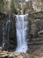
 The Cirque de Saint-Même waterfall
 Visorando Member
 6.06 mi
 +1,430 ft
 -1,424 ft
 4h 00
 Moderate
 Departure from Saint-Pierre-d'Entremont (Isère)
From Saint-Pierre-d'Entremont, this beautiful walk leads to the source of the Guiers-Vif, follows the course of the torrent, passes through hamlets and reveals the large clearing of the Cirque de Saint-Même.
The Cirque de Saint-Même is a very popular spot, attracting families in search of fresh air in the summer months. Hikers will find a little more freshness and tranquillity as they climb towards the Cascade du Guiers-Vif.
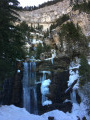
Cirque de Saint Même - Guiers Vif waterfalls
 1.77 mi
+676 ft
-669 ft
1h 25
 Difficult
Departure from Saint-Pierre-d'Entremont (Savoie) (Savoie)
Short hike in the forest to discover the waterfalls of the Guiers Vif.
Historical and prehistoric loop of Saint-Christophe la Grotte
 3.76 mi
+1,004 ft
-1,001 ft
2h 35
Moderate
Departure from Saint-Christophe (Savoie) (Savoie)
Short hike to discover prehistory at the Fru site and the historic passage of the Via Sarde between Lyon and Turin.
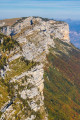
Le Grand Manti, the Trèfle tunnel and Alpettaz via Pas de la Mort
 6.02 mi
+3,855 ft
-3,862 ft
6h 05
Difficult
Departure from Saint-Pierre-d'Entremont (Savoie) (Savoie)
Hike to discover the sources of the Guiers Vif and the Crêtes du Grand Manti, among waterfalls, caves, cliffs and mountain pastures.
Please note that this hike is vertiginous in some areas (Pas de la Mort) and is not recommended for people who are prone to vertigo or in wet weather.
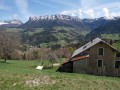
The Government Castle
 7.26 mi
+1,775 ft
-1,798 ft
4h 55
Moderate
Departure from Saint-Pierre-d'Entremont (Savoie) (Savoie)
Around the two communes of Saint-Pierre d'Entremont, this walk covers the two departments of Savoie and Isère, exploring the architectural heritage and Carthusian landscapes. The most beautiful panorama can be seen from the esplanade of the Château du Gouvernement in Saint-Pierre d'Entremont (Isère).
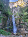
Around the Cirque de Saint-Même
 8.20 mi
+3,970 ft
-3,983 ft
7h 15
Difficult
Departure from Saint-Pierre-d'Entremont (Savoie) (Savoie)
From the Cirque de Saint-Même and its waterfalls, across the Hauts de Chartreuse plateaus via 3 Pas to the Croix de l’Alpe (1,821 m).Stunning views.
⚠️ This route is partly unmarked, unmaintained and presents significant risks. Hikers undertake this route at their own risk. Please follow the official marked trails.
Corbel - Saint-Pierre
 5.11 mi
+1,562 ft
-1,562 ft
3h 45
Moderate
Departure from Corbel (Savoie)
A circular route between two villages in Chartreuse.
This route's highest point is just over 1,000 metres, making it suitable for when temperatures have dropped.
At these altitudes, the hand of man is often present in the villages and hamlets. You will encounter old dwellings, fountains, bread ovens...
The route is well signposted.
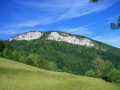
Circular Mont Beauvoir from Saint-Christophe-la-Grotte
 10.59 mi
+3,379 ft
-3,386 ft
7h 50
Difficult
Departure from Saint-Christophe (Savoie) (Savoie)
This circular loop combines a crossing of a little-visited summit offering views of the Chartreuse and the Avant Pays Savoyard with historic or documented passages: ascent via the Route Sarde and the Sentier du Beauvoir, return via the route Béatrice de Savoie and the Voie Royale.
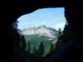
Cirque de Saint-Même: Waterfalls and Cave via the Pas Ruat
 2.62 mi
+1,056 ft
-1,030 ft
3 hrs
 Very difficult
Departure from Saint-Pierre-d'Entremont (Savoie) (Savoie)
The Cirque de Saint-Même is very busy in summer, with most visitors content to have a picnic on the meadows or follow the signposted route through the waterfalls. The short circular loop suggested here extends this route by taking in an additional waterfall and the Source du Guiers Vif, via the steep Pas Ruat pass with its astonishing passage beneath the rock face emerging in front of the Grotte du Guiers Vif.
⚠️ This route is partly unmarked, unmaintained and presents significant risks. Hikers undertake this route at their own risk. Please refer to the official marked trails.
⚠️ The footbridge leading to the Grotte du Guiers Vif (4) was damaged by a rockslide in July 2023: a mayoral order currently prohibits access.
Route du Château, Randocroquis
 Tourist office
 3.87 mi
+1,217 ft
-1,204 ft
2h 50
Moderate
Departure from Saint-Pierre-d'Entremont (Isère)
This circular walk exploring Château de Montbel is also a Randocroquis® route offering introductory art workshops: drawing techniques, contrasts, perspective and landscapes.
Circular Saint-Pierre-d’Entremont loop, via the bottom of the Cirque de Saint-Même
9.14 mi
+1,804 ft
-1,781 ft
5h 45
Moderate
Departure from Saint-Pierre-d'Entremont (Savoie) (Savoie)
A circular route around Saint-Pierre-d’Entremont via the Cirque de Saint-Même, returning via the Torrent du Cozon gorges. The views are magnificent all along the way, and you reach the cirque on foot, rather than by car, to see the first waterfall. The route is marked and well signposted with numerous signs.
Cirque de Saint-Même: a bit of an adrenaline rush
 4.44 mi
+2,651 ft
-2,664 ft
4h 20
Difficult
Departure from Saint-Pierre-d'Entremont (Savoie) (Savoie)
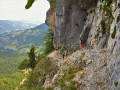
A superb circular walk featuring waterfalls, a natural tunnel, a cave, climbing sections, an exposed ledge and a mountain pasture, topped off with some stunning views throughout the route.
⚠️ Part of this route is unmarked, unmaintained and presents significant risks. Hikers undertake this route at their own risk. Please refer to the officially marked trails.
⚠️ The ‘Pas de la Mort’ between (5) and (9) is classified as dangerous and is strongly discouraged. See practical information.
On all vertical sections, do not rely on the GPS track but follow the route description.
In the depths of the Guiers Vif
 3.23 mi
+801 ft
-781 ft
2h 10
Difficult
Departure from Saint-Christophe-sur-Guiers (Isère)
A hike off the marked river trails, involving short stretches where you’ll need to wade through the water.
Please note:
* It is impossible to avoid the swimming sections!;
* Once you’ve entered the river, it’s impossible to turn back until you reach the exit of the gorges;
* Do not attempt this hike during high water, periods of heavy rainfall, when there is a risk of thunderstorms, or during the snowmelt season;
* The water in the Guiers Vif is often very cold, even in summer; bring a wetsuit if necessary.
Tour of the Rocher du Quartier and the Pointe du Frou
 10.88 mi
+3,635 ft
-3,632 ft
8h 10
Very difficult
Departure from Entre-deux-Guiers (Isère)
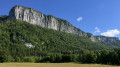
A beautiful, long circular route at moderate altitude, with exposed sections that can be slippery. Start directly below the Rocher du Quartier and climb via Tramoley, passing the Saint-André fir tree to the Col de la Sarriette, then cross the Plateau de la Ruchère before descending via the postman’s path beneath the Pointe du Frou.
Cirque de Saint-Même – Col du Coq
13.05 mi
+6,362 ft
-4,580 ft
11h 35
Very difficult
Departure from Saint-Pierre-d'Entremont (Savoie) (Savoie)
The fifth and final stage of the Tour of the Ten Highest Peaks of the Chartreuse, linking the Cirque de Saint-Même to the Col du Coq, via the Lance Sud de Malissard, the Dôme de Bellefond, the Piton de Bellefond, and the Dent de Crolles. This is one of the longest stages of the Tour, featuring a technical section: the Pas de la Mort.
Saint-Pierre-de-Chartreuse – Saint-Pierre-d’Entremont
9.00 mi
+4,160 ft
-4,633 ft
7h 45
Very difficult
Departure from Saint-Pierre-de-Chartreuse (Isère)
This third stage of the Tour of the Ten Highest Peaks of the Chartreuse links Saint-Pierre-de-Chartreuse to Saint-Pierre-d’Entremont, via the Grand Som. There are no technical difficulties, unless you decide to follow the southern ridge of the Grand Som, which offers some very beautiful and exposed rock climbing.
Tour of the 10 highest peaks in the Chartreuse
63.25 mi
+24,304 ft
-24,291 ft
5 days
Very difficult
Departure from Saint-Pierre-de-Chartreuse (Isère)
This itinerary describes a circular route that takes in the ten highest peaks of the Chartreuse. Covering the massif’s most classic hikes, it is divided into five stages, with half-board accommodation available. Allow around ten hours’ walking per day, with a few unavoidable technical sections. Naturally, the views over the Chartreuse and beyond are incredible. Throughout the route, you’ll discover magnificent flora and fauna, as well as a few geological and archaeological gems that are well worth a detour. The ten peaks are merely a pretext for a major hike in an exceptional setting.