


 Country:

 City:
City:



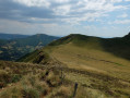
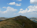
Starting point from the informal car park (maximum 20 cars) at the hairpin bend on the D17 at the Col de Redondet. NB: shuttle buses heading up to Puy Mary use this road and pass this point.
(S/E) From the car park, of the two visible tracks (the one on the right going uphill and the one on the left going downhill), take the track on the left heading downstream (Mandailles valley).
(1) At the edge of the forest, look out for a Fork in the road and take the path on the right (not shown on IGN maps), signposted ‘Trail’.
(2) At the end of the descent and as you emerge from the woods, turn right at the signposted junction located by the paddock gates.
(3) At the signposted crossroads, take the path on the right that leads uphill to begin the ascent of Le Piquet, leading to the ridge of Puy Chavaroche.
(4) Take care for about 300 m after the start of the climb (area where the actual terrain differs from the IGN map): follow the GPS track, which takes the path on the right at a Fork in the road that is unmarked, then follow the visible path without heeding the mapped PR® route, which has in fact been abandoned (the mapped GR® route rejoins the path 200 m further on at the pass).
(5) At the pass after the climb up the Piquet, turn right to climb to the summit of Puy Chavaroche.
(6) Then begin the descent, following the re-routed sections designed to restore the old, degraded paths. This will take you to the Col de Redondet.
(7) At the signposted junction, take the path descending to the right, north-east, towards the car park (S/E), which is visible in the distance.
 Visorando Member


 Difficult
 Easy
Easy 
