Country:

 City:
City:


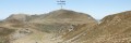
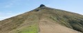
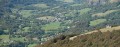
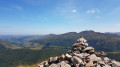
(S) From Pas de Peyrol, take theGR®400which starts behind the bar, follow it, then take a very well-marked path that heads off along the right-hand side of the ridge. The path reaches the ridge at a weather station. Stay on this path along the ridge, heading to your right; it then runs alongside a fence to the summit of Puy de la Tourte.
(1) Descend from the Puy and take a faint track that heads off to the left towards the fence. Follow the path alongside the fence. At the point where the fence meets at a right angle, go over the one you’re following to reach a better-marked path. Continue following the fence.
(2) Join theGR® then climb a ladder over the fence (just before the knoll). Stay on theGR® until you reach the pass.
(3) Passing the Knoll of the Blatte.
(4) Cross the fence and follow theGR® as it heads off to the right.
(5) At the ruins, go underneath them; then, at the last one, head straight down towards the beech hedge to rejoin the path (GR® markings are present but barely visible). After passing the fence, follow the path that starts in the forest (GR®).
(6) At the first junction, turn left, then take a path on the right which cuts across the bends in the track.
(7). Carry on and make sure you stay on theGR® path when you reach the resort’s ski runs.
(8) At the ski resort car park, take the road and follow it. Pass the wayside shrine of Notre-Dame des Perdus en Neige and turn right.
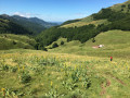
(9) The path branches off to the right (gate) and leads to the Étang de Lascourt, which you walk around. The path runs behind the forest and reaches a second gate; turn left towards Le Claux, then take the path that descends gently to your right. Follow it; it then leads to a mountain pasture (gate). Follow the edge of the pasture to reach the ladder. Go down the path.
(10) Take the road on the left, then the second road on the right, then turn left to return to the shuttle bus car park (E).

 Visorando Member

 Difficult