Punta Tre Chiosis – Pontechianale

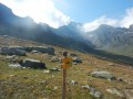
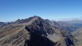
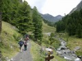
A summit from which to take in the full view of Monte Viso! An unforgettable 360° panorama!
A GPS is essential for the return leg.

Details

n°38312223
Creation:
Last update:
Last review:
  • Walking
    Activity: Walking
  • ↔
    Distance: 5.23 mi
  • ◔
    Average duration: 4h 40 
  • ▲
    Difficulty: Moderate

  • ⚐
    Back to start: Yes
  • ↗
    Ascent: + 2,595 ft
  • ↘
    Descent: - 2,575 ft

  • ▲
    Highest point: 10,066 ft
  • ▼
    Lowest point: 7,654 ft

Photos

Description of the walk

From Pontechianale, take the Maddalena–Serviero chairlift (Seggiovia), open in summer, which takes you up 700 m in altitude with no effort! There are several free car parks in the village.

(S/E) When you get off the chairlift, take the path branching off to the right above the restaurant, heading towards Le Conce. (Please note: on the IGC and OSM maps, Le Conce is not marked in the correct location. Le Conce corresponds to the small cairn at the next waypoint.) Continue to a junction.

(1) Carry on straight ahead, still heading towards Le Conce, and you’ll reach it at the small cairn.

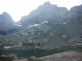
(2) There’s a magnificent view over the Vallon de Vallanta if you walk down a few metres.
Climb back up and take the small path straight ahead, which leads back to the ridge.

(3) Continue the ascent up the Cresta Savaresch, which passes by the top station of a ski lift. Carry on for a further 1 km or so until you reach the fork marking the return route at an altitude of approximately 2,800 m.

(4) Continue straight ahead on the gentle climb to the summit, Punta Tre Chiosis.

(5) The summit area is very spacious, with – as is often the case – a cross! It’s the ideal spot for a picnic. On a clear day, the view is stunning.
Head back to the previous junction, which you spotted on the way up.

(4) On the IGC106 map, a very winding path is shown. On the ground, you’ll need to use your imagination. The path is no longer maintained and gets lost amongst the tracks left by herds of cows. The idea is to descend more or less directly, due west, to an altitude of around 2,560 m.

(6) Then join a track that branches off to the left, running along the mountainside, and meets a ski run.

(7) Continue along the path which crosses the Savarex ski lift and then the Conce ski lift. From the latter, look out for the top station of the chairlift (S/E) a little further down. Choose one of the many tracks to reach it.

Waypoints

  1. S/E : mi 0 - alt. 7,654 ft - Upper station of the - Télésiège (seggiovia) Maddalena-Serviero
  2. 1 : mi 0.53 - alt. 7,940 ft - Arrival on the ridge, view of Viso
  3. 2 : mi 0.75 - alt. 7,992 ft - Conce cairn
  4. 3 : mi 0.94 - alt. 8,307 ft - Ridge line
  5. 4 : mi 1.91 - alt. 9,170 ft - Round trip to the summit
  6. 5 : mi 2.7 - alt. 10,066 ft - Punta Tre Chiosis (3080 m)
  7. 6 : mi 3.92 - alt. 8,399 ft - Start of the off-trail section
  8. 7 : mi 4.49 - alt. 8,291 ft - Towards the Savarex ski lift
  9. S/E : mi 5.23 - alt. 7,654 ft - Upper station of the - Télésiège (seggiovia) Maddalena-Serviero

Notes

I’m not a fan of electric-assisted hiking, but I have to admit that the chairlift cuts the elevation gain in half! Summer 2023 prices: €12 for a return ticket, €8 for a single.
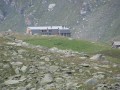
At the chairlift terminus, there is a mountain restaurant open in summer.

Alternative route: As part of the return route is off-trail, it is essential to carry a route map (GPS or paper) with you and to have a good understanding of the terrain. Otherwise, it is better to return by following the ridge all the way to (1) without going back via Le Conce: at (3), go straight on to reach (1), then return to (S/E) via the reverse route of the outward journey.

A high-altitude hike (2,400 to 3,100 m) requiring a reasonable level of fitness.
IGC Map No. 106 Monviso Sampeyre Bobbio Pellice (1:25,000) or Fraternali Hiking Map No. 17. Alta Val Varaita. (1:25,000)
No water sources on the route (apart from the mountain restaurant).

Worth a visit

The little village of Chianale, a 5-minute drive from Pontechianale on the way back towards the Col Agnel, is well worth a visit. It has been beautifully restored and features a costume museum...

Reviews and comments

4.7 / 5
Based on 1 review

Reliability of the description
5 / 5
Ease of following the route
4 / 5
Route interest
5 / 5
martine.bourgeois@hotmail.fr

Overall rating : 4.7 / 5

Date of your route : Jun 29, 2024
Reliability of the description : ★★★★★ Very good
Ease of following the route : ★★★★☆ Good
Route interest : ★★★★★ Very good
Very busy route : No

A lovely approach route.
It was just an approach for us, though, because, as I always say, you have to stay humble in the mountains, and the weather (fog) meant we couldn’t make it all the way to the top (even though we weren’t far off!).
Safety first, especially when the group consists of 15 walkers.
We’ll be back… to make it all the way… perhaps…

Machine-translated

Other walks in the area

For more walks, use our search engine .

The GPS track and description are the property of this route's author. Please do not copy them without permission.