Refine your search for walks in Prugnanes
Prugnanes walks
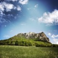
 The Roc Paradet from Prugnanes

A hike from a pretty little village on the Sentier Cathare GR®367, the GR®36, and the GRP® Tour des Fenouillèdes.A sense of direction is required. The reward comes at the summit, with its 360° panorama.On the way back, a visit to a large and beautiful cave is very interesting.
 The Roc Paradet circular from Prugnanes

A beautiful, fairly challenging circular between Aude and Pyrénées Orientales with a magnificent 360° panorama at the summit of Paradet as a reward.
 The Source of the Agly and the Salt Spring

A very pleasant hike, but best avoided in summer.
Beautiful views of Bugarach and the Corbières. Along the route, you can see the site of the old glass furnaces and taste the saltwater spring.
The hike is classified as difficult because you need to know how to find your way, read a map and/or follow the GPS track.
The GPS track and map are almost essential as there are many paths and the trails are not always well marked.
 Le Pla de Brézou and Pech d'Auroux

A very pretty route that takes you through areas still used for grazing and to Pech Auroux, offering a 360° view of the Corbières to the north, the Fenouillèdes to the south and Bugarach to the west. The last part of the route overlooks the Gorges de Galamus.
Hike closer to 750 m elevation gain.
A less challenging version is available: Le Pla de Brézou
 The Pla de Brézou

Very nice circuit that will take you over grazing areas that are still used.
The last part of the circuit overhangs the gorges of Galamus.
 The ruined sheepfolds of La Couillade and Campeaux
In this remote corner, two hours from the nearest village, families dedicated to farming lived just a few decades ago.
 Saint-Jaume Gorges and Fenouillet Fortresses

When the valley was unsafe, the men would retreat to the heights. The hills surrounding the Boulzane and Agly valleys are dotted with prestigious strongholds (Puylaurens, Fenouillet, Quéribus, etc.). And getting there was no easy task, as the Gorges de Saint-Jaume demonstrate.
 The heights of Taïchac in Saint-Martin-de-Fenouillet

At the meeting point of the African-Iberian and European tectonic plates, this interpretive trail offers many geological, natural and scenic attractions through vineyards, fir trees and heathland.
 The Fajas d'en Baillette

This splendid hike invites you to discover a magnificent forest with its springs, its view of the Canigou massif... and of course this truly remarkable beech tree: the 500-year-old Fajas d'en Baillette!
 The Pech de Bugarach via the shortest route

It's not the most interesting route in the massif, but it's the shortest way to quickly reach the summit of the famous site that became legendary in 2012, the Pech de Bugarach, the mysterious highest point of the Corbières massif, a foothill of the Pyrenees and a landmark for griffon vultures, which you're sure to spot.
 Le Pech de Bugarach from the Col du Linas

Route providing access to Pech de Bugarach.Warning: the access path is extremely damaged and eroded. It is more like a mountain trail.Do not underestimate this short hike, where you will need to use your hands in places. I have classified it as difficult.Please stay on the marked path. Warning signs saying "Hors Sentier" (off trail) have been installed in many places. Thank you.
5 May 2025. Route updated following user comments. So please follow the advice above: stay on the marked paths.
 Between salt and glass in Sougraigne, La Sals and its history.

In Sougraigne, in the heart of the Hautes Corbières, springs forth the Sals, a saltwater spring that has always attracted the attention of neighbouring populations.
Today, the Salicorne association brings together the surrounding villages around a common project. It invites you to discover this unique site, once frequented by many different people: glassmakers, jet miners, charcoal burners, woodcutters, shepherds, peddlers and, of course, smugglers and customs officers from the Ferme Générale hot on their heels.
 Le Pech du Bugarach from Bugarach

This is a relatively short, intense loop route at altitude, climbing Pech du Bugarach from the village via La Fenêtre.
 Pic Vergès and Saint-Arnac

An exceptional route starting from Ansignan and its famous Roman aqueduct, where you will discover the beautiful village of Saint-Arnac and a sumptuous panorama at Pic Vergès.
 The dolmens of Trilla
On the heights between Ansignan and Lac de Caramany, the village of Truilla clings to its granite mountain. The first inhabitants used the boulders scattered across the area to build their tombs. The trail winds through this landscape of ridges and granite chaos, connecting two of these dolmens lost in the heart of the vineyards.
Recent information: fences have been installed between points 6 and 7, preventing access.
