Country:

 City:


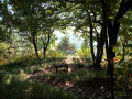
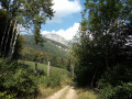
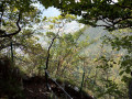
Park at the Chevalon car park, near the old cement works.
(S/E) Take the tarmac track heading towards Chalais, signposted as 5.1 km away. The track climbs gradually past the factory and leads to the Voreppe shooting range. Continue along this track; the tarmac soon gives way to a stony path.
(1) Walk along the right-hand side of the old Sautaret quarry. Shortly afterwards, the track curves sharply to the right. At this point, a path branches off straight ahead into the woods, marked with a yellow sign. Take this path, which continues to climb gradually through the forest. Pass by a spring with a bucket. The path runs alongside the Malsouche stream
(2) The path rejoins the forest track you left a short while earlier. Take the track on the left. After about a hundred metres, you’ll reach a Fork in the road. You’ll see a forest shelter on the left. Let the main track branch off to the left towards this shelter in the direction of Chalais and head straight on towards Mont-Saint-Martin, as indicated by a small wooden sign. Follow this path as it climbs through the forest, marked with yellow stripes; the gradient varies. Towards the end, watch out for the slope – take care not to slip on the fallen leaves!
(3) Join the path leading from Le Cuchet to Chalais. Take it on the right, downhill (signposted towards Mont-St-Martin, Le Cuchet). Continue along this path, which remains downhill. Watch out for falling rocks!
(4) You will then reach a Fork in the road at a spot known as the “Cheminée de Mont-St-Martin”: turn left towards the chimney. The path climbs briefly before running alongside the cliff face. It is fitted with a cable at a point where the path has more or less collapsed. Be very careful – the ground is unstable – and you must hold onto the cable at all times.
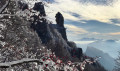
(5) You will then reach the base of the chimney. This is fully equipped with cables and handrails. The path is therefore more impressive than it is actually difficult. The climb is steep and offers beautiful views of the Chevalon de Voreppe, the Dent de Moirans and the whole valley.
At the top of the chimney, you’ll soon reach a large cairn at the point known as ‘Haut de la Cheminée’, at an altitude of 975 m. Continue to the right towards Mont-St-Martin.
(6) At the spot known as “sur l’Espagne”, hikers have two options for reaching Mont-St-Martin. For this walk, we chose to continue straight on, following the “Mont-St-Martin via Namière” route (you can also turn right to reach the village more quickly via a lovely path through the meadows).
So carry on straight ahead along the Côte Charvet path. At the spot known as “Pied de la Côte Charvet”, keep going straight ahead. You’ll be walking along a lovely, fairly wide track lined with meadows, with a magnificent view of the Rochers de Chalves.
(7) You’ll reach a spot called “Les Combes”. You’ll then come to a small tarmac road closed to traffic. Turn right onto it and head downhill. Walk past a pumping station. You’ll soon reach the barrier closing this road to traffic, at a spot called “Namière”.
(8) Continue straight on along the tarmac road which descends towards Mont-St-Martin. There may be cars here, so take care and stay close to the side of the road. As you approach the village of Mont-Saint-Martin, you’ll soon catch sight of the bell tower. The road curves in an S-shape and passes a small car park. Keep following it downhill towards the village.
(9) You’ll arrive at Mont-St-Martin: there’s a signpost and a small car park with a bench. You can take a stroll around the church and the town hall to admire the sundial and read the information board. From here, there’s a lovely view of the Moucherotte, a peak in the Vercors massif on the other side of the valley. Then return to the small car park and take the path leading down to the left. The direction to Chevalon is signposted.
The path winds down alongside the Lanfrey stream, which was dry in mid-September. In spring, you can find wild garlic on the banks of the stream. Shortly afterwards, the path joins the D105d – Route de Mont Saint-Martin. Follow it straight on for a few metres before you come to a path on the left which descends and cuts across the bend in the road; it is marked with yellow stripes.
Then rejoin the road, which winds towards the pylons. Follow the bend round the pylons and look for a path branching off to the right. Take this until you rejoin the road at Le Cuchet.
(It’s possible to miss the paths mentioned above, as they are sometimes obscured by vegetation. Don’t worry: if you follow the road all the way, you’ll still reach Le Cuchet; it’s just less pleasant to walk on tarmac.)
(10) At Le Cuchet, head up the road to the left for a few dozen metres until you find the path branching off to the right (signposted). It will be marked with yellow lines all the way along. Follow it downhill, and cross the road once more (head up the road to the right for a few dozen metres before rejoining the path that descends to the left).
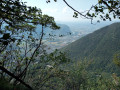
Follow this path, which is still marked, as it descends into the woods. On the way down, you’ll pass a small viewpoint on the left with a bench from which you can admire the lovely view over the valley and the Vercors opposite. Continue down to the end; you’ll reach a road. Turn right here (going round a burnt-out house) and continue straight along the track until you return to the Chevalon car park (S/E).

 Visorando Member

 Association / Club / Walk leader
 Moderate
 Tourism professional
 Very difficult
 Easy
 Extremely difficult