Country:

 City:
City:


Easy parking by the side of the D62 road along the lake, opposite the hamlet of Rouquié.
(S/E) Cross the road carefully and take the road opposite that leads uphill to the hamlet of Rouquié. Turn left to cross the hamlet and follow the forest track that climbs gently through the woodland. After 200 m, you’ll reach the junction with the GR® de pays trail, marked with yellow and red signs.
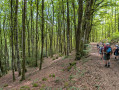
(1) Follow this path to the right, climbing through shady woodland; pass a water intake, leave a track on your left and continue climbing steadily. After less than a kilometre, join a path marked in yellow (the Balade Monteliote) and follow it uphill to the left.
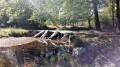
(2) The path climbs to an elevation of 874, then winds around the Puech Vert (with no particular view of the lake below due to the forest). It turns due north, crosses the Rieupeyroux stream via a makeshift ford at a place called Les Sagnes, and finally emerges onto the Route de Lacaune (D52).
(3) Cross the road with care and continue straight on along the Route de Fréjerau, which runs alongside a wooded private estate. 500 m further on, look out for a path branching off to the right (still marked in yellow).
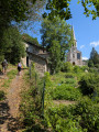
(4) Turn onto this path; you will arrive opposite Lamontélarié church. Follow Rue de l’Église and then Grande Rue until you reach the village outskirts.
(5) Turn left onto a side road, following the signposting. At the first junction, join the yellow and red signposting for the GR® de Pays and head due west, crossing several side roads and tracks until you reach the Brizaude fish farm.
(6) As you approach it, turn left onto the road, following the signposts. Walk along the road beside the reservoir; the route remains wooded, so you cannot see the body of water (the estate is fenced off and entry is prohibited).
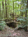
(7) After a wide bend, leave the road and head up to the left along a path that remains signposted. Heading due east at first, the path turns due south, climbing up a stony track from the ruins of the ancient settlement of Sicardens. It joins a wider track on the edge of a property; turn away from it and continue to the left. 200 m further on, you’ll reach a fork in the road with two signposted paths.
(8) Continue on the Yellow and Red GRP® (so do not follow the yellow markings alone) by turning right. Follow this forest track for about 1 km, leaving the paths on your left, until you reach a major junction of marked tracks.
(9) Turn right to continue on the Yellow and Red GRP®, this time heading due south for about 2 km before emerging from the woodland and reaching the Fork in the road between the tarmac roads D52 and D62.
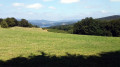
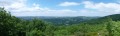
(10) Cross both roads carefully and take a small, very steep path opposite on the left – a shortcut that takes you back to the Yellow and Red marked trail , which remains in the woodland above the lake, now visible below. Continue to a further Fork in the road about 1 km on.
(11) Turn right and descend via a series of bends to return to the junction you passed on the way out.
(1) Follow the route you took on the way out in the opposite direction to pass through Rouquié and return to the car park (S/E), crossing the road once more with care.

 Visorando Member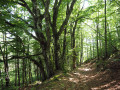

 Difficult
 Tourist office