A walk in the Gers starting from Mourède

This route is not signposted, but the path is easy to follow, even across fields and through woodland.

Details

n°13612792
Creation:
Last update:
Last review:
  • Walking
    Activity: Walking
  • ↔
    Distance: 4.16 mi
  • ◔
    Average duration: 2h 05 
  • ▲
    Difficulty: Easy

  • ⚐
    Back to start: Yes
  • ↗
    Ascent: + 233 ft
  • ↘
    Descent: - 246 ft

  • ▲
    Highest point: 535 ft
  • ▼
    Lowest point: 367 ft
  • ⚐ Country: France
  • ⚐ City: Mourède (32190)
  • ⚑
    Start/End: N 43.800025° / E 0.29589°
  • ❏
    IGN map(s): Ref. 1742SB
  • Hour-by-hour weather

Description of the walk

Park in the car park at Mourède church.

(S/E) Take the tarmac road heading uphill, pass the hamlet of Cardeillac and continue uphill. You’ll reach the junction with the road leading to the hamlet of Touade.

(1) Turn left onto the tarmac track which descends, then climbs again towards Touade. At the sign for Touade, turn right.

(2) Carry on straight ahead until you reach the next junction.

(3) Turn left, cross the Touade stream and reach a junction with a road.

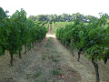
(4) Follow the road on the left towards Pessalle. Walk through this very pretty little village, then take the first street on the left. At the end of the street, follow the path that branches off to the right and walk alongside the fields until you reach a crossroads.

(5) Turn right and continue along the path until you reach the tarmac road, then the junction with a small track.

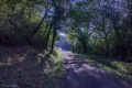
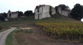
(6) Turn left onto this small path through the woodland. Walk behind Baradot Castle. Carry on until you emerge from the woodland. Pass a hay shed on your left and head downhill until you reach a tarmac path. Pass the junction leading to the hamlet of Le Bosc and, a few metres further on, you’ll come to another junction.

(7) Turn left onto the downhill path, then follow a short climb to reach the car park at Mourède Church (S/E).

Waypoints

  1. S/E : mi 0 - alt. 420 ft - Car park at the - Église Saint-Orens (Mourède)
  2. 1 : mi 0.65 - alt. 492 ft - Crossroads towards Touade
  3. 2 : mi 0.91 - alt. 486 ft - Crossroads
  4. 3 : mi 1.21 - alt. 535 ft - Touade Stream
  5. 4 : mi 1.98 - alt. 466 ft - Junction with the Pessalle road
  6. 5 : mi 2.34 - alt. 482 ft - Crossroads
  7. 6 : mi 2.82 - alt. 433 ft - Crossroads on a path through the woodland
  8. 7 : mi 3.66 - alt. 443 ft - Crossroads after Le Bosc
  9. S/E : mi 4.16 - alt. 420 ft - Car park at the - Église Saint-Orens (Mourède)

Reviews and comments

4.2 / 5
Based on 2 reviews

Reliability of the description
4.5 / 5
Ease of following the route
4.5 / 5
Route interest
3.5 / 5
Laurent Carlier
Laurent Carlier

Overall rating : 4.7 / 5

Date of your route : Nov 09, 2026
Reliability of the description : ★★★★★ Very good
Ease of following the route : ★★★★★ Very good
Route interest : ★★★★☆ Good
Very busy route : No

A easy, very peaceful route with lovely views and a stroll through a beautiful woodland.

Machine-translated

User 29491331
• Edited:

Overall rating : 3.7 / 5

Date of your route : Jun 01, 2026
Reliability of the description : ★★★★☆ Good
Ease of following the route : ★★★★☆ Good
Route interest : ★★★☆☆ Average
Very busy route : No

I did this walk at the end of May: some sections take you through cultivated fields, where you need to be careful not to trample the crops, whilst others follow unmaintained paths through tall grass and brambles, where snakes and ticks are present. I recommend going properly equipped. The rest of the walk went smoothly, though there wasn’t much of interest.

Machine-translated

Other walks in the area

For more walks, use our search engine .

The GPS track and description are the property of this route's author. Please do not copy them without permission.