The Roquebrune Forest and Grassio Castle

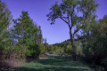
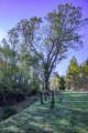
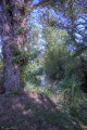
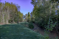
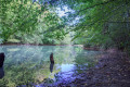
This short walk through the Roquebrune State Forest leads to an educational trail running alongside the Osse, a small river 120 km long and a tributary of the Garonne.

Details

4124638
Creation:
Last update:
Last review:
  • Walking
    Activity: Walking
  • ↔
    Distance: 2.42 mi
  • ◔
    Average duration: 1h 05 
  • ▲
    Difficulty: Easy

  • ⚐
    Back to start: Yes
  • ↗
    Ascent: + 13 ft
  • ↘
    Descent: - 13 ft

  • ▲
    Highest point: 390 ft
  • ▼
    Lowest point: 374 ft
  • ⚐ Country: France
  • ⚐ City: Vic-Fezensac (32190)
  • ⚑
    Start/End: N 43.737997° / E 0.30948°
  • ❏
    IGN map(s): Ref. 1742SB, 1743SB
  • Hour-by-hour weather

Photos

Description of the walk

The start is on the D 34 heading towards Riguepeu, at a car park situated 500 m to the left after the riding centre.

(S/E) Set off along the tarmac road. Pass the path to the hamlets of La Coste and La Garenne on your left and continue until you reach a wide dirt track on your right, blocked by a wooden gate.

(1) Go through the gate and continue along the track to the footbridge crossing the River Osse.

(2) As you leave the footbridge, go down the steps and continue to the right, following the small brown signs marked ‘Circular walk’. Following this wooded path, you will find two wide, green-coloured cuttings on your left, marked by yellow arrows labelled ‘Variante 1’ and then ‘Variante 2’, which allow you to shorten this walk if you wish.

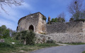
(3) At the “Variante 2” sign, veer to the right to continue the long circular route. As you approach the departmental road, you’ll see an information board and an old barn on your left. Continue towards the woodland ahead of you.

(4) As you emerge from the woodland, take the tarmac road on your left until you reach the bridge over the Osse. Take the path on the left before the bridge and continue along the banks of the Osse until you reach the footbridge.

(2) Cross it again, then follow the same route as on the way there back to the car park (S/E).

Waypoints

  1. S/E : mi 0 - alt. 387 ft - Car park
  2. 1 : mi 0.29 - alt. 384 ft - Wooden gate
  3. 2 : mi 0.44 - alt. 374 ft - Wooden footbridge - Osse (rivière)
  4. 3 : mi 1.04 - alt. 381 ft - Sign for “Variant 2”
  5. 4 : mi 1.22 - alt. 384 ft - Exit from the woodland
  6. S/E : mi 2.42 - alt. 387 ft - Car park

Worth a visit

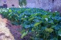
At the start of the walk, 300 m to the left, is the market gardener ‘Le Colibri’. Permaculture courses and guided tours available by prior booking.

Reviews and comments

4.8 / 5
Based on 2 reviews

Reliability of the description
5 / 5
Ease of following the route
4.5 / 5
Route interest
5 / 5
Mardavmaéans
Mardavmaéans
• Edited:

Overall rating : 5 / 5

Date of your route : Jul 30, 2026
Reliability of the description : ★★★★★ Very good
Ease of following the route : ★★★★★ Very good
Route interest : Not used / Not applicable
Very busy route : No

This is the first time we’ve gone for a drive in reverse!
The sound of cars is constant as the route runs alongside a very busy road; as a result, certain sections have become makeshift motorway toilets, with mounds of toilet paper littering the ground for a considerable distance.
The route itself isn’t at all authentic; the path has been cut through the fields with a brush cutter. The cut stalks of plants sticking out of the ground like spikes make walking along it perilous (and painful for the little ones).
Apart from some beautiful alders on the way back, there is absolutely nothing of note to see on this walk.

Machine-translated

LiliG
LiliG

Overall rating : 4.7 / 5

Date of your route : Oct 08, 2023
Reliability of the description : ★★★★★ Very good
Ease of following the route : ★★★★☆ Good
Route interest : ★★★★★ Very good
Very busy route : No

It’s lovely to discover a spot for a walk just a stone’s throw from home. It’s a short, accessible route (no elevation gain). However, it’s also a hunting area where you cross a clearing lined with shooting posts. You’d need to check how often hunters use the area to ensure it’s safe to walk there if you’re thinking of venturing out on a hunting day.

Machine-translated

Other walks in the area

For more walks, use our search engine .

The GPS track and description are the property of this route's author. Please do not copy them without permission.