Walk from Saint-Ronan to Plozévet

The Haut Pays Bigouden Community of Communes is responsible for managing the drinking water catchments in the area between Plozévet and Landudec. To this end, it manages a protection zone comprising wooded areas.
This walk takes you through this area of deciduous woodland (oaks, chestnut trees and beech trees) along a well-signposted path.
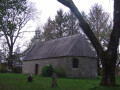
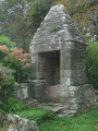
The walk also offers the chance to discover the idyllic site of the Saint-Ronan Chapel with its votive fountain.

Details

16793152
Creation:
Last update:
Last review:
  • Walking
    Activity: Walking
  • ↔
    Distance: 1.99 mi
  • ◔
    Average duration: 0h 55 
  • ▲
    Difficulty: Easy

  • ⚐
    Back to start: Yes
  • ↗
    Ascent: + 30 ft
  • ↘
    Descent: - 30 ft

  • ▲
    Highest point: 266 ft
  • ▼
    Lowest point: 207 ft
  • ⚐ Country: France
  • ⚐ City: Plozévet (29710)
  • ⚑
    Start/End: N 47.98891° / W 4.374637°
  • ❏
    IGN map(s): Ref. 0419ET, 0519OT
  • Hour-by-hour weather

Photos

Description of the walk

From the D784 between Landudec and Plozévet, when you can see the water tower, take the road leading towards it. Ignore a road on the left, turn onto a track signposted ‘Chapelle Saint-Ronan’ and you’ll reach a dirt car park.

Signposted with orange and red arrow signs

(S/E) From the car park, near the sign marking the route, head left along a lovely avenue of deciduous trees dotted with fitness circuit stations. Cross the access road to a farm and continue straight on, following the fitness circuit. Ignore a path branching off to the left and you’ll reach an open area with interactive information boards.

Signposted with red arrow signs

(1) Leave the orange-signposted trail on your right and turn left to begin a descent towards a footbridge crossing a wetland area.

(2) Cross the wetland and head straight up the slope opposite (no path shown on the map, but there is a sign marked ‘Landudec’). Turn right, cross a small road leading to the Domaine de Kerlosquet and follow the path as it winds through the woods to go round this property. You’ll come out onto the road to the left of the property.

(3) Leave the road and carry on straight ahead to rejoin the outbound route. At the sign for Plozévet, turn left to head back down and cross the footbridge.

(2) Turn left to follow the narrow path overlooking the wetland between Landudec and Plozévet. This section, on the edge of an older woodland, is the wildest part of the route. Climb a flight of steps, continue along a lovely straight stretch and you’ll come to the double signposting again.

Signposted with orange and red arrow signs

Carry on to reach the hamlet of Trébrévan. Take a short detour to the right to admire the imposing stone well.

(4) Resume the route by following a long straight stretch along a farm track, running alongside the fenced-off area marking the perimeter of the water catchment zone. You’ll reach a gate near the car park.

No signposting

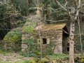
Turn left (signpost) towards the idyllic site of the little Saint-Ronan Chapel, which dates from 1720 and was restored in 1979. Around the chapel, you’ll find oval-shaped stones (evidence of an ancient ritual?). Also on the site is the sarcophagus where Saint Ronan is said to have been buried, as well as the beautiful votive fountain, 150 metres further down. Benches provide a place to rest in this leafy spot.

Follow the route back in the opposite direction to the car park (S/E).

Waypoints

  1. S/E : mi 0 - alt. 236 ft - Car park near Saint-Ronan Chapel
  2. 1 : mi 0.59 - alt. 259 ft - Junction
  3. 2 : mi 0.73 - alt. 236 ft - Footbridge
  4. 3 : mi 1.19 - alt. 249 ft - Kerlosquet junction
  5. 4 : mi 1.63 - alt. 217 ft - Trébrévan
  6. S/E : mi 1.99 - alt. 236 ft - Car park near Saint-Ronan Chapel

Notes

Several signposts with a map help you find your way around.
Picnic table at the car park.
Fitness stations along the first part of the route.

Worth a visit

Reviews and comments

4.7 / 5
Based on 3 reviews

Reliability of the description
4.5 / 5
Ease of following the route
5 / 5
Route interest
4.7 / 5
Arzaela
Arzaela

Overall rating : 5 / 5

Date of your route : Aug 17, 2026
Reliability of the description : Not used / Not applicable
Ease of following the route : ★★★★★ Very good
Route interest : ★★★★★ Very good
Very busy route : No

A very easy walk, shaded all the way along. There are three different routes indicated by signs at the start of the walk, and the path is then very well signposted. The longest route is the one suggested on Visorando.

Machine-translated

Mf peron
Mf peron

Overall rating : 5 / 5

Date of your route : Aug 26, 2025
Reliability of the description : ★★★★★ Very good
Ease of following the route : ★★★★★ Very good
Route interest : ★★★★★ Very good
Very busy route : No

a lovely 3.5 km walk through the woods with a challenging route for those who want it, very well signposted and close to a pretty renovated chapel and fountain. A lovely discovery for me.

Machine-translated

ChrisWild
ChrisWild

Overall rating : 4.3 / 5

Date of your route : Nov 01, 2022
Reliability of the description : ★★★★☆ Good
Ease of following the route : ★★★★★ Very good
Route interest : ★★★★☆ Good
Very busy route : No

A route for a short walk lasting just over an hour, if you take your time (a few fun features and plenty of chestnuts in season).
A lovely, fun spot, with a few information boards.

Machine-translated

Other walks in the area

For more walks, use our search engine .

The GPS track and description are the property of this route's author. Please do not copy them without permission.