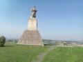
Walk through the fields around Manonviller

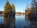
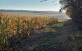
This is a pleasant walk through the fields and along the meandering course of the Vezouze. Best avoided in wet weather!

Details

n°1096802
Creation:
Last update:
Last review:
  • Walking
    Activity: Walking
  • ↔
    Distance: 3.18 mi
  • ◔
    Average duration: 1h 30 
  • ▲
    Difficulty: Easy

  • ⚐
    Back to start: Yes
  • ↗
    Ascent: + 59 ft
  • ↘
    Descent: - 59 ft

  • ▲
    Highest point: 863 ft
  • ▼
    Lowest point: 764 ft

Description of the walk

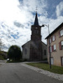
To start the walk, park in front of Manonviller church, by the foot of a fountain.

(S/E) Start by walking up Rue de l’Église; follow this road as it bends to the left and ignore the two paths that branch off to the right and then to the left.

(1) Take the path on the left, ignoring the path on the right which goes uphill. Continue straight on for 500 metres.

(2) Turn right, ignore the path on the right and carry on straight ahead until you reach a small copse with beehives (no danger) and a road at a place called La Grande Zabelle.

(3) Follow this road, turning left and ignoring the path on the right.

(4) Take the path on the left just before the bridge leading to Thiébauménil. Then walk alongside the meandering Vezouze and admire the magnificent circular bends formed by the river. Please note that this section of the path is very muddy after rain as the river sometimes bursts its banks.

(5) When you rejoin the D161a road, turn left to head back towards the village of Manonviller.
Take the first street on the left to return to the starting point (S/E).

Waypoints

  1. S/E : mi 0 - alt. 820 ft - Manonviller Church
  2. 1 : mi 0.28 - alt. 863 ft - Path on the left
  3. 2 : mi 0.72 - alt. 794 ft - Turn right at the fork
  4. 3 : mi 1.37 - alt. 774 ft - A place known as La Grande Zabelle
  5. 4 : mi 1.68 - alt. 764 ft - Path on the left before the bridge at the - Vezouze (rivière)
  6. 5 : mi 2.87 - alt. 774 ft - D161a junction
  7. S/E : mi 3.18 - alt. 823 ft - Manonviller Church

Notes

Please be careful: a section of the path is very muddy after rain as the river sometimes bursts its banks.

Reviews and comments

4.7 / 5
Based on 1 review

Reliability of the description
5 / 5
Ease of following the route
5 / 5
Route interest
4 / 5
RPodor
RPodor

Overall rating : 4.7 / 5

Date of your route : Aug 11, 2021
Reliability of the description : ★★★★★ Very good
Ease of following the route : ★★★★★ Very good
Route interest : ★★★★☆ Good
Very busy route : No

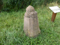
A short family walk to enjoy the delights of Lorraine in the sunshine (a rare sight this year). The route is dotted with information boards about ‘farm life’, which help you appreciate the countryside even more and make the experience a fun one.

Machine-translated

Other walks in the area

For more walks, use our search engine .

The GPS track and description are the property of this route's author. Please do not copy them without permission.