


 Country:
 City:


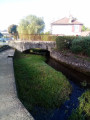
In Paray-le-Monial, park in the car park on Boulevard du Collège, on the other side of the Bourbince, on the left bank, as you face the town centre.
(S/E) Head eastwards to reach the junction with Rue des Deux Ponts and turn left. Cross the Bourbince via the Pont de Pierre, then turn immediately right, via the wooden footbridge, towards the Basilica of the Sacred Heart. Visit the church, with its beautiful modern chandeliers, then the cloister on its right. As you leave the cloister, turn right, walk past the church again and go round it on the left. You’ll arrive on Rue de la Visitation, opposite the Jardin Saint-Hugues.
(1) Do not follow the signs into the park opposite, but follow the road to the right. Walk past the Chapel of the Visitation Monastery – with its beautiful porch – and, at the end of the street, you’ll reach Rue de la Paix.
(2) Turn left. You’ll reach the church and the Saint-Nicolas Tower; on your left is the Maison Jayet, with its sumptuous carved façade, which houses the town hall. Walk round the tower to the right, passing a small square with a fountain and benches on your right; walk past the entrance to the tower, then, continuing in the same direction, cross Place Guignault, where you’ll see a house with a turret (which once belonged to a Protestant family); also note the rear of the town hall and the shops. At the end, head straight on towards a house with a turret, at the junction with Rue Billet.
(3) Continue along the street to the right of the turreted house (against the flow of traffic). Ignore all the streets on either side (Rue du Four on the left, Rue Dame Dieu on the left, Rue de la Poterne on the right and Rue de Palinges on the left) and you will reach the Jardin Saint-Hugues. Cross it to find yourself at the rear of the basilica.
(1) Turn right, then at the T-junction, opposite the war memorial, follow the road to the right (Avenue Jean-Paul II). Ignore Rue de la Poterne on your right.
(4) Turn right onto Rue Victor Hugo. At the fountain, veer left and cross Cours Jean Jaurès.
(5) Turn left, still on Cours Jean Jaurès, and follow the pedestrian walkway, passing a large car park on your right. You’ll come out onto Rue de la Poste, opposite the post office (with its beautiful façade).
(4) Turn left, then right onto Rue des Deux Ponts. Cross the Pont de Pierre over the Bourbince, then turn right onto Boulevard du Collège to return to the car park (S/E).
 Visorando Member


 Difficult

 Very difficult
 Tourist office
 Moderate

