Walk to the west of Tournefeuille

A walk through several neighbourhoods of Tournefeuille.

Details

n°30918659
Creation:
Last update:
Last review:
  • Walking
    Activity: Walking
  • ↔
    Distance: 6.32 mi
  • ◔
    Average duration: 3h 00 
  • ▲
    Difficulty: Moderate

  • ⚐
    Back to start: Yes
  • ↗
    Ascent: + 79 ft
  • ↘
    Descent: - 79 ft

  • ▲
    Highest point: 607 ft
  • ▼
    Lowest point: 502 ft

Description of the walk

The route starts at the Jean Gay bus stop behind the Carrefour Market.

(S/E) Enter the housing estate via Boulevard Jean Gay and, at the pedestrian crossing, turn right onto Rue du Val Louron until you reach the junction.

(1) Turn right onto the footpath by the large pine tree and continue straight on along Rue de la Savoie and Rue du Rhône; then, at the roundabout, turn right onto Chemin Saint Pierre until you reach the next roundabout.

(2) Turn left onto Boulevard de l’Île de France and, after about a hundred metres, take the footpath on the right. Once you reach Parc de la Paderne, turn left and follow the path to the left, then to the right, until you reach the water tower.

(3) Turn right until you reach the junction with Rue du Larzac.

(4) Turn into this street and turn right at the second street, then carry straight on through the pedestrian zone. Cross Chemin du Cournaudis (watch out for traffic). Then turn right onto Rue du Var until you see a footpath on your left.

(5) Follow this, then in the Parc du Cabirol follow the paths on your right. Walk past the tennis club and then the Clinique des Pyrénées.

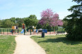
(6) Continue straight ahead along Chemin du Poujouane, then head straight down, passing the Lucie Aubrac State Primary School. Cross Boulevard Jean-Auguste Ingres and continue straight ahead until you reach the playground.

(7) Then turn right and take the footpaths through the housing estate, then exit and turn left past the rainwater harvesting tank. Follow Avenue François Verdier, then Rue du 19 mars 1962, and, opposite the shopping centre, cross Boulevard Vincent Auriol to reach Rue Gaston Doumergues.

(8) Follow it to the right as far as the town hall.

(9) Turn between the bus stop and the post office and head up Allée des Sports. You’ll arrive at the swimming pool.

(10) Take the footpath on the right. Walk up Rue des Violettes, then turn left onto Rue de Belbèze and follow Chemin de la Gravette. You’ll reach Route de Tarbes; follow it to the left until you reach the petrol station.

(11) Turn right, towards the Collège Pierre Labitrie, then turn left onto Rue du Petit Train and walk up to the starting point (S/E).

Waypoints

  1. S/E : mi 0 - alt. 528 ft - Jean Gay bus stop
  2. 1 : mi 0.23 - alt. 528 ft - Grand Pin
  3. 2 : mi 0.96 - alt. 522 ft - First roundabout in the 30 km/h zone
  4. 3 : mi 1.53 - alt. 607 ft - Water tower
  5. 4 : mi 1.68 - alt. 604 ft - Rue du Larzac
  6. 5 : mi 2.23 - alt. 604 ft - Secret path
  7. 6 : mi 2.81 - alt. 604 ft - Clinique des Pyrénées
  8. 7 : mi 3.37 - alt. 512 ft - Playground
  9. 8 : mi 4.15 - alt. 509 ft - Rue Gaston Doumergue
  10. 9 : mi 4.6 - alt. 512 ft - Town Hall
  11. 10 : mi 4.93 - alt. 502 ft - Swimming pool
  12. 11 : mi 5.82 - alt. 522 ft - Petrol station
  13. S/E : mi 6.32 - alt. 528 ft - Jean Gay bus stop

Reviews and comments

4.7 / 5
Based on 1 review

Reliability of the description
5 / 5
Ease of following the route
4 / 5
Route interest
5 / 5
Olivier Bel Air
Olivier Bel Air

Actually, he was referring to the Venerque–Clermont-le-Fort circular walk… what a scatterbrain! My apologies – I’ve already posted a comment on that walk from Tournefeuille…

Machine-translated

314
314

A very nice comment. However, I’m afraid it might not be about the right walk.

Machine-translated

Olivier Bel Air
Olivier Bel Air

Overall rating : 4.7 / 5

Date of your route : Apr 03, 2023
Reliability of the description : ★★★★★ Very good
Ease of following the route : ★★★★☆ Good
Route interest : ★★★★★ Very good
Very busy route : No

A superb walk on Thursday 30 March, with just the right amount of climbs (and descents!) in the first half of the route, followed by a second half with no elevation gain at all – very pleasant – following the opposite bank of the Ariège. Some sections (from the climb to the orientation point just above Venerque to Clermont-le-Fort) can be tricky if the ground is slippery – walking poles are recommended! That wasn’t the case for us; the path was dry and presented no difficulties. There are plenty of interesting spots along the route. A quick note: in the route description, under point 9, the route shown on the map isn’t the one described, but rather the descent along the edge of the bridge. The path through the nature reserve is quite a long way along the main road, so it might be better to try the steep descent right next to the bridge!

Machine-translated

Other walks in the area

For more walks, use our search engine .

The GPS track and description are the property of this route's author. Please do not copy them without permission.