


 Country:

 City:


(S/E) Starting from the shelter on the left at the entrance to Amage when coming from Raddon, head into Amage, keeping to the left-hand side of the road. Ignore the first junction (Rue des Champs Pey, which will be your return route) and turn left at the second street you come to. Walk past Amage Town Hall (on your left), then Place de la Gare, and carry on straight ahead. At the first junction, carry on straight ahead along Route du Tacot, cross a small bridge over a stream, and continue to a crossroads where you turn left onto Chemin des Champs de la Pierre. Walk until you come to a wide path running perpendicular to the road.
(1) Turn right onto this path (Chemin des Champs Pougeot), which narrows and begins to climb. Continue along this steep path until you come to a very narrow and very steep path running at right angles to the one you are following.
(2) Head slightly to the left and climb until you come to a wider path, where you turn immediately right at a right angle. Follow this path straight ahead. After a more or less flat stretch, you will see the hunters’ hut on your right.
(3) From the hunters’ hut, head back towards a wide forest track and follow it to the right. It takes a fairly wide first bend to the right, then begins a second, tighter bend to the left. Ignore the first track entrance on the left until you reach a track running perpendicular to the one you are following. Turn left onto this path and, at the next fork in the road just ahead, stay on the left-hand branch. Continue straight ahead until you come to a right-angle bend to the right. Shortly afterwards, you’ll reach a fork in the road.
(4) Turn right onto the path that climbs and continue at a leisurely pace until you reach a small road, the Chemin de Cagnevoire.
(5) Follow the road, which, after a wide left-hand bend, begins a right-angled bend. Take the path opposite the road at this bend. Carry on straight ahead, ignoring a right-angled turn-off on the right, then a diagonal turn-off on the left. Carry on until you come to a turn-off on the right, at right angles to the path you are following. Turn right onto this path, keep to the left at the Fork in the road to reach a small road leading from the hamlet of Pré d’Avril.
(6) Follow this road, which turns at a right angle as it leaves the hamlet. Walk through the hamlet of Grand Fahy and, at the first junction after that, turn right. Walk on to a large crossroads near Les Grillots.
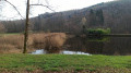
(7) Take the first road on the far left. It makes a wide right-angle bend, passing in front of a large farm building. Continue until you are walking alongside the Étang des Grandes Fouillies.
(8) Walk past the pond and take the first path on the left, which starts in the hollow of a right-angle bend in the road you are following. At the first Fork in the road, which you’ll come to very soon, stay on the left-hand path, which will lead you to a four-way junction.
(9) Take the path furthest to the left, at a right angle. At the first Fork in the road, take the path on the right, at a right angle. Follow it straight ahead, ignoring various turnings on both the right and left, until you reach a small forest track that joins from the left and continues straight ahead.
(10) Continue along this track, which has numerous forest path entrances on both the left and right. Carry on until you reach an entrance on the right marked with a sign reading ‘coupe 12’.
(11) Turn onto the track on the right, then take a wide left-hand bend, ignoring two turnings on the right that run perpendicular to the track you are following. Continue straight on along this track until you reach a Fork in the road, where you should take the left-hand branch. You will arrive at the next Fork in the road, in the dip of a wide left-hand bend.
(12) Take the left-hand fork and follow the track straight ahead. You’ll take a wide left-hand bend, followed by a sharper right-hand bend. Carry on along this steeply descending path, which will take you back to the road linking Amage to Raddon. All you need to do then is turn right to reach the entrance to Amage and the starting point (S/E).
 Visorando Member

 Easy


 Difficult


