Country:

 City:
City:


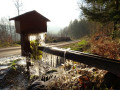
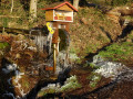
(S/E) Starting from the shelter on the left at the entrance to Amage when coming from Raddon, enter Amage, keeping to the left-hand side of the road. Ignore the first junction (Rue des Champs Pey) and turn left into the second street you come to. Walk past Amage Town Hall (on your left), go past Place de la Gare and carry on straight ahead. At the first junction, carry on straight ahead along Route du Tacot. Cross a small bridge over a stream and carry on until you reach a crossroads, where you turn left onto Chemin des Champs de la Pierre. Walk until you come to a wide path running perpendicular to the road you are following.
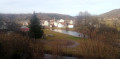
(1) Turn right onto the path (Chemin des Champs Pougeot). It narrows and begins to climb. Continue along this steep path until you reach an information sign marking a rather remarkable viewpoint over the Breuchin valley.
(2) Carry on climbing until you come to a very narrow and very steep track, running perpendicular to the one you are following. Turn left and climb until you reach a wider track, where you turn immediately right. Follow this track straight ahead. After a more or less flat stretch, you will see the hunters’ hut on your right.
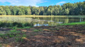
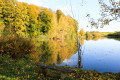
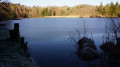
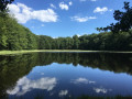
(3) Then head off to the left towards a wide path which makes a first wide bend to the right and then begins a second, tighter bend to the left. At the bottom of this second bend, take a path on the right which will lead you to the edge of the Étang d’Épée.
(4) Turning right, you’ll find a path that runs some distance along the right-hand side of the pond, before veering away from it completely to take you to the edge of the road coming from Sainte-Marie-en-Chanois.
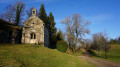
(5) Turn right and follow the road to the first junction with a small road (Impasse Saint-Colomban), where you’ll turn right. Carry on straight ahead, ignoring a path entrance on the left. After a right-angle bend to the right, you’ll arrive at the Saint-Colomban Chapel. The site is perfect for contemplation and relaxation!
(6) Walk past the chapel on your right. The path you need to follow is on the right and leads into the forest. Follow it carefully as it is poorly marked. You’ll come to your first hairpin bend to the right, then join a path coming in from your left. Carry on straight ahead until you reach another hairpin bend to the left. At the Fork in the road, take the path on the right, which descends gently. Ignore the first path on your left and carry on until, at a left-hand bend, you come to a path joining from the right.
(7) Take this path, which climbs steeply, and when you come to another path running perpendicular to the one you’re on, turn left. Carry on along this path, which will take you to the junction with the Route de Saint-Colomban.
(8) Turn left onto this road, which descends quite steeply towards Sainte-Marie-en-Chanois. Continue along it until you pass the town hall of Sainte-Marie-en-Chanois.
(9) Shortly after the town hall, you’ll reach the Grande Rue, which you should cross (with care, as it’s a busy road) to turn, slightly diagonally, onto Rue de la Proiselière. Carry on along this street for a short while and turn right at the first junction you come to, joining the Chemin des Champs des Pierres. Carry on until you come to a short, uphill path on your left, which will take you to the Chapelle Saint-Roch. As the chapel is situated on a hillock, you’ll have a lovely view of the valley and the surrounding hills.
(10) To continue, head downhill until you cross Chemin des Champs des Pierres again, turning left onto it. The path changes its name to Chemin de Saint-Roch. Follow it until you reach a junction, where you should take the first road on the right. Very soon, you’ll arrive at Rue des Trois Fontaines, which leads to the heart of Amage. Cross it carefully – it’s a busy road – then follow it to the left along its right-hand side until you reach a street that runs diagonally: this is Rue du Tacot.
(11) Turn into this street to retrace your steps: walk past the town hall, then follow the right-hand side of the road leading to Raddon until you reach the bus shelter where you started (S/E).

 Visorando Member
 Easy
Easy 
 Difficult
  Tourist office