Country:

 City:
City:




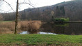
Car park next to the town hall.
(S/E) Head towards the old railway station and the sign for the Pré d’Oro route indicating the direction to take. Continue straight on along Route du Tacot.
(1) Turn left, following the Yellow Ring and yellow arrow markings, plus the ‘Pré d’Oro’ sign. Follow these markers throughout the route.
(2) Keep to the left and do not follow the yellow arrow, which belongs to the route in the neighbouring village. The path begins to climb slightly; keep to the right, the road turns into a path and continues to climb. On the flat section, veer to the left and continue along the path, which leads further on to a tarmac road.
(3) Turn right and walk past the Goulottes ponds, then carry on along this road.
(4) Take the path on your left and head uphill to reach Pré d’Avril, keeping north-east. You’ll come to a junction.
(5) Turn left, passing a few houses in the hamlet of Pré d’Avril.
(6) Turn right onto the tarmac road to reach the Grand Fahy plateau. Walk alongside a pond on your right-hand side until you reach the next junction.
(7) Turn right towards the houses in the hamlet of Les Grillots, then left towards the mast, and walk past the farm and then the pond.
(8) Take the path on your left to reach Muse; at the end of this path, turn left again to reach a T-junction.
(9) Take the path on the right (Pré d’Oro route) and stay on it until you reach the junction with a tarmac road. Continue straight on along the forest track and, at Grand Ban, turn left to begin the descent.
(10) Just after a left-hand bend, turn right onto a path that descends to the D6 at the entrance to Amage (shelter with a bench). Continue left towards the village centre and return to the car park next to the town hall (S/E).

 Visorando Member

 Easy
Easy  Tourist office

 Difficult