Country:

 City:
City:


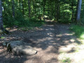
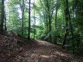
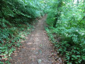
Park at Place de la Poste in Raddon and Chapendu.
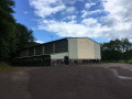
(S/E) From the car park, walk a few metres uphill towards Fougerolles until you come to Rue de l’Église on your right. Continue until you reach Rue du Moulin, which you take on your left, just before the bridge over the Raddon. At the first junction, turn onto Rue du Stade. At the second junction, carry on straight ahead along Rue du Stade until you reach a large sports hall.
(1) Take the path running alongside the sports hall on your left. After a long bend to the right, turn sharply left. The path begins to climb; it is marked by a Yellow Ring. Continue along this path. Shortly after the start of a wide bend to the left, turn right onto a path marked, on a tree on your left, by a Yellow Cross and a sign reading ‘Raddon et Chapendu 10’.
(2) Take this small path, cross a stream via two small fords, then turn right onto a relatively flat path (ignore the path that continues straight ahead, uphill). Carry on straight ahead until you reach a road. Turn right and follow this road until you come to a fairly wide path on the left.
(3) Take this path and follow it for quite a while until you reach a junction with three other paths, two of which lead downhill.
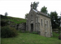
(4) Take the one on the left, marked with a Green Cross, which climbs quite steeply. Follow this path until you reach a small road; take this road straight ahead. Take the first path on your right to climb up to the Chapel of Pierrot de Toto, which is visible from the road.
(5) The location of this chapel offers a beautiful view of the countryside. Head back down, turn right onto the road and walk to the junction with another road. Cross it to take the path directly opposite. Continue until you reach another road. First turn left then right to take the Route des Granges du Bois. Pass by the foot of a large mast. Follow this road until you reach a wide path on your left.
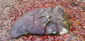
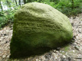
(6) Take this track and carry on straight ahead, ignoring various paths to the right and left, until you reach a road. First turn right then left to take a wide track, which you follow whilst ignoring the small paths branching off to the left or right. After a few undulations, you’ll come to a right-angled left-hand bend, followed a little further on by a right-angled right-hand bend. Shortly after this bend, take the first track you come to on the left, then turn left again onto the first track you cross. Another hundred metres or so, and a right-angled right-hand bend will take you to the Pierre la Miche.
(7) Then take the path marked with a Yellow Arrow, which runs in line with the one you have been following so far (do not turn left onto the path marked GR®). Take the left-hand Fork in the road at the first junction and continue straight on until you reach a wide stony track.
(8) Turn left and carry on straight ahead until you reach a small road, near the Grange Durand.
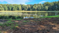
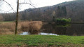
(9) Turn left onto a small road which soon widens into a broad track. Pass Étang Sommepey on your left (sometimes dry) and carry on until you reach Étang Trésurier, which you can admire as you walk a little further along its bank.
(10) Retrace your steps a little. Ahead of you, there are three paths: on the right, the one you came along; on the left, a path leading straight down to the sports hall – do not take this one. Take the middle path. Carry on until you reach a right-hand bend at a right angle which leads past Étang Béjeot, but that is not the direction we are heading in. Just before this bend, turn left onto a grassy path.
(11) Keep going straight along this path until you reach the Route de Fougerolles (D18), which you should cross carefully. Follow the road ahead until you reach the Étang de la Cubette.
(12) Carry on straight ahead. The road turns into a track which you follow until you reach a Fork in the road.
(13) Ignore the path on the left and take the one on the right. Carry on straight ahead, ignoring several paths branching off to both the left and the right. After a while, the path begins to descend steeply and takes you back to the car park where you started (S/E).

 Visorando Member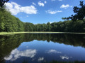

 Difficult
 Easy
Easy 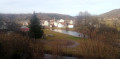
 Tourist office