


Refine your search for walks in Posada de Valdeón
Posada de Valdeón walks


 Farfada Spring
 Visorando Member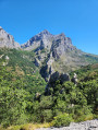
 8.06 mi
 +2,051 ft
 -2,057 ft
 5h 30
5h 30
 Moderate
 Departure from Posada de Valdeón (León)
A walk from the beautiful village of Posada de Valdeón, in the heart of the Picos de Europa National Park, to the source of the Farfada. Superb views over the Rio Cares valley.
Montó from Santa Marina de Valdeón
 6.32 mi
+1,709 ft
-1,709 ft
4h 25
Moderate
Departure from Posada de Valdeón (León)
6.32 mi
+1,709 ft
-1,709 ft
4h 25
Moderate
Departure from Posada de Valdeón (León)
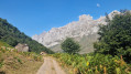
A lovely walk that climbs up the Prada valley to the Monto sheepfold. The path is wide, the ascent steady and largely shaded, and the scenery is superb.
In total, there is a 550-metre ascent.
A signposted route named “PR®-PNPE 14 Montó (Valle de Prada)” in the Picos de Europa National Park.
You can also start from Prada, which adds a little more elevation gain.
From the Vegabaño Refuge to the Collado Jermoso Refuge
 11.71 mi
+5,807 ft
-3,425 ft
10 hrs
11.71 mi
+5,807 ft
-3,425 ft
10 hrs
 Extremely difficult
Departure from Oseja de Sajambre (León)
Extremely difficult
Departure from Oseja de Sajambre (León)
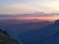
A long stage that begins with a climb through a beech forest, then turns towards Posada de Valdeón to follow a gently sloping valley, before tackling the very difficult climbs of the Canal de Asotín, El Berón and the Canal de Congosto. Finally, you arrive at the magnificent site of Collado Jermoso, where the refuge is perched.
From the Vega de Ario Refuge to the Vegarredonda Refuge
 9.57 mi
+1,896 ft
-2,428 ft
6h 05
9.57 mi
+1,896 ft
-2,428 ft
6h 05
 Difficult
Departure from Onís (Asturias)
Difficult
Departure from Onís (Asturias)
A magnificent stage that begins with a descent to the superb site of the Covadonga Lakes, before starting a pleasant climb to the Vegarredonda Refuge.
Vega Urriellu – Puente de la Jaya
 7.09 mi
+577 ft
-6,129 ft
3h 45
Difficult
Departure from Cabrales (Asturias)
7.09 mi
+577 ft
-6,129 ft
3h 45
Difficult
Departure from Cabrales (Asturias)
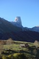
A superb descent towards Poncebos with magnificent views of Picu Urriellu, the majadas of Tenerosa and the little village of Sotres, where the famous Queso Picon is produced.
From the Vega Urriellu Refuge to Poncebos via the Amuesa and Bulnes routes
 8.84 mi
+1,923 ft
-7,467 ft
7 hrs
Extremely difficult
Departure from Cabrales (Asturias)
8.84 mi
+1,923 ft
-7,467 ft
7 hrs
Extremely difficult
Departure from Cabrales (Asturias)
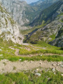
Most of this stage is downhill. However, contrary to what one might think, this does not make the stage easy. The descents are steep. Just like the passage through the Brecha de los Cazadores or the section linking the Jou de los Cabrones refuge to Campa del Trave with its rugged landscapes, or the dizzying Canal de Amuessa and its 950m descent that seems endless. A difficult stage, but one of spectacular beauty.
Fuente Dé
 Association / Club / Walk leader9.05 mi
+1,391 ft
-3,629 ft
5h 20
Moderate
Departure from Camaleño (Cantabria)
Association / Club / Walk leader9.05 mi
+1,391 ft
-3,629 ft
5h 20
Moderate
Departure from Camaleño (Cantabria)
This asymmetrical hike begins with an ascent by cable car, which explains the big difference between the positive and negative elevation gains.
Superb views of the Picos de Europa and a good workout for your calves on the descent.
Descent from the Fuente Dé cable car, Picos de Europa.
7.78 mi
+755 ft
-3,346 ft
4h 15
Moderate
Departure from Camaleño (Cantabria)
After taking the cable car up, you can walk down via a long circular route that goes round the mountain in a clockwise direction.
Download the route before you go up, as there is usually no mobile signal.
The path (PR®-PNPE-24) is easy for about 7 km. It is generally well signposted, but not always. After the wooden bridge, the path is narrow and more difficult for about 500 metres. It then continues through the woods, without difficulty, to Fuente De.
The hike is long, so it’s best to be well-equipped and in good shape.
From the Vegarredonda Refuge to the Vegabaño Refuge
 9.62 mi
+3,881 ft
-4,357 ft
8 hrs
9.62 mi
+3,881 ft
-4,357 ft
8 hrs
 Very difficult
Departure from Cangas de Onís (Asturias)
Very difficult
Departure from Cangas de Onís (Asturias)
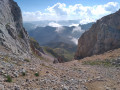
This is going to be a magnificent day; the route passes through rugged terrain with exceptional scenery. You will see herds of chamois, vultures and, with a bit of luck, bearded vultures. From the top of the Cuesta Cebolleda, if you turn around, you will have a magnificent view of Lake Ercina and the Cantabrian Sea.
Through woodland and pretty hamlets via the PR®-PNPE 26
 6.74 mi
+1,877 ft
-1,896 ft
4h 45
Moderate
Departure from Camaleño (Cantabria)
6.74 mi
+1,877 ft
-1,896 ft
4h 45
Moderate
Departure from Camaleño (Cantabria)
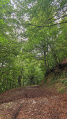
A gentle forest walk with a steep climb at the start; a descent followed by another steep climb halfway along the route.
You’ll pass through two pretty hamlets with Asturian granaries. A few clearings in the trees offer lovely views.
This walk is numbered and signposted “PR®-PNPE 26 Hayedo de Las Ilces” within the national park.
This walk can be done as an alternative to the descent from Santa Fé, which may be in fog.
Anillo Extrem – The Picos de Europa Circular Route in Spain
53.23 mi
+25,646 ft
-25,663 ft
6 days
Extremely difficult
Departure from Cabrales (Asturias)
WARNING! Following the removal of the handrail on the descent from Horcados Rojos (point (7) on the section from the Collado Jermoso Refuge to the Vega Urriellu Refuge), this hike is not recommended for anyone without good climbing experience. According to Tomas, the warden at the Vega Urriellu Refuge whom we met on 05/08/2023, an alternative route is being considered to bypass this difficulty. However, pending a solution, (the stage in question has been removed from the guide). Please therefore take care not to embark on this journey unprepared
A magnificent circular route in the heart of the Picos de Europa. Composed mainly of karst rock, the Picos de Europa offer an extraordinary landscape. Sharp peaks, chaotic rock formations, scree slopes, dizzying drops and deep chasms.
You will see numerous herds of chamois, flocks of vultures (always in great numbers), a few bearded vultures and all manner of domestic animals grazing peacefully.
From Poncebos to the Vega de Ario Refuge via the Canal de Trea
 7.81 mi
+9,974 ft
-5,518 ft
8 hrs
Very difficult
Departure from Cabrales (Asturias)
7.81 mi
+9,974 ft
-5,518 ft
8 hrs
Very difficult
Departure from Cabrales (Asturias)
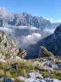
A very beautiful hike that begins with the magnificent Ruta del Cares. You then take the very steep Trea gorge to reach the Vega de Ario, where the refuge is located.
Village of Bulnes
 4.57 mi
+1,913 ft
-1,906 ft
3h 45
Moderate
Departure from Cabrales (Asturias)
4.57 mi
+1,913 ft
-1,906 ft
3h 45
Moderate
Departure from Cabrales (Asturias)
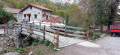
Bulnes is worth a visit for many reasons, whether by funicular railway or on foot. The village has an unusual atmosphere, a rural setting where you will see barely a dozen neighbours and a good number of Asturian houses, many in ruins, including the parish church. The advantage is that you can take the funicular railway one way or both ways. But hiking both ways is really the best option! Don't miss the Picu Urriellu viewpoint, also known as Naranjo de Bulnes, which is located a few minutes from the village of Bulnes. It offers a breathtaking panoramic view of this famous peak in the Picos de Europa.
Ruta del Cares from Poncebos to Caín and back
 12.65 mi
+9,652 ft
-9,629 ft
14h 15
Difficult
Departure from Cabrales (Asturias)
12.65 mi
+9,652 ft
-9,629 ft
14h 15
Difficult
Departure from Cabrales (Asturias)
Closed sections marked 2.3 km from the start (October 2025).
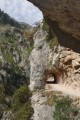
The Ruta del Cares is undoubtedly the most beautiful route in the entire Picos de Europa mountain range, also known as Garganta Divina (Divine Gorge in Spanish).
This path, carved into the rock on the mountainside, overlooks the Rio Cares for more than 10 kilometres. It will take you from Poncebos to Caìn through a breathtakingly beautiful gorge.
N.B. The total elevation gain is overestimated: expect around 700 metres.
From Poncebos to the old village of Bulnes
 7.50 mi
+2,779 ft
-2,779 ft
5h 50
Moderate
Departure from Cabrales (Asturias)
7.50 mi
+2,779 ft
-2,779 ft
5h 50
Moderate
Departure from Cabrales (Asturias)
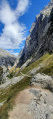
A mountain trail that winds its way around the bed of the River Cares and climbs up to the old village of Bulnes, offering breathtaking views at the foot of the Naranjo de Bulnes, one of the legendary peaks of the Picos de Europa.
From Tielve to Sotres
4.82 mi
+1,942 ft
-794 ft
3h 55
Moderate
Departure from Cabrales (Asturias)
This hike requires leaving a vehicle at the finish point to bring the drivers back to the start. The route is in the uphill direction as this represents less risk of falling than downhill.
The “Invernales de Vanu” circular route starting from Arenas de Cabrale
 3.73 mi
+1,214 ft
-1,020 ft
2h 45
Moderate
Departure from Cabrales (Asturias)
3.73 mi
+1,214 ft
-1,020 ft
2h 45
Moderate
Departure from Cabrales (Asturias)
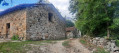
A lovely walk starting from Las Arenas, recommended by the Cabrales region’s tourist office: “No. 9: Excursion to Las Invernales de Vanu”. The path climbs initially through a forest of maple and plane trees, offering magnificent views of the famous Pic Urriellu in Asturian (or Pic Naranjo de Bulnes in Spanish), then descends, crossing the Vanu pastures and their many 18th-century sheepfolds, which are still in use today.