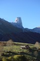
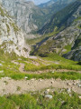
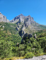
Through woodland and pretty hamlets via the PR®-PNPE 26

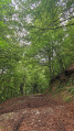
A gentle forest walk with a steep climb at the start; a descent followed by another steep climb halfway along the route.

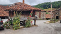
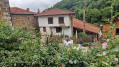
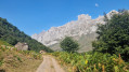
You’ll pass through two pretty hamlets with Asturian granaries. A few clearings in the trees offer lovely views.

This walk is numbered and signposted “PR®-PNPE 26 Hayedo de Las Ilces” within the national park.

This walk can be done as an alternative to the descent from Santa Fé, which may be in fog.

Details

103556828
Creation:
Last update:
Last review:
  • Walking
    Activity: Walking
  • ↔
    Distance: 6.74 mi
  • ◔
    Average duration: 4h 45 
  • ▲
    Difficulty: Moderate

  • ⚐
    Back to start: Yes
  • ↗
    Ascent: + 1,877 ft
  • ↘
    Descent: - 1,896 ft

  • ▲
    Highest point: 3,609 ft
  • ▼
    Lowest point: 2,625 ft

Photos

Description of the walk

The walk starts in the village of Espinama, where it is fairly easy to find a parking space.

The path starts at the eastern end of the village, heading towards Pido.

(1) The pretty hamlet of Pido, with an Asturian granary in good condition.

After a quick tour of the hamlet, rejoin the path for the climb through the forest.

The path is fairly wide and continues along the mountainside to Invernal del Matu.

(2) Leave the path and take a track that descends until it crosses the road just below Les Ilces.

(3) Cross the hamlet of Les Ilces and head back up into the forest.

Climb until you come to a path on the mountainside.

(4) At the junction, take the path on the left. The path continues through the forest and, a little further on, descends. Follow it to the road.

Continue along the road until you reach the starting point.

Waypoints

  1. S/E : mi 0 - alt. 2,877 ft - Espirama
  2. 1 : mi 0.41 - alt. 3,028 ft - Pido
  3. 2 : mi 3.3 - alt. 3,228 ft - Invernal del Matu
  4. 3 : mi 4.07 - alt. 2,661 ft - las Iles
  5. 4 : mi 4.67 - alt. 3,264 ft - junction
  6. S/E : mi 6.74 - alt. 2,877 ft - Espirama

Notes

Please note: the path is better marked on the OSM-rando map than on topographical maps (such as IGN).

Always be cautious and plan ahead when you're outdoors. Visorando and the author of this route cannot be held responsible for any accidents occurring on this route.

The GR® and PR® markings are the intellectual property of the Fédération Française de Randonnée Pédestre.

Other walks in the area

For more walks, use our search engine .

The GPS track and description are the property of this route's author. Please do not copy them without permission.