Country:
 City:
City:


To get to the starting point in Poncebos, at the Ovar public car park: you can drive there (please note that whilst the car park is quite large, it fills up quickly in summer as Poncebos is the starting point for the underground funicular that goes up to Bulnes and also for the ‘La ruta del Cares’ walk). The best option is to take the Arenas–Sotres bus, which passes through Poncebos.
Bus information (to be confirmed with the tourist office): ALSA buses depart from the main square in Las Arenas de Cabrales from 8.15 am to 1.00 pm and from 5.00 pm to 7.00 pm, approximately every hour. The first bus leaves Arenas at 8.15 am. The journey between Arenas and Poncebos takes about 15 minutes and costs €3.10 return. All buses stop at the Ovar car park and continue on to Poncebos. If possible, ask to get off at Poncebos – this will save you the 2.5 km walk to the starting point (1) of the hike.
(S/E) Once at the car park, continue along the road for 2.5 km before reaching Poncebos.
(1) Cross the bridge leading to the hotel car park and follow the signposted walking routes, crossing the hotel car park via the small path that leads past the entrance to the power station.
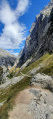
(2) Take the path that climbs to the right of the power station, go through a small tunnel and then past a drinking trough where goats often come to drink. This PR® path is marked in white and yellow. Go behind the houses and then join the tarmac road, which soon becomes a stony track; turn right onto it.
(3) Turn left onto the signposted variant of the GR®202 and cross the “Punte de la Jaya” before climbing towards the village of Bulnes. Just before the entrance to the village, take a look at the terminus of the underground funicular railway linking Poncebos and Bulnes , two villages in the concejo (municipality) of Cabrales . The funicular runs through a tunnel dug beneath a mountain called Peña Maín (Maín Rock). This structure, which opened up Bulnes by connecting it to its municipality of Cabrales, was opened to the public in 2001.
(4) When you reach the funicular station, carry straight on.
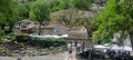
(5) You will arrive at the village of Bulnes, which is now dedicated to tourism and serves as a starting point for hikes and mountaineering routes. Visit the little “Chapelle des Neiges” at the entrance to the village. There are plenty of cafés and restaurants to choose from, housed in the old, beautifully restored buildings, where you can enjoy a meal. Return to the Ovar public car park (S/E) via the same route in the opposite direction, allowing you to enjoy the magnificent scenery even more.
 Visorando Member
 Difficult
 Extremely difficult
 Very difficult
 Association / Club / Walk leader