Vega Urriellu – Puente de la Jaya

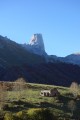
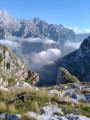
A superb descent towards Poncebos with magnificent views of Picu Urriellu, the majadas of Tenerosa and the little village of Sotres, where the famous Queso Picon is produced.

This walk is part of a multi-day hike: Circuit de Vega Urriellu

Details

891695
Creation:
Last update:
Last review:
  • Walking
    Activity: Walking
  • ↔
    Distance: 7.09 mi
  • ◔
    Average duration: 3h 45 
  • ▲
    Difficulty: Difficult

  • ⚐
    Back to start: No
  • ↗
    Ascent: + 577 ft
  • ↘
    Descent: - 6,129 ft

  • ▲
    Highest point: 6,391 ft
  • ▼
    Lowest point: 820 ft
  • ⚐ Country: Spain
  • ⚐ City: Cabrales 
  • ⚑
    Start: N 43.20281° / W 4.821473°
  • ⚑
    End: N 43.254592° / W 4.836675°
  • Hour-by-hour weather

Photos

Description of the walk

(S) Leave the Vega Urriellu mountain hut on the right (north-east) and begin the descent towards Tenerosa via thePR®-PNPE 21 trail. Head for the Valleja canal.

(1) Caution! This section is particularly dangerous in windy conditions. Continue down to the Tenerosa Refuge.

(2) Follow the path towards Collado de Pandébano until you reach a steeper path.

(3) Turn left to begin the descent towards Bulnes. Reach the junction of the paths.

(4) Leave thePR®-PNPE and join theGR®202– Ruta de la Reconquista. Continue on to Bulnes.

(5) Here, rejoin thePR®-PNPE19 that you followed the previous day.

(6) Pass the upper station of the funicular.

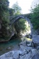
(7) Enter the Canal del Tejo and continue the descent to the River Cares, cross the Jaya Bridge and climb up to the road. Head to the Puente de la Jaya car park (E).

Waypoints

  1. S : mi 0 - alt. 6,385 ft - When leaving the mountain hut, please remember to take your rubbish with you!
  2. 1 : mi 1.68 - alt. 5,020 ft - Dangerous stretch (gusts of wind)
  3. 2 : mi 2.71 - alt. 4,337 ft - Tenerosa Mountain Hut
  4. 3 : mi 2.88 - alt. 4,278 ft - Turn left
  5. 4 : mi 3.3 - alt. 3,970 ft - Junction with the GR 202
  6. 5 : mi 5.08 - alt. 2,123 ft - At Bulnes, continue along the PR-PNPE 19
  7. 6 : mi 5.35 - alt. 2,047 ft - Upper station of the funicular
  8. 7 : mi 5.64 - alt. 1,870 ft - Entrance to the Canal del Tejo
  9. E : mi 7.09 - alt. 833 ft - Parking

Notes

The weather is very changeable in the Picos de Europa, so do check the forecast before setting out: Weather

Drinking water is scarce in the Pics d’Europe, so please plan ahead.

Remember to book whatever you need: overnight accommodation, dinner, breakfast, or a picnic for the following day: Booking

It is possible to camp near the refuge; the camp must be set up at nightfall and taken down at daybreak.

A 1:25,000 map and a compass are essential:

Worth a visit

You can take a short break at the Tenerosa Mountain Refuge.

In Bulnes, there are bars and restaurants waiting for you.

If you’re feeling a bit tired, in Bulnes you can take the funicular, which will take you to Poncebos.

Always be cautious and plan ahead when you're outdoors. Visorando and the author of this route cannot be held responsible for any accidents occurring on this route.

The GR® and PR® markings are the intellectual property of the Fédération Française de Randonnée Pédestre.

Reviews and comments

4.3 / 5
Based on 2 reviews

Reliability of the description
4.5 / 5
Ease of following the route
4.5 / 5
Route interest
4 / 5
Pep 64
Pep 64

Overall rating : 4.7 / 5

Date of your route : Aug 07, 2023
Reliability of the description : ★★★★★ Very good
Ease of following the route : ★★★★★ Very good
Route interest : ★★★★☆ Good
Very busy route : Yes

A lovely path up to the Tenerosa mountain hut; however, the descent to the village of Bulnés is, in my opinion, uninteresting and tedious. The path is shaded by hazel and ash trees, but the section leading to Bulnés is muddy, stony and very damp, making it rather slippery.
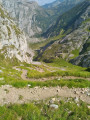
On the other hand, the descent towards Poncebos is superb, to the left of the funicular station, along a path running along a ledge above a magnificent gorge.

Machine-translated

Aquacyclopode
Aquacyclopode

Overall rating : 4 / 5

Date of your route : Sep 04, 2021
Reliability of the description : ★★★★☆ Good
Ease of following the route : ★★★★☆ Good
Route interest : ★★★★☆ Good
Very busy route : No

A lovely descent. It’s worth noting that the only tricky bit is the approach path to the village of Bulnes. It’s a path with wet pebbles, so it’s very slippery. The rest is fairly easy.

Machine-translated

Other walks in the area

For more walks, use our search engine .

The GPS track and description are the property of this route's author. Please do not copy them without permission.