Vega de Llos

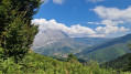
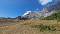
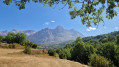
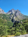
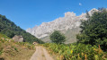
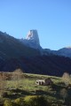
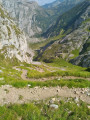
A superb hike that climbs up to the mountain pastures of Vega de Llos, where there is a shelter. Stunning views throughout the route. The walk starts from Posada de Valdeón and passes through the very pretty village of Soto de Valdeón (with its charming Asturian granaries) before gradually climbing. The second part of the descent is steeper (and shorter) than the ascent route. A signposted route named “PR®-PNPE 12 Vega de Llos” within the Picos de Europa National Park.

Details

n°103409540
Creation:
Last update:
Last review:
–
  • Walking
    Activity: Walking
  • ↔
    Distance: 7.78 mi
  • ◔
    Average duration: 5h 30 
  • ▲
    Difficulty: Average

  • ⚐
    Back to start: Yes
  • ↗
    Ascent: + 2,178 ft
  • ↘
    Descent: - 2,156 ft

  • ▲
    Highest point: 5,167 ft
  • ▼
    Lowest point: 3,002 ft

Photos

Description of the walk

The walk starts right next to the large car park at the southern exit of Posada de Valdeón.

(S/E) Follow the river along a wide path to Soto de Valdeon.

(1) Walk through the village, admiring the granaries and the view. The path continues, climbing gently.

(2) Carry on along the path, which turns right towards the east, and continue the climb.

(3) Further on, at the Fuente Oscura, the path veers northwards (leave the downhill track on your right). The path remains fairly wide until you emerge from the forest.

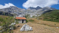
(4) Climb up to the shelter situated in the mountain pastures.

(5) Climb further up to the drinking trough (for horses and cows).

(5) Head back down the same path to the junction at Fuente Oscura.

(3) The descent continues straight on along a narrower, steeper and rockier path. At the bottom, turn right and you’ll reach the exit from Soto.

(1) The final stretch is flat and follows the outward route in the opposite direction to return to the car park (S/E).

Waypoints

  1. S/E : mi 0 - alt. 3,002 ft - Posada de Valdeón
  2. 1 : mi 0.65 - alt. 3,087 ft - Soto de Valdeón
  3. 2 : mi 2.96 - alt. 3,885 ft - Junction heading east
  4. 3 : mi 3.66 - alt. 4,403 ft - Fuente Oscura
  5. 4 : mi 4.47 - alt. 5,089 ft - Shelter (Refugio de la Caseta de Llos)
  6. 5 : mi 4.64 - alt. 5,167 ft - Vega de Llos
  7. S/E : mi 7.78 - alt. 3,012 ft - Posada de Valdeón

Notes

Please note: the path is better marked on the OSM-rando map than on topographical maps (such as IGN).

Always be cautious and plan ahead when you're outdoors. Visorando and the author of this route cannot be held responsible for any accidents occurring on this route.

The GR® and PR® markings are the intellectual property of the Fédération Française de Randonnée Pédestre.

Other walks in the area

For more walks, use our search engine .

The GPS track and description are the property of this route's author. Please do not copy them without permission.