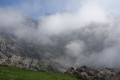
Montó from Santa Marina de Valdeón

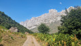
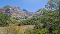
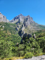
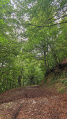
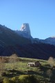
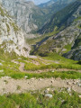
A lovely walk that climbs up the Prada valley to the Monto sheepfold. The path is wide, the ascent steady and largely shaded, and the scenery is superb.

In total, there is a 550-metre ascent.

A signposted route named “PR®-PNPE 14 Montó (Valle de Prada)” in the Picos de Europa National Park.

You can also start from Prada, which adds a little more elevation gain.

Details

103804463
Creation:
Last update:
Last review:
  • Walking
    Activity: Walking
  • ↔
    Distance: 6.32 mi
  • ◔
    Average duration: 4h 25 
  • ▲
    Difficulty: Moderate

  • ⚐
    Back to start: Yes
  • ↗
    Ascent: + 1,709 ft
  • ↘
    Descent: - 1,709 ft

  • ▲
    Highest point: 5,177 ft
  • ▼
    Lowest point: 3,714 ft

Photos

Description of the walk

Start somewhere past Santa Marina on the road to the campsite (follow the campsite signs and find somewhere to park; do not drive all the way to the campsite)

There are two options for the start (and finish): the path following the Rio El Arenal westwards is very damp, even after a dry spell; the path heading south is more passable (farm track).

The route follows a farm track used by shepherds, so it is easy to find your way.

(1) You’ll cross the path coming from the village of Prada, which you should leave to your right.

A gradual ascent, generally in the shade and offering superb views.

(2) First shepherd’s shelter at Pradolargo.

Continue along the path.

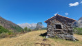
(3) You’ll reach the end of the path at the Monto shelter in the pastures.

Return via the same route.

Waypoints

  1. S/E : mi 0 - alt. 3,714 ft - Santa Marina de Valdeon
  2. 1 : mi 1.54 - alt. 4,203 ft - Junction with the path coming from Prada
  3. 2 : mi 1.9 - alt. 4,409 ft - Prado Largo shelter
  4. 3 : mi 3.16 - alt. 5,177 ft - Monto shelter
  5. S/E : mi 6.32 - alt. 3,714 ft - Santa Marina de Valdeon

Notes

Please note: the path is better marked on the OSM-rando map than on topographical maps (such as IGN maps).

Always be cautious and plan ahead when you're outdoors. Visorando and the author of this route cannot be held responsible for any accidents occurring on this route.

The GR® and PR® markings are the intellectual property of the Fédération Française de Randonnée Pédestre.

Other walks in the area

For more walks, use our search engine .

The GPS track and description are the property of this route's author. Please do not copy them without permission.