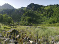
Col Dret, Tuc du Laguel and Courtal de Cougniet

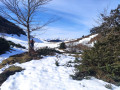
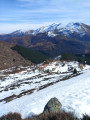
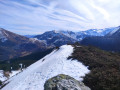
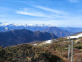
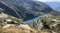
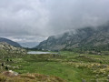
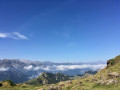
At the foot of Mont Béas, a lovely climb towards Col Dret offers stunning panoramic views of the Couserans peaks, the Pic des Trois Seigneurs massif and, if the weather is clear, the Roc Blanc in the background behind Port de Lers. The descent takes you through the Courtal de Cougneit, former shepherds’ huts, before continuing through a beautiful fir forest.

Details

69702473
Creation:
Last update:
Last review:
  • Walking
    Activity: Walking
  • ↔
    Distance: 4.56 mi
  • ◔
    Average duration: 3h 20 
  • ▲
    Difficulty: Moderate

  • ⚐
    Back to start: Yes
  • ↗
    Ascent: + 1,460 ft
  • ↘
    Descent: - 1,522 ft

  • ▲
    Highest point: 5,308 ft
  • ▼
    Lowest point: 4,167 ft

Photos

Description of the walk

Car park in front of the Étang de Lers bar and restaurant.

(S/E) Head towards the large wooden information boards and take the path leading down to the left, then follow the track veering right towards the lake (purple-yellow signposting). Reach the shore of Étang de Lers and follow it to the wooden jetty. 

(1) Cross the road to the right and join the track leading off to the left.

(2) Take the path that climbs to the left towards the forest: be careful, as it is hard to spot – look for a yellow mark on a small holly bush. Follow this path, which crosses a stream and then widens out near the pine trees. You’ll reach a junction with an old track. 

(3) Continue straight on along the path (yellow markings). 

(4) At the junction, leave the old forest track to your right (return route). Continue left along the path to reach the Col Dret and enjoy the view. 

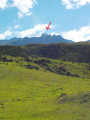
(5) Do not take the GRP® marked in yellow and red. Turn right towards the fence on the ridge. Follow the path closest to the fence (numerous cattle tracks) to reach the summit of the Tuc de Laguel on a small rock. 

(6) Continue along the ridge, following the fence, to reach a small pass. Take the path that descends into the valley on the right, eventually leading down into the Courtal de Cougneit valley (ruins of a shepherd’s hut). 

(7) Follow the track that emerges between the fir trees, and further down, cross the Ribes stream.

(8) Immediately afterwards, head up to the right along the embankment to find an old forest track, which isbarely visible and unmarked. Follow it until you reach the junction you passed on the way out. 

(4) Turn left and follow the route back in the opposite direction to reach the car park (S/E). 

Waypoints

  1. S/E : mi 0 - alt. 4,331 ft - Car park - Étang de Lers
  2. 1 : mi 0.37 - alt. 4,180 ft - Crossing the D8f
  3. 2 : mi 0.79 - alt. 4,262 ft - Track/path junction
  4. 3 : mi 1.14 - alt. 4,642 ft - Junction with old track
  5. 4 : mi 1.25 - alt. 4,701 ft - Junction of the circular loop
  6. 5 : mi 1.56 - alt. 4,797 ft - Col Dret (1454m)
  7. 6 : mi 2.12 - alt. 5,308 ft - Tuc du Laguel (1628m)
  8. 7 : mi 2.56 - alt. 4,885 ft - Start: forest track
  9. 8 : mi 3.14 - alt. 4,514 ft - Tricky junction to the right
  10. S/E : mi 4.56 - alt. 4,268 ft - Car park

Notes

Yellow PR® markings are visible up to the Col Dret but are much older and less visible further on.  

(8) You can continue along the main track, which winds down in a zigzag. After joining another track, turn off to rejoin (2).

Worth a visit

(S/E) Étang de Lers: depending on the time of year, fishing is possible with the purchase of a day permit.

Always be cautious and plan ahead when you're outdoors. Visorando and the author of this route cannot be held responsible for any accidents occurring on this route.

The GR® and PR® markings are the intellectual property of the Fédération Française de Randonnée Pédestre.

Reviews and comments

4.5 / 5
Based on 2 reviews

Reliability of the description
4.5 / 5
Ease of following the route
4 / 5
Route interest
5 / 5
PAFE72
PAFE72

Overall rating : 4.3 / 5

Date of your route : Jul 06, 2026
Reliability of the description : ★★★★☆ Good
Ease of following the route : ★★★★☆ Good
Route interest : ★★★★★ Very good
Very busy route : No

A very pleasant route, on which we came across just one person in total... Magnificent scenery, with the climb in the shade. The only slight downside: the path disappears on the ridge; without GPS guidance, it would be tricky!

Machine-translated

Netlander
Netlander

Overall rating : 4.7 / 5

Date of your route : Oct 08, 2025
Reliability of the description : ★★★★★ Very good
Ease of following the route : ★★★★☆ Good
Route interest : ★★★★★ Very good
Very busy route : No

Hike completed under beautiful autumn sunshine.
Although short, the hike is very pleasant and varied. It is well shaded.
The ridge, between 5 and 6, is not easy to follow (lots of scrub), but you can't get lost!

Machine-translated

Other walks in the area

For more walks, use our search engine .

The GPS track and description are the property of this route's author. Please do not copy them without permission.