


Refine your search for walks in Refuge de Bassiès
Refuge de Bassiès walks


 The Étangs de Bassiès from Massada
 Visorando Member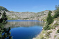
 9.11 mi
 +3,212 ft
 -3,202 ft
 7h 00
7h 00
 Difficult
 Departure from Auzat (Ariège)
First day of a three-day trip (August 2023) starting from Vicdessos (Val de Sos).Please note: the suggested route, which is in excellent condition, is only sparsely signposted, except for the section of theGR®®10.This hike is classified as difficult due to the need for a good sense of direction, the poor condition of theGR®®10, the numerous steps to negotiate, the duration, etc.If it is simply a return trip to the refuge via theGR®®10, then the walk can be classified as moderate.=> August 2026: access to the lakes and the refuge may be affected by this => GR®10 in Ariège: Temporary closure of the Marc > Port de Saleix section (diversion)It should be possible to do a return trip to the lakes and the refuge via the power station (6) without returning via the GR®10!
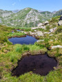
Pique Rouge de Bassiès
 9.11 mi
+4,295 ft
-4,288 ft
7h 55
Difficult
Departure from Aulus-les-Bains (Ariège)
9.11 mi
+4,295 ft
-4,288 ft
7h 55
Difficult
Departure from Aulus-les-Bains (Ariège)
A very beautiful hike that follows a ridge line and offers magnificent views of the entire massif. This is a hike with a significant elevation gain, reserved for experienced hikers.
Refuge de Bassiès via Port de Saleix
7.09 mi
+2,677 ft
-2,657 ft
5h 35
 Moderate
Departure from Aulus-les-Bains (Ariège)
Moderate
Departure from Aulus-les-Bains (Ariège)
A magnificent hike through varied landscapes along the entire route. The climb to Port de Bassiès is steady and not too difficult. Unfortunately, there is a 280 m descent to the refuge, which you will have to climb back up.
Take advantage of the view of the lakes and the Pique Rouge cirque to rest for a while.
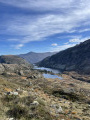
Bassiès Refuge via the Port de Saleix and Bassiès
 7.00 mi
+2,969 ft
-2,969 ft
5h 50
Difficult
Departure from Aulus-les-Bains (Ariège)
7.00 mi
+2,969 ft
-2,969 ft
5h 50
Difficult
Departure from Aulus-les-Bains (Ariège)
This lovely circular walk takes you to the Refuge de Bassiès, over mountain passes, and past lakes and an old mine on the way back.
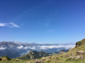
Two-day route via the Bassiès Refuge
 11.43 mi
+4,810 ft
-4,806 ft
2 days
Difficult
Departure from Suc-et-Sentenac (Ariège)
11.43 mi
+4,810 ft
-4,806 ft
2 days
Difficult
Departure from Suc-et-Sentenac (Ariège)
Do not underestimate these two days, which pack in significant gradients over a relatively short distance.The first day is interesting for the discoveries it offers and a section with virtually no signposting. The arrival at the refuge is magnificent.Spending the night at the Refuge de Bassiès allows you to look forward to the return journey on the second day with greater peace of mind.A visit to the Étangs de Bassiès can be planned for the second day from the refuge, leaving some of your kit there. You can then collect all your kit for the challenging return walk to the Port de Lers car park.
Bassiès-Port de Lers mountain hut via the Étang d’Alate and Mont Ceint
3.97 mi
+1,883 ft
-2,313 ft
3h 30
Difficult
Departure from Auzat (Ariège)
Before heading back, there is the option of a return trip to the Étang de Bassiès from the refuge, leaving some of your luggage at the refuge.A fairly short second stage, with two steep ascents (19% to 38%): one from the Refuge de Bassiès to the Port de Bassiès, and the even more challenging one from the Port de Saleix to the Pic de Girantès or Mont Ceint. In fact, it is a rather gruelling, up-and-down stage, classified as difficult. The ascents and descents are on challenging trails (pebbles, rocks, scree). The whole day is spent in open country with stunning panoramic views. The route passes the beautiful Étang d’Alate.The relative altitude, between 1,520 m and 2,100 m, means this day’s walk is feasible even in the height of summer.
Port de Lers–Bassiès Refuge via Pas du Roc, Étang de Labant, Col Fouzès
 7.46 mi
+2,927 ft
-2,493 ft
6h 00
Difficult
Departure from Suc-et-Sentenac (Ariège)
7.46 mi
+2,927 ft
-2,493 ft
6h 00
Difficult
Departure from Suc-et-Sentenac (Ariège)
The first day takes you to the Refuge de Bassiès, passing huts, a valley, mountain passes, an old mine, a pond, and various cols and mountain passes. The stretch from the Col de las Fouzès to the Port de Bassiès is particularly beautiful.The route follows paths and tracks that are difficult due to their terrain (rock, scree, unmarked).See practical information * From (3) to (6) an unmarked path with gradients of 15% and 25%, with the presence of Patou dogs from (4). From (12) to (18) a marked path with gradients of 16% to 30%.The GPX track is necessary in places to avoid any confusion, as the route does not necessarily follow GR®, GRP® or PR® trails.Allow around 6 hours for the walk.