


Refine your search for walks in Pont Saint-Pierre (Grégy-sur-Yerre)
Pont Saint-Pierre (Grégy-sur-Yerre) walks


 The bridges of Évry-Grégy-sur-Yerres
 Visorando Member
 7.10 mi
 +299 ft
 -305 ft
 3h 30
3h 30
 Moderate
 Departure from Évry-Grégy-sur-Yerre (Seine-et-Marne)
Circular route around Évry-Grégy-sur-Yerres, allowing you to discover different ways of crossing the river: bridges, fords, footbridges. Two of these bridges date from the 17th and 18th centuries and are listed in the inventory of historic monuments.
This route takes you past the Priory of Vernelle (private), which is a beautiful spot.
Walks near Pont Saint-Pierre (Grégy-sur-Yerre)
From Quincy to Montgeron along the Yerres
11.29 mi
+171 ft
-302 ft
5h 20
Moderate
Departure from Combs-la-Ville (Seine-et-Marne)
This is an unusual route, as the outward journey is by train from Montgeron station to Combs la Ville-Quincy-sous-Sénart station, and the return journey is on foot along a path that largely follows the banks of the Yerres.
From Brunoy to Combs-la-Ville
 8.11 mi
+348 ft
-279 ft
4h 00
Moderate
Departure from Brunoy (Essonne)
8.11 mi
+348 ft
-279 ft
4h 00
Moderate
Departure from Brunoy (Essonne)
A hike from station to station in a semi-urban environment, following paths through gardens and pleasant riverside trails.
Along the Yerres and Réveillon rivers and through the Bois de la Grange
7.13 mi
+230 ft
-210 ft
3h 30
Moderate
Departure from Brunoy (Essonne)
A pleasant walk along two rivers, the Yerres and the Réveillon. You completely forget the nearby urban environment.
From Corbeil to Ballancourt via Villeroy Park and the Fontenay Marshes
 12.46 mi
+354 ft
-302 ft
6h 00
12.46 mi
+354 ft
-302 ft
6h 00
 Difficult
Departure from Corbeil-Essonnes (Essonne)
Difficult
Departure from Corbeil-Essonnes (Essonne)
A walk from station to station starting in Vieux Corbeil (large mills, cathedral). After following the Seine, the route climbs before descending to Moulin Galant, then follows the Essonne. The walk concludes with a stroll through Villeroy Park, set in a wooded landscape, followed by an exploration of the Fonteanay Marshes and their birdwatching hides.
Following the Essonne
 97.78 mi
+3,153 ft
-3,136 ft
10 days
Moderate
Departure from Corbeil-Essonnes (Essonne)
97.78 mi
+3,153 ft
-3,136 ft
10 days
Moderate
Departure from Corbeil-Essonnes (Essonne)
Named after Acionna, the Gallo-Roman goddess of rivers, the Essonne flows through the north of the Loiret department and the south of the Île-de-France region. The first five stages follow its course downstream, while the last four follow it upstream. These nine stages are accessible by train. One stage, which is not accessible by train, forms a circular route upstream. The route alternates between paths along the river, passages through woods and those across cultivated plateaus.
Along the Seine from Corbeil to Juvisy
 8.46 mi
+13 ft
-23 ft
3h 55
Moderate
Departure from Corbeil-Essonnes (Essonne)
8.46 mi
+13 ft
-23 ft
3h 55
Moderate
Departure from Corbeil-Essonnes (Essonne)
A walk from station to station with a relatively straightforward route, as it mainly follows the right bank of the Seine. Apart from the approach from the starting station and the approach to the finishing station, the route stays as close as possible to the river.
Arc Boisé in eastern Paris
 15.21 mi
+161 ft
-220 ft
7h 10
Difficult
Departure from Boissy-Saint-Léger (Val-de-Marne)
15.21 mi
+161 ft
-220 ft
7h 10
Difficult
Departure from Boissy-Saint-Léger (Val-de-Marne)
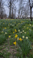
This long hike goes from one RER A station to another. It begins with a climb in Boissy Saint-Léger but the rest is flat. We start with a circular walk through the Gros-Bois Forest, then the main part of the walk takes us through the Notre-Dame Forest. We alternate between wide avenues and footpaths, with a wide variety of trees. The walk ends with a long, gently sloping green corridor and a walk through Morbras Park. Several alternative routes allow you to shorten the route.
From Boissy to Brunoy via the Grange forest and the banks of the Yerres
 8.10 mi
+243 ft
-249 ft
3h 55
Moderate
Departure from Boissy-Saint-Léger (Val-de-Marne)
8.10 mi
+243 ft
-249 ft
3h 55
Moderate
Departure from Boissy-Saint-Léger (Val-de-Marne)
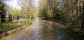
The first part of this hike from station to station is mainly through forest, with a mix of wide paths and winding trails. Then you follow the course of the Yerres, playing leapfrog with the river, its branches and tributaries.
Sequoia Avenue - Ferrières and Armainvilliers Forests
 9.83 mi
+36 ft
-39 ft
4h 35
Moderate
Departure from Ozoir-la-Ferrière (Seine-et-Marne)
9.83 mi
+36 ft
-39 ft
4h 35
Moderate
Departure from Ozoir-la-Ferrière (Seine-et-Marne)
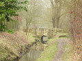
This hike takes you through the forests of Armainvilliers and Ferrières, where you can discover many species of trees and the Sequoia Avenue. The route then continues to the Taffarette Pond, where you can stop for a picnic in a relaxing and pleasant setting. See the old laundry room of the Château de Ferrières and its wash house, as well as the Church of Saint-Rémy. The route ends with a walk through the forest to Roissy-Brie station, following the Morbras.
From Ozoir-la-Ferrière to Tournan via the Armainvilliers Forest
 8.73 mi
+36 ft
-66 ft
4h 05
Moderate
Departure from Ozoir-la-Ferrière (Seine-et-Marne)
8.73 mi
+36 ft
-66 ft
4h 05
Moderate
Departure from Ozoir-la-Ferrière (Seine-et-Marne)
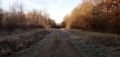
A two-part hike from station to station. First, you cross the Armainvilliers National Forest, on wide paths and then on a trail that winds through the undergrowth. The rest of the route takes you through fields, through the village of Favières and finally to the heritage sites of Tournan-en-Brie.