Country:
 City:
City:


Starting point and access: Corbeil-Essonnes station.
- RER - Line D, terminus of a section from Paris and on the section between Juvisy and Malesherbes.
Take the Henri Barbusse / Centre-ville exit (if necessary, use the footbridge).
No signposting
(S) On leaving the station, head diagonally to the left and cross the bus station. At the corner of a bar, turn right onto Avenue d’Arblay (signposted further on). At the traffic lights, continue straight ahead. At the roundabout, go straight on towards Vieux Corbeil. At the next roundabout, turn left onto Rue de la République and walk past the old buildings of the Grands Moulins de Corbeil on your right. At the end, cross Quai Mauzaisse at the pedestrian crossing to reach the banks of the Seine.
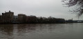
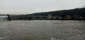
(1) Turn right, walk along the Seine on your left and cross over the mouth of the Essonne. At the Fork in the road (traffic lights), take the right-hand lane of the quay, the one that goes uphill towards the bridge. Cross the bridge over the Seine. At the roundabout on the opposite bank, turn left onto Rue du 14 Juillet. Go straight on and, four times, cross streets on the left whose names refer to a port. At the traffic lights, continue straight on and immediately cross Rue du Port de l’Étoile on the left.
Red and white markings
(2) At the next traffic lights, turn left into Rue du Port des Marines. At the end, climb a flight of steps and then descend another to reach the banks of the Seine. Then turn right and follow a path (not shown on the map) between the Seine on the left and a wall on the right. Return to the road you left earlier (Rue Waldeck Rousseau) and stay on the grassy path running alongside it (houseboats moored on the left). After the last houseboat, take the pavement on the road.
(3) Just after the Corbeil-Essonnes exit sign, when the road bends to the right, turn left onto a path towards Évry. On your right, walk past allotments and then a meadow. At an information sign about pike, stay on the main path which turns right to go round a wetland area. Then ignore a turn-off on the right and go under the Francilienne bridge.
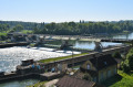
(4) Pass through a metal gate and enter the Domaine Départemental des Coudrayes. Walk alongside horse pastures on your right. You will reach a pumping station.
Red and white + yellow markings
(5) Pass through a series of small rocks and cross a wooden bridge, heading towards Évry and Soisy-sur-Seine. Walk alongside a meadow on your right. Cross a second bridge and continue along a hard-packed track beside the Seine. Pass through another series of rocks and emerge into a small car park.
(6) Keeping an information sign on your right, two paths appear ahead: take the one on the right, which starts behind a series of small rocks (the one on the left, not shown on the map, leads to a private houseboat). Walk along a field on your right. At a signpost, continue straight on towards Soisy and pass under a road bridge.
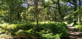
(7) Shortly afterwards, pass under the remains of an old bridge, now demolished, and continue along the banks of the Seine. Pass through a forest gate and continue along a shaded path. Stay as close to the river as possible and ignore all turn-offs to the right. After a short concrete section, pass through a chain barrier and emerge into a small car park. Then turn left, pass through two successive metal gates and continue along the towpath to the Évry lock.
Red and white markings
(8) Pass the lock and the dam, continue on theGR®2along the towpath, which is now tarmac, and walk past the sports grounds on your right. When the tarmac turns right, continue straight on along a path, still following the banks of the Seine. Walk past a large property, pass a metal gate and walk past a football stadium on your right.
Red and white + blue markings
(9) At the junction, continue straight ahead and walk along a fence on your right, then a hedge. The path gives way to a track leading to moored barges. When the track turns right, continue straight ahead (zigzag) and follow a path that winds between the Seine and a fence on the right-hand side. Pass a private jetty and continue along the narrow path.
(10) You’ll emerge at the edge of a field and turn left to walk along the field on your right. Further on, continue along the path that winds along the banks of the Seine and pass two or three small beaches. Return to the field, walk along it on your right, then continue through the woodland. At the information sign “Entre Seine et Sénart” (Port Saint-Victor on the map), turn left and follow a path between the Seine and a fence on the right-hand side.
Red and white markings
Pass under the Champrosay Bridge, at the entrance to Draveil, and continue along a tarmac road.
No markings
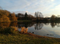
(11) When this road turns right, veer left onto a path. Walk between a bushy hedge (on the left) and a field (on the right). N.B. It should be possible to reach a path closer to the Seine by taking a gap in the hedge, as this path is signposted at the other end of the field. At the end of the field, therefore, turn right onto the path. After about fifty metres, at a fork in the road, follow the path on the left which runs alongside the lake in a leisure park. Wind your way through the woodland and pass the foot of two signs indicating the direction of Juvisy.
Red and white + red and yellow markings
(12) You’ll come out onto a small, poorly maintained road; follow it to the left. Pass the gate of the Draveil Yacht Club on your left and take a path towards Juvisy. Ignore a forest gate on the left and turn right to follow the Seine again. Take a footbridge over the channel of a water sports centre and continue straight on. Take a second footbridge and walk along the right-hand side of the Fosse aux Carpes lake.
(13) Cross a road on the right and continue along a path beside the Seine. Ignore all the turnings on the right and pass in front of a water sports centre building. Continue between the Seine (on the left) and the fences of houses (on the right).
No signposting
(14) At the foot of the road bridge, follow a narrow lane running perpendicular to the Seine (do not go under the bridge). Immediately on the left, you will find a flight of steps leading to Juvisy RER station; climb them. At the top, turn left and cross the Seine via the bridge. On the other side, turn left onto Rue Jean Danaux. At the next set of traffic lights, cross Rue de Draveil then turn right to cross Rue Montessuy (there is only one pedestrian crossing on this side). Continue straight on along Rue de Draveil until you reach Juvisy station, which is clearly visible (E).

 Visorando Member
 Difficult
 Easy
Easy