Country:
 City:
City:


Starting point and access: Corbeil-Essonnes railway station.
- RER – Line D, terminus for a section of the line from Paris and on the section between Juvisy and Malesherbes.
Take the Henri Barbusse / Centre-ville exit (if necessary, use the footbridge).
No signposting
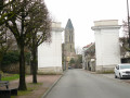
(S) On leaving the station, head diagonally to the left and cross the bus station. At the corner of a bar, turn right onto Avenue d’Arblay (signposted further on). At the traffic lights, carry on straight ahead. At the roundabout, go straight on towards Vieux Corbeil. At the next roundabout, turn right and walk past the old Grands Moulins de Corbeil buildings on your left. Cross Boulevard Crété then cross the River Essonne.
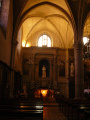
(1) Immediately afterwards, turn right into Rue des Remparts. Cross a small square, then a street, and continue along the river (market hall on the left). You’ll arrive at the foot of Saint-Spire Cathedral.
Red and white markings
Carry on straight ahead along Rue du Trou Patrix. Ignore a footbridge on the right, cross a street and walk alongside a small car park. Pass under a stone arch, emerge into a car park and turn left. At the end of the alley, follow a cobbled street to the left. Take thefirst right, Rue Albert Mercier. At the end, turn right. At the next junction, turn left onto Rue de la Triperie. At the end, cross Quai Jacques Bourgoin.
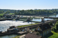
(2) Then turn right. On your left, walk alongside the Seine and then the fence of Créteil Harbour. After the harbour, you can either continue along the roadside (where the signposting is) or head for the banks of the Seine on the left (lawn, footpath; marked on the map). Walk past the facilities of a sailing school.
(3) At the end of the tarmac, continue along a shaded gravel path. When you reach a road, keep to the left and follow a path running parallel to it. When you reach a small water-ski centre, ignore the road which veers away from the river and take a wide, compacted path.
No signposting
(4) At the corner of a small derelict building, turn right onto a grassy lane. Walk alongside a low wall on your right, then a derelict building on your left. Pass through a forest gate, come out onto a small road and follow it to the right for about thirty metres.
Red and yellow markings
There are also a few faded red and white markers, which bear witness to the formerGR®11Croute.
(5) At the corner of No. 128, turn left onto the Sentier de l’Escargot, which starts between two walls. Climb the winding path, which is interspersed with wooden steps and lined with a handrail. Continue along the tarmac, still climbing. At the top, turn left onto Rue Louis Baudoin. Turn right as the road bends (take care: this is a narrow stretch with poor visibility; use the mirror positioned in the bend to help you). Then turn left and walk past a school on your right.
(6) At the roundabout, turn right onto Rue Balzac. At the traffic lights, carry on straight ahead along Rue du Chêne. At the three-way junction, take the right-hand branch downhill. Pass Chemin des Lorittes on your left and follow the railway line. At the stop sign, turn left and cross the railway line at the level crossing. Turn immediately right onto Rue Paul Bert towards the stationery shop, and you’ll arrive at the foot of Moulin Galant station.
(7) Then turn left onto Rue J.A. Geoffroy. Ignore a dead-end on the left, then turn right onto Grande Rue. You’ll cross Rue Raymond Brunot on the right, and cross three branches of the River Essonne in succession. At the end of the street, head left up the Côte de Moulin Galant. Pass the Allée des Grands Chênes on your left and take the bridge over the railway line.
(8) As you come off the bridge, turn left onto Chemin des Vignes. When the road becomes a no-entry street, take a path leading off to the left through a gap in a hedge. Head downhill and follow the railway line. At the bottom (on the left, the railway bridge over the Essonne), turn right onto a stony path. Further on, rejoin the river and follow it on your left. Ignore a path on the right and pass under the A6 motorway bridge.
(9) Then continue straight on along the Essonne and note an old mill on the opposite bank. Carry on along the shaded path. Pass through a metal gate and continue along the path. Walk alongside what appears to be an abandoned allotment. Pass through a second metal gate and continue down a narrow lane.
Blue signposts
(10) At the traffic lights, turn left. Cross several branches of the Essonne and enter Ormoy. Pass the Parc de Châteaubourg on your right. At a left-hand bend, leave the road and turn right into the Ruelle de la Vallée (zigzag). At the end, turn right, walk past the foot of the church and cross the Rue du Pressoir on your left. At the Stop sign, follow Rue du Général Leclerc to the right and cross Rue Jean Jaurès on your left.
(11) As you come out of a left-hand bend, turn right onto Chemin de la Manufacture. When you reach a large gate, turn left and pass the allotments. Cross the underground Loing aqueduct and continue straight on. At the T-junction, turn right, pass a chain barrier and turn left immediately. Take thefirst left and, at the end, turn right. At the roundabout, go straight ahead. At the corner of a small car park, turn left (hairpin bend) and take a tarmac lane that passes under the railway line.
(12) Go round the roundabout on the left and follow Rue du Maréchal Philippe de Hauteclocque dit Leclerc (labelled Rue du Général Leclerc on the map) straight ahead. Walk up the street and pass the Portes de Paris. At the next junction, take thesecond left, Rue du Puits Massé. After the street curves to the right, cross the Place de la Mairie. Then turn right and walk past the church on your right.
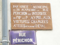
(13) At the end, turn left into Rue de la Fontaine. Immediately turn right into Rue Périchon. At the Stop sign, turn left into a one-way street (take care, narrow passage). Wind your way through a residential area and ignore the side streets. At a Stop sign, go straight on and walk alongside the blocks of flats. At the next stop sign, cross Avenue de Villeroy at the pedestrian crossing. Then turn right, go round the roundabout on the left and take thefirst left. Leave the main road immediately and turn left into Parc de Villeroy.
No signposting
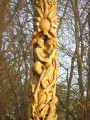
(14) Shortly after the entrance (cello sculpture), leave the tarmac and take thethird left, the Allée Charlemagne. Climb gently into the forest and walk along the left-hand side of an eco-grazing plot. At two successive junctions (building on the right), continue straight ahead. At the crossroads, take thesecond right, the Allée des Hêtres Pourpres.
Blue signposts
(15) At the crossroads, take thesecond left, the Allée des Noyers. At the next crossroads, turn left up a slight incline onto the Allée de Nito. At the end, turn right onto the Allée du Clocher. Carry on straight ahead, ignoring the paths branching off to the left. You’ll reach the Allée des Séquoias. Then turn left and walk up this aptly named avenue. At the end, veer left, rejoin the tarmac and pass between a sports hall on the left and a multi-purpose hall, then a building housing a dojo and a fencing hall. You will then leave Villeroy Park and emerge onto the D191.
(16) Turn right and follow the cycle path running alongside the road. Go round the roundabout on the right and take thefirst right, towards Fontenay-le-Vicomte. Turn right immediately onto Rue du Reignault. At the end, turn left onto Rue du Chemin Vert. After the first few houses, turn right onto Rue du Court Fétu. At the end, turn right into a cul-de-sac. Pass by the base of two masts, go through a small gate to cross the railway line (be careful, look both ways) and turn left onto the path.
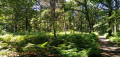
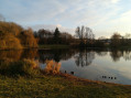
(17) Enter the Marais de Fontenay departmental park and follow a well-maintained, stabilised path through the woodland. Ignore a turn-off on the right (stone bench). Cross the Ru du Château then walk along the edge of a pond.
No signposting
(18) At the next junction, if you wish, turn sharply right to reach a birdwatching hide. Retrace your steps.
Blue signposting
(18) Continue to the right (south-west) along the signposted path. Cross a stream and ignore a path branching off to the right. At the T-junction, turn left. Immediately turn right (west), cross the Ru de Fontenay and continue along a wide white path, skirting a grazed enclosure on your left.
Unmarked
(19) If you wish, take the footbridge on the right to reach a second viewpoint. Retrace your steps.
Blue signposting
(19) Continue to the right (west) along the white track, which soon turns left and then right. Cross a small car park, leave the departmental park and come out onto a small road (level crossing on the left).
(20) Then turn right and walk along the left-hand side of a property’s fence (the fact that it is private is clearly signposted). At a Fork in the road, turn right. Stay on the main path, which winds through the woodland, and ignore any vague side paths. Cross a stream via a wooden footbridge and pass under a high-voltage power line.
(21) At the end of the path, continue along a narrow lane. Turn right along the lane and pass through a residential area. Continue along the tarmac road below the railway line.
Blue + Yellow + Red and White markings
Cross the D17 at the level crossing and continue opposite along Rue de l’Essonne towards the SNCF station. At the Stop sign, turn left and you’ll soon reach Ballancourt station (E).
To get back home:
- RER – Line D, towards Juvisy and Paris (access to platform 2 before the level crossing) or Malesherbes (access to platform 1, either via the underpass from platform 2, or after the level crossing and after going round the station building to the left).




 and Parc des Marais (at point 19, after observatory 2, a path to the right takes you as close as possible to the marshes – raised footbridge – and an area perfect for a ‘picnic on the grass’ and perhaps a restorative nap). Thank you for this discovery.

 Visorando Member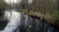
 Moderate
 Easy
Easy