Country:
 City:
City:


Start from Place Gianfranco Giannini, near the Cultural Centre.
(S/E) Cross the D656 at the traffic lights and head towards the village hall. Walk between the village hall and the school, then turn left to reach the footbridge on the right. Cross the Ruisseau Laurendanne and continue along the yellow-marked path until you reach a road, the D310, which you cross to head up Rue de Pont-du-Casse on the opposite side.
(1) Turn left onto Chemin de Marche Bas, leaving Allée du Soleil Couchant on your right.
At the end of the path, leave the house on your left and head down to the right across the meadow until you reach a hedge; cross it at the first gap, then follow it on the other side to the right. Cross a ditch on the right and walk alongside the Ruisseau la Masse until you reach a tarmac road.
(2) When the road branches off to the left towards Moulin Labat, turn right and, in front of the house entrance, follow the path which climbs to the left alongside the house to Jourda Bas and then Jourda Haut, the top of the hill.
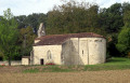
(3) When you reach the junction at Jourda Haut, turn right then left onto the Chemin de Serres towards the church and the hamlet of Serres.
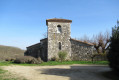
At the church, follow the grassy path which descends between the church and the house, then continues along a road to the hamlet of Pépelat Bas.
(4) At the junction with the Côte de Pépelat, head down to the right, then take the first sandy path on the right signposted ‘dead end’. This path becomes grassy and then tarmac. Continue until you see letterboxes 345 and 343 on the right.
(5) A small path on the left leads down to the D656; cross this carefully and take the Chemin d’Audubert opposite. Cross the Ruisseau de l’Auradon and walk alongside a pond on your left.
(6) Take the road on the left towards Naudi, which you bypass on the left via a grassy path running alongside a hedge, marked with green signposts, before joining a road with a cluster of houses.
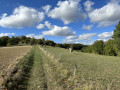
(7) Turn onto the first road on the right in the village; this is tarmac at first, then becomes a stony track, continuing as a grassy path between two fields to the hamlet of Tastebi, where it ends at a tarmac road running through woodland for a few hundred metres.
(8) Turn right below the road onto a gravel path that winds down towards the meadows.
At the end of the descent, the track is blocked by an electric fence, which you open and close behind you.
Head down through the field to the right until you reach the lower part of the plot, where you’ll find a second gap in the electric fence; then continue straight ahead to join a track and finally a road in the hamlet of Audebert.
(9) Take the road on the right. This leads towards the Route de Naudi.
(6) Turn left just before the road, then immediately right towards the cabaret Le Petit Paradis.
Cross the cabaret’s car park and continue straight ahead along a grassy path which joins Rue Charles De Gaulle, leading to Place Gianfranco Giannini (S/E).

 Visorando Member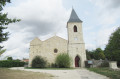

 Moderate