Gaillard and the Ermitage in Agen

From the canal, this route passes through the Gaillard neighbourhood on its way to the heights of Saint-Esprit and the Ermitage, which overlooks the town of Agen.

Details

43128792
Creation:
Last update:
Last review:
  • Walking
    Activity: Walking
  • ↔
    Distance: 5.32 mi
  • ◔
    Average duration: 2h 55 
  • ▲
    Difficulty: Easy

  • ⚐
    Back to start: Yes
  • ↗
    Ascent: + 584 ft
  • ↘
    Descent: - 561 ft

  • ▲
    Highest point: 551 ft
  • ▼
    Lowest point: 161 ft
  • ⚐ Country: France
  • ⚐ City: Agen (47000)
  • ⚑
    Start/End: N 44.207994° / E 0.627482°
  • ❏
    IGN map(s): Ref. 1840SB
  • Hour-by-hour weather

Photos

Description of the walk

Park between the Centre universitaire du Pin and Avenue de Stalingrad (Pont de la Libération, Route de Villeneuve); access via the Rond-Point des Pompiers.

(S/E) Leave the car park heading towards the canal, cross the Quai de Dunkerque at the pedestrian crossing and take Avenue de Stalingrad as far as the bridge over the canal. Cross the bridge over the canal.

(1) Turn left onto Quai Georges Leygues, then immediately turn right up Rue Frantz Liszt, following the yellow/red signposting. Continue to the end of this street, then turn right onto Avenue de Courpian until you reach the traffic lights at Avenue de Stalingrad, following the red signposting. Cross this avenue at the pedestrian crossing, then you’ll arrive at the entrance to Gaillard Cemetery on Place du Repos.

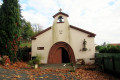
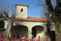
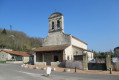
(2) Turn slightly to the right, passing in front of the little church in Gaillard, and continue along Rue des Deux Rocs, which runs alongside the cemetery on the right. Continue up the long slope of this street until you reach Rue Michel Reine, then carry on to the next junction.

(3) Turn left, leaving Rue de Berlioz opposite you. Continue along Rue des Deux Rocs to the left, following the red markings. At the junction with the N21, cross carefully and take the uphill street opposite, Rue des Mimosas. At the top of the hill, at the end of the street, turn left onto Route de Lavolte, towards Soureille. Pass Rue de l’Atlantique on your right and continue to a fork in the road.

(4) Turn right onto Chemin de Ferrou (street), which curves left as it descends.

(5) Before a hairpin bend, immediately after the house at number 12, take the path below the house to the left,GR® 652, Rue de Tibet. Continue along this path through the woodland until you reach a road; turn left at the hamlet of Tibet and carry on to the next junction with a transformer on the right.

(6) Turn right onto Avenue Joseph Amouroux, until you reach Rue de Cazemajou, where you turn right, following the red and black markings and the Yellow Cross. Pass through the hamlet of Bufoben and continue along the small road for about 300 m.

(7) Before a telephone pole marked with a Red Cross and a Blue Cross, take the grassy path on the left, below a hedge. At the end of the hedge, turn left for about ten metres towards a small house; then, in front of this house, go down the grassy path on the right towards the woods. At the end of the descent, continue to the left, then follow the path through the woodland to the right. Continue along a hedge towards a house. When you reach it, turn left and continue along Rue de Bellevue until you reach a junction.

(8) Turn right onto Avenue Joseph Amouroux and head down towards Agen, following the red and black markings. After just over 300 metres, you’ll reach a junction.

(9) Turn left onto Rue de la Falaise. At the end of the tarmac section, continue to the right along the path with steps leading down to Avenue de Courpian, which you should take to the right. Continue downhill to reach the Canal de Garonne (formerly the Canal Latéral à la Garonne).

(10) Turn left before the bridge onto Quai Georges Leygues. Continue along the canal until you reach Avenue de Stalingrad. Turn right to cross the bridge over the canal and join the (S/E).

Waypoints

  1. S/E : mi 0 - alt. 161 ft - Car park at the Centre universitaire du Pin - Gare d'Agen
  2. 1 : mi 0.15 - alt. 184 ft - Bridge over the - Canal de Garonne
  3. 2 : mi 0.36 - alt. 194 ft - Rue des 2 Rocs
  4. 3 : mi 1.09 - alt. 482 ft - Junction with Rue de Berlioz opposite.
  5. 4 : mi 1.94 - alt. 486 ft - Junction with Chemin de Ferrou on the right.
  6. 5 : mi 2.33 - alt. 367 ft - GR652
  7. 6 : mi 2.84 - alt. 456 ft - Junction with Avenue Joseph Amouroux.
  8. 7 : mi 3.31 - alt. 522 ft - Junction with a path on the left
  9. 8 : mi 3.97 - alt. 469 ft - Junction with Avenue Joseph Amouroux
  10. 9 : mi 4.21 - alt. 335 ft - Junction with Rue de la Falaise.
  11. 10 : mi 4.8 - alt. 194 ft - GR652 - Canal de Garonne
  12. S/E : mi 5.32 - alt. 161 ft - Car park at the Centre universitaire du Pin

Notes

A semi-urban route suitable for winter.

Worth a visit

Views of the town of Agen from the heights of the Ermitage.

Always be cautious and plan ahead when you're outdoors. Visorando and the author of this route cannot be held responsible for any accidents occurring on this route.

The GR® and PR® markings are the intellectual property of the Fédération Française de Randonnée Pédestre.

Reviews and comments

4.6 / 5
Based on 3 reviews

Reliability of the description
4.3 / 5
Ease of following the route
4.3 / 5
Route interest
5 / 5
User 3710498

Overall rating : 5 / 5

Date of your route : Jun 10, 2026
Reliability of the description : ★★★★★ Very good
Ease of following the route : ★★★★★ Very good
Route interest : ★★★★★ Very good
Very busy route : No

Hello, Enjoy a pleasant walk above Agen. To make it even more interesting, combine it with the Vérone route to explore the small, steep-sided valleys and the pretty windmill.

Machine-translated

User 28259262
• Edited:

Overall rating : 3.7 / 5

Date of your route : Dec 29, 2025
Reliability of the description : ★★★☆☆ Average
Ease of following the route : ★★★☆☆ Average
Route interest : ★★★★★ Very good
Very busy route : Yes

The map provided with the PDF is old and no longer entirely accurate. But we managed to find our way around! However, new buildings and housing developments confused us a little.
Otherwise, the hike is interesting and accessible to everyone.

Machine-translated

teddygers
teddygers

Overall rating : 5 / 5

Date of your route : Jan 14, 2024
Reliability of the description : ★★★★★ Very good
Ease of following the route : ★★★★★ Very good
Route interest : ★★★★★ Very good
Very busy route : No

I wasn’t able to print the map, but the instructions are clear
Thank you

Machine-translated

Other walks in the area

For more walks, use our search engine .

The GPS track and description are the property of this route's author. Please do not copy them without permission.