Country:
 City:
City:



From the D44 linking Bénodet to Pont-l’Abbé, turn off at the sign for Kermor, the beach and the viewpoint symbol. The large car park is immediately on the right once you take this road.
PR® signposting: Yellow
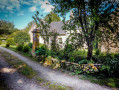
(S/E) At the far end of the car park, head towards the old dovecote, which has been converted into an observatory (you can go up there). Take the wide stony path on the right until you reach the first house on the right (Gorréquer on the map).
No signposting
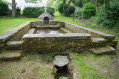
(1) Turn right onto a path at the back of the house (barrier), walk through meadows, continue through a wooded area and arrive at a sewage treatment plant. Follow the road which goes round the Créac’h leisure centre (fountain on the right) and continue until you reach a road.
(2) Turn left and follow this road. At a place called Kergulan, veer right and continue along this small road, which leads onto a larger one. Follow it to the left towards the former Kerloch Gwen holiday village, now a private residence, and walk alongside the complex until you reach the end of the buildings.
PR® signposting: Yellow
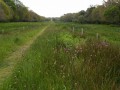
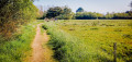
(3) Leave the road and turn right onto a path running alongside a wire fence; then, at the signpost, turn left to begin a long straight stretch along the path through the polder. Cross a footbridge over a stream and continue due south towards the sea. You’ll emerge near the water sports centre.
GR® ®34 White and Red andPR® Yellow signposting
(4) Turn left onto the Chemin des Douaniers, behind the dune, and follow this path, which is shared with cyclists. Pass a first car park on your left, then a second, and arrive at a third.
(5) At this point, turn right onto a path leading up to the top of the dune (wide viewpoint), then descend to the beach and continue left, heading east. Leave the beach to reach a car park with toilets.
(6) Turn left as you leave theGR® to walk alongside the car park, passing a restaurant, bar and nightclub, and rejoin the Chemin des Douaniers until you reach the car park where you left it.
PR® Yellow
(5) At the signpost (polder variant 8 km), turn right and follow this path, which runs alongside a campsite on your right and winds its way through the polder between meadows.
(7) At a fork in the road, ignore the path branching off to the right and carry on straight ahead along the track lined with wetlands. You’ll reach a road, which you cross at Kermor Bihan. Continue straight on towards the gate marking the entrance to the Kerscuntec Polder and cross the long bridle path.
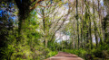
(8) At the signpost, turn right into a wooded area (a discreet little silver cross on the embankment on the left) and follow this single path as it winds through the woods, skirting an orchard on your left. At a fork in the road, ignore the path on the left and continue along the signposted path (the markings are a little faded) until you come out onto a small road near the Kerscuntec lodge.
(9) Follow this road past the lodges until you reach the gate near the dovecote. Turn right to return to the car park (S/E).




 Visorando Member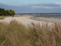
 Moderate