


Refine your search for walks in Pointe du Télégraphe (1719m)
Pointe du Télégraphe (1719m) walks


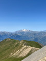
 Côte de Lancheton and the Roches Rouges
 Visorando Member
 8.18 mi
 +3,317 ft
 -3,317 ft
 6h 40
 Moderate
 Departure from Saint-Julien-Mont-Denis (Savoie)
A circular walk in a remote corner of the Maurienne, along a fairly wide ridge path surrounded by mountain pastures and their cows, always with the Grand Perron des Encombres and the Cime de la Scia in view.
Walks near Pointe du Télégraphe (1719m)
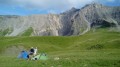
Montpascal – Valbuche
 8.10 mi
+4,413 ft
-1,834 ft
5 hrs
 Very difficult
Departure from Pontamafrey-Montpascal (Savoie)
First day of a two-day hike in the Maurienne with a bivouac.
Hike completed in 2016 with a break at the Col de la Baisse, another above the Chalet des Brunes and a final one at the Chalet du Tovet.
Note: The route shown is based on my GPS watch, which I never paused, which explains the circular patterns in certain places.
Valbuche – Montpascal
5.98 mi
+2,096 ft
-4,669 ft
5 hrs
Very difficult
Departure from Saint-Jean-de-Belleville (Savoie)
The second day of a two-day hike in the Maurienne region, including a bivouac.
 From Les Menuires to the Roc 1 cable car
5.51 mi
+1,673 ft
-272 ft
3 hrs
Moderate
Departure from Saint-Martin-de-Belleville (Savoie)
This route takes the Sentier des Girauds and then the Sentier des Teppes, before retracing its steps and ending with the Sentier des Girauds, which leads to the Roc 1 cable car arrival point. As the ski touring trail is not marked before the Christmas holidays and is impossible to find, it is still possible to take the footpath, which offers a beautiful, easily accessible hike, perfect for an introduction to ski touring.
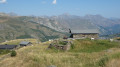
Along the ridges between Les Menuires and Le Molard
 3.64 mi
+279 ft
-531 ft
2h 00
 Easy
Departure from Saint-Martin-de-Belleville (Savoie)
The walk climbs gently before descending towards Le Molard and the Saint-Martin 1 cable car. Throughout the route, you’ll be treated to sweeping views of the mountains and the Belleville valley. The alpine pastures offer magnificent scenery. Best done in summer whilst the ski lifts are operating.
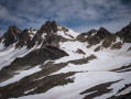
From Grange Bernard to the Refuge de Terre Rouge
 Association / Club / Walk leader
 5.14 mi
+1,896 ft
-33 ft
4h 00
Moderate
Departure from Valmeinier (Savoie)
First stage of the Petit tour du Mont Thabor hike
Lacs du Cheval Noir – Saint-François-Longchamp
3.44 mi
+249 ft
-3,123 ft
1h 50
Easy
Departure from Saint-Jean-de-Belleville (Savoie)
Final, connecting stage. A gruelling descent along the Col du Cheval Noir trail before rolling gently towards Saint-François-Longchamp, past cattle sheds, herds and ski facilities.
Valmeinier 1800 – Refuge du Thabor
 9.69 mi
+5,079 ft
-2,690 ft
10 hrs
Very difficult
Departure from Valmeinier (Savoie)
The route begins on theGRP® Tour du Mont Thabor trail, starting from the Petite Station in Valmeinier 1800. You’ll pass the Col des Marches, Lake Bissorte, the Refuge des Marches, Lake des Batailléres, the pass of the same name, Lake Long and Lake Rond before arriving at the Refuge du Thabor.
Lac de la Grande Léchère mountain hut – Montartier Lakes
10.81 mi
+4,577 ft
-3,084 ft
8h 55
 Difficult
Departure from Montgellafrey (Savoie)
A lovely climb through the upper pastures where the cows that produce the milk for Beaufort cheese graze, with views of the Vanoise, the Thabor Massif, the Aiguilles d’Arves and the foothills of the Écrins. Then the route changes direction, offering views of Belledonne, the Chartreuse and the Bauges, before setting up camp at the Montartier Lakes.
Saint-François-Longchamp – Lac de la Grande Léchère mountain hut
3.90 mi
+833 ft
-528 ft
2h 30
Easy
Departure from Saint-François-Longchamp (Savoie)
Starting from Saint-François-Longchamp, this first stage of the Tour de la Lauzière is a gentle walk to the Grande Léchère Lake Mountain Hut, where you’ll spend your first night.
From Tougnète to Les Ménuires via the ski lifts
 3.18 mi
+299 ft
-614 ft
1h 45
Easy
Departure from Saint-Martin-de-Belleville (Savoie)
Spectacular panoramic views from the summit of Tougnète, at an altitude of 2,437 m. Magnificent panoramic views from vantage points along the entire route. Arrival at the top of the Roc 1 cable car, at 2,260 m.
This hike should be undertaken during the summer when the ski lifts are operating for hikers.