A circular route via the Col du Chardonnet and Col des Béraudes, starting from Fontcouverte

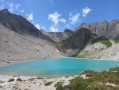
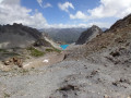
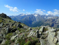
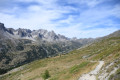
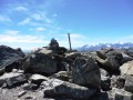
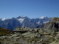
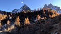
A fairly challenging circular route in the Clarée Valley, classified as very difficult due to a long stretch of unstable scree and exposed sections with or without handrails; whilst these are few in number, they may put off those prone to vertigo. Magnificent views from the Col du Chardonnet and the Col des Béraudes. Lovers of rocky terrain and high-altitude lakes will not be disappointed.

Please note: this circular route is reserved for experienced hikers.

Details

n°23391612
Creation:
Last update:
Last review:
  • Walking
    Activity: Walking
  • ↔
    Distance: 10.00 mi
  • ◔
    Duration according to the author: 8 hrs 
  • ▲
    Difficulty: Very difficult

  • ⚐
    Back to start: Yes
  • ↗
    Ascent: + 3,494 ft
  • ↘
    Descent: - 3,484 ft

  • ▲
    Highest point: 9,121 ft
  • ▼
    Lowest point: 6,099 ft

Photos

Description of the walk

Park in the car park opposite the Fontcouverte campsite or just past the campsite.

(S/E) Take the road leading towards the Laval chalets until you reach a junction (public toilets).

(1) Turn left and continue along an uphill track. After two hairpin bends, you’ll reach the hamlet of Les Chalets du Queyrellin.

(2) On leaving the hamlet, take the unmarked but clearly signposted path which climbs gradually. Follow the Ruisseau du Chardonnet for a short distance until you reach it.

(3) Cross it over the flat stones and continue along its right bank. You’ll reach the dried-up Lake Chatelard. Here you’ll find the junction with theGR®57.

(4) Turn right onto the GR®57 and follow it uphill to reach the Col du Chardonnet Sud, where you can enjoy the view of the Écrins and La Meije.

(5) Leave theGR®57, turn right and head for the Col du Chardonnet Nord.

(6) Take care here: head left onto the very rocky slope; this route is only suitable for experienced walkers with a head for heights. See an alternative route in the practical information section.
NB: this sloping path is very unstable; a few years ago it formed part of theGR®57, which has since been rerouted further down into the Vallon du Clot des Vaches.
Take great care on this long traverse. At the end of this long scree slope, you’ll reach the junction with the Sentier des Béraudes.

(7) Turn right here and begin the ascent; cross a section using a handrail for support before reaching the Col des Béraudes.

(8) Then begin the descent, using the handrail as you continue down. You’ll reach Lac des Béraudes and its outlet stream.

(9) Continue the descent some distance from the right bank of the stream. You’ll reach the Pont du Moutet.

(10) Cross the Clarée via the bridge and you’ll immediately reach the large car park at Laval. Follow the road for a good hundred metres to reach the junction with a footpath near the Chapelle Saint-Jacques.

(11) Turn right onto this path and head for the footbridge to cross the Clarée once more. Continue along this beautiful path, keeping to the right bank of the Clarée. You will then reach the Roche Noire chalets.

(12) Stay on this path, enter the forest and, at the bottom of the descent, join the road near the Pont du Jadis.

(13) Turn right onto the road and you’ll soon reach the junction you passed on the way out.

Follow the route you took on the way there in the opposite direction to return to the Fontcouverte car park (S/E).

Waypoints

  1. S/E : mi 0 - alt. 6,102 ft - Fontcouverte car park
  2. 1 : mi 0.12 - alt. 6,112 ft - Junction of the circular loop - Clarée (rivière)
  3. 2 : mi 0.69 - alt. 6,535 ft - Queyrellin Chalets
  4. 3 : mi 1.59 - alt. 7,451 ft - Fording
  5. 4 : mi 1.9 - alt. 7,530 ft - GR57 - Lac du Châtelard
  6. 5 : mi 3.49 - alt. 8,658 ft - Col du Chardonnet
  7. 6 : mi 3.81 - alt. 8,825 ft - Col du Chardonnet Nord (2681m)
  8. 7 : mi 5.35 - alt. 8,540 ft - Sentier des Béraudes
  9. 8 : mi 5.68 - alt. 9,072 ft - Col des Béraudes
  10. 9 : mi 6.45 - alt. 8,219 ft - Lac des Béraudes
  11. 10 : mi 7.64 - alt. 6,631 ft - Pont du Moutet
  12. 11 : mi 8.02 - alt. 6,545 ft - Chapelle Saint-Jacques (Névache)
  13. 12 : mi 8.63 - alt. 6,444 ft - Chalets de Roche Noire
  14. 13 : mi 9.56 - alt. 6,129 ft - D301T road
  15. S/E : mi 10 - alt. 6,099 ft - Fontcouverte car park

Notes

Please note: between mid-July and the end of August, access is closed to private vehicles from 8.30 am; you will need to take the shuttle bus to reach the area, departing from Roubion or Névache – Ville Haute. Check with the Tourist Office for further information.
Please note: part of the route is not signposted; pay close attention to the route description and your surroundings to avoid getting lost.

Between (6) and ::7: the path is very technical; it requires suitable kit, sure-footedness, the IGN map (3535OT) and good weather. For this reason, an alternative route is suggested:
Alternative route: for those prone to vertigo or who do not feel comfortable on this type of path, this alternative route – whilst admittedly longer – is recommended. To take it: (5) keep to the left on theGR®57and follow it to the Col de la Ponsonnière. Then turn right onto the Sentier des Béraudes to reach (7).

Partially signposted; the markings appear to have been altered in places and do not always correspond to the IGN map, sometimes due to changes in the terrain following rockfalls.
IBP difficulty rating = 142

Always be cautious and plan ahead when you're outdoors. Visorando and the author of this route cannot be held responsible for any accidents occurring on this route.

The GR® and PR® markings are the intellectual property of the Fédération Française de Randonnée Pédestre.

Reviews and comments

5 / 5
Based on 1 review

Reliability of the description
5 / 5
Ease of following the route
5 / 5
Route interest
5 / 5
LGP38
LGP38

Overall rating : 5 / 5

Date of your route : Jul 15, 2023
Reliability of the description : ★★★★★ Very good
Ease of following the route : ★★★★★ Very good
Route interest : ★★★★★ Very good
Very busy route : No

We did the walk in the opposite direction, taking the route via Lac de la Ponsonnière, the Grand Lac and the Clot des Vaches before heading up to the Col du Chardonnet to avoid the slightly too technical section. This alternative route allows you to see two extra lakes (Ponsonnière and the Grand Lac) but adds about 300 metres of elevation gain and quite a few kilometres. The route is very easy to follow (well signposted) and the views are stunning (though it does take its toll on your legs a bit too ;-). It really is an extraordinary, breathtaking hike – an absolute must-do!!!! There’s a handrail to help you cross the Col des Béraudes and descend on the other side, but honestly, it’s no problem at all. Personally, I prefer to have climbed up this way because on the Béraudes side, it’s a bit vertiginous and if you fall, you’ll end up in the lake. On the Ponsonnière side, it’s much less vertiginous and a fall would end up much lower down. But honestly, as long as you’re careful and take your time, there’s no problem – except perhaps for those who are very prone to vertigo. Thank you for this lovely route.

Machine-translated

Other walks in the area

For more walks, use our search engine .

The GPS track and description are the property of this route's author. Please do not copy them without permission.