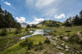
Pic de Néouvielle

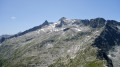
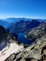
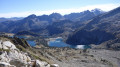
Climb up to Néouvielle, a magnificent granite massif surrounded by lakes. It is one of the most popular peaks in the French Pyrenees.
Moderator's addition on 02/08/2021: Some people have had problems with the GPS track. It also seems that crampons are very useful. See the reviews at the bottom of this page
You are entering the Néouvielle National Nature Reserve, which is protected by regulations. Please respect them (see practical information).

Details

1189
Creation:
Last update:
  • Walking
    Activity: Walking
  • ↔
    Distance: 5.78 mi
  • ◔
    Average duration: 5h 25 
  • ▲
    Difficulty: Difficult

  • ⚐
    Back to start: Yes
  • ↗
    Ascent: + 3,173 ft
  • ↘
    Descent: - 3,166 ft

  • ▲
    Highest point: 10,013 ft
  • ▼
    Lowest point: 7,028 ft

Photos

Description of the walk

Access to the Lac d'Aubert car park is restricted.

(S/E) From the car park at the edge of Lac d'Aubert, head to the right of the refuge and follow a path downhill towards the dyke. Cross the dyke and, at the western end, follow a marked path heading south-west.
At around 2,260 metres, the route turns right, first west then north. Pass several easy ledges.
You will arrive at the breach in the Crête de Barris d'Aubert at an altitude of 2,439 metres.

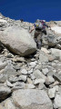
(1) The route descends a little then climbs slightly up the side. Cross an area of large boulders. Watch where you put your feet!
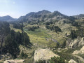
Through the rocks and slight grassy ledges, head towards the clearly visible Brèche de Chausenque, due west. There is not just one route, but several that eventually converge once you get close to the breach. Leave this breach above and to your right and turn left.

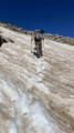
(2) Head south-west up a wide valley that is not very steep in its lower section. Step onto the snow of the Anciens Glaciers de Néouvielle.

(3) These are now, in fact, a single large snowfield.
Follow the tracks that leave from the right towards the left, or climb directly to the left, progressing over rocks.
Arrive at the north-east ridge of the peak, 100 m below the summit

(4) The slope steepens and you will easily reach the summit ridge, which you follow south-east for 30 m to reach the summit of Pic de Néouvielle or Pic d'Aubert at an altitude of 3,091 m.

(5) Then turn back along the same route until you are below the Brèche de Chaussenque.

(2) Now follow the cairns, which are not always easy to see, heading northeast across the scree of large boulders and small rocky ridges. There are some passages that are not always easy to find, but head towards the Hourquette d'Aubert at an altitude of 2,498 metres.

(6) Descend to the right, due east, along a well-marked path towards Lac d'Aubert until you reach the starting point. (S/E)


Waypoints

  1. S/E : mi 0 - alt. 7,087 ft - Parking - Lac d'Aubert
  2. 1 : mi 1.1 - alt. 7,956 ft - Breach in the Crête de Barris d'Aubert.
  3. 2 : mi 1.93 - alt. 8,898 ft - Common fork in the road to the Pic de Néouvielle
  4. 3 : mi 2.2 - alt. 9,337 ft - Former glaciers of Néouvielle. Snowfield.
  5. 4 : mi 2.47 - alt. 9,908 ft - North-eastern ridge of the Pic de Néouvielle.
  6. 5 : mi 2.54 - alt. 9,918 ft - Pic de Néouvielle ou d'Aubery (3091m)
  7. 6 : mi 4.11 - alt. 8,176 ft - Hourquette d´Aubert
  8. S/E : mi 5.78 - alt. 7,087 ft - Parking - Lac d'Aubert

Notes

Regulations concerning the Néouvielle National Nature Reserve:
• Dogs are not allowed in the core area of the Pyrenees National Park, even on a leash
• Dog kennels - information available from Aragnouet Town Hall - Tel: 05 62 39 62 63
• No fires, to prevent fires and damage to the ground
• Please keep quiet to preserve the peace and quiet of the area
• Bring bin bags with you to take your rubbish back down with you
• No picking or collecting of plants, minerals or fossils
• Capturing animals is prohibited
• Regulated camping is permitted more than an hour's walk from a road access point, between 7 p.m. and 9 a.m
• No camping or parking of motorhomes overnight to preserve the beauty of the sites and avoid pollution
• Hunting and fishing are prohibited

This route passes through a protected area, which may be subject to special regulations:

Worth a visit

Since (2), to reach the Hourquette d'Aubert, you need very good visibility and a good sense of direction to find the passages through the small rocky outcrops. The entire route is a hike, although you may need to use your hands at times.

Reviews and comments

4.1 / 5
Based on 50 reviews

Reliability of the description
4 / 5
Ease of following the route
3.7 / 5
Route interest
4.5 / 5
raylann
raylann
• Edited:

Overall rating : 3.7 / 5

Date of your route : Jun 14, 2025
Reliability of the description : ★★★★☆ Good
Ease of following the route : ★★★☆☆ Average
Route interest : ★★★★☆ Good
Very busy route : No

The climb to the peak of Néouvielle was done with crampons on our feet because there was still a lot of snow between points 2 and 5. No problems and a superb panorama at the summit. The return via the Col or Hourquette d'Aubert is a little difficult to follow because there are cairns everywhere, but it's not too bad. It's easy to find your way among all the rocks. At the pass, there's also a beautiful view of other lakes. The return from the pass is on a very easy and fast path.
A very beautiful hike, difficult up to the peak and then challenging to the pass, but offering a wonderful day in the mountains.

Machine-translated

Mickaelmf47
Mickaelmf47
• Edited:

Overall rating : 3.7 / 5

Date of your route : Oct 14, 2024
Reliability of the description : ★★★★☆ Good
Ease of following the route : ★★★☆☆ Average
Route interest : ★★★★☆ Good
Very busy route : Yes

Stones and rocks: nothing else. The trail back is really hard to follow.
The view of Cap de Long Lake from the summit is beautiful.
Before reaching the summit, the snow was frozen and very slippery.

Machine-translated

LaFeeMorgane
LaFeeMorgane
• Edited:

Overall rating : 4 / 5

Date of your route : Oct 13, 2024
Reliability of the description : ★★★★☆ Good
Ease of following the route : ★★★★☆ Good
Route interest : ★★★★☆ Good
Very busy route : No

The path to the Pic is well marked by cairns, and the view is superb. There are a few nice technical sections. On the way back, you branch off again onto scree, which is long and uninteresting, and not easy to follow. It just takes you back to a pretty path to finish the hike and complete the loop.

Machine-translated

jemebalade33
jemebalade33
• Edited:

Overall rating : 4 / 5

Date of your route : Aug 20, 2024
Reliability of the description : ★★★★☆ Good
Ease of following the route : ★★★★★ Very good
Route interest : ★★★☆☆ Average
Very busy route : Yes

Hike completed on 19 August 2024. Lots of difficult scree slopes, large boulders making progress difficult. At the end of summer, the few remaining snowfields are easy to get around, crampons were not necessary. You need to be in good physical shape to tackle this route, which is not very long but demanding. I would rate this hike as difficult +.

Machine-translated

Alex776
Alex776
• Edited:

Overall rating : 4 / 5

Date of your route : Jul 23, 2024
Reliability of the description : ★★★★★ Very good
Ease of following the route : ★★★★☆ Good
Route interest : ★★★☆☆ Average
Very busy route : No

Route completed on 22/07/24. The outward journey went well, just follow the cairns and the red and white markings. We decided to climb the snowy section without crampons but put them on for the descent for safety and speed.
In my opinion, the loop presented here isn't really worth doing. The traverse to the Hourquette d'Aubert (pass) is a long and difficult scree slope, and we had already spent quite a bit of time on scree slopes on the way up, so unless you're very sure-footed, you won't want to add to that...
This crossing is useful for reaching the pass and crossing over to the other side towards the Tourmalet.

Machine-translated

DV99
DV99
• Edited:

Overall rating : 5 / 5

Date of your route : Jul 08, 2024
Reliability of the description : ★★★★★ Very good
Ease of following the route : ★★★★★ Very good
Route interest : ★★★★★ Very good
Very busy route : No

Did it yesterday... a wonderful walk... the part towards Pic d'Aubert was a bit tricky to find, but otherwise it was well worth it

Machine-translated

leosartorius
leosartorius
• Edited:

Overall rating : 4.7 / 5

Date of your route : Jun 15, 2024
Reliability of the description : ★★★★★ Very good
Ease of following the route : ★★★★☆ Good
Route interest : ★★★★★ Very good
Very busy route : No

Superb hike still covered in snow from 2,500 metres upwards. This makes the climb easier (the trail becomes obvious) and the descent much faster. At a good pace, the ascent takes 3 hours and the round trip without the loop takes 5 hours with about 30 minutes of stops, including 20 minutes at the summit. Without snow, 6 or even 7 hours seems more realistic for an average walker. With snow, it is best to set off early and have crampons in your bag.

Machine-translated

chafrise
chafrise
• Edited:

Overall rating : 4.7 / 5

Date of your route : Oct 09, 2023
Reliability of the description : ★★★★★ Very good
Ease of following the route : ★★★★☆ Good
Route interest : ★★★★★ Very good
Very busy route : No

Some difficulty finding the route at the foot of the Chausenque breach. Note that this route is marked by red marks on the rocks, almost to the foot of the peak. Beautiful day and magnificent view from the summit.

Machine-translated

RAND19
RAND19
• Edited:

Overall rating : 3.7 / 5

Date of your route : Oct 09, 2023
Reliability of the description : ★★★★☆ Good
Ease of following the route : ★★★☆☆ Average
Route interest : ★★★★☆ Good
Very busy route : No

A demanding hike that should only be attempted if you are in good shape, as it consists of nothing but boulders of varying sizes. We made the round trip via the normal route, which is very well marked and impossible to get lost on. At the end, red paint circles also help you find your way.
The view from the peak is sublime
There were very few hikers that day, and we benefited from the advice of a hiker who was doing it for the sixth time.
We did it on a beautiful sunny day in October 2023, so there was no trace of snow.

Machine-translated

Dan 007
Dan 007
• Edited:

Overall rating : 2.7 / 5

Date of your route : Sep 25, 2023
Reliability of the description : ★★★★☆ Good
Ease of following the route : ★☆☆☆☆ Very disappointing
Route interest : ★★★☆☆ Average
Very busy route : No

Very nice weather. Difficult route to follow, so we lost time. Difficult hike because 80% of it was on rocky outcrops (were we really on the right track?). We stopped 1-1.5 hours from the summit because we started too late in relation to the actual climbing time and due to poor ice/snow conditions reported in the summit couloir. The route to the Hourquette d'Aubert was also difficult. Therefore, the duration of this hike is underestimated and the lack of signposting should be pointed out. We were disappointed not to have reached the summit.

Machine-translated

GLEPATIO
GLEPATIO
• Edited:

Overall rating : 3.7 / 5

Date of your route : Oct 10, 2022
Reliability of the description : ★★★☆☆ Average
Ease of following the route : ★★★☆☆ Average
Route interest : ★★★★★ Very good
Very busy route : No

Hey there, fellow hiker! This hike is worth it for anyone who's up for the challenge... The route is a bit random, but you're heading in the right direction... Just make sure you follow the cairns and don't rely on the map... We got caught out by snow at 2,800 metres, which slowed us down a lot, and of course we'd left our crampons and ice axes in the truck...so it took us 4.5 hours to reach the summit, but what a sight to behold! What's more, there was a window of sunshine until 1pm. Magnificent! I won't hide the fact that the descent was extremely slippery down to 2,800 metres and really dangerous without specific equipment... then, follow the cairns and the general direction of the loop towards the Hourquette d'Aubert, which quickly becomes painful for the joints. In the end, it took us over 9 hours to complete the loop, and the end was more of an ordeal than a pleasure, so I strongly advise against this loop unless you enjoy climbing. Regarding the 5 hour 15 minute timing, several other apps give 7 hours for the round trip to the Pic de Neouvielle - Lac d'Aubert without the loop, so please check with the moderators
To conclude, don't forget that you are in the high mountains, so check the weather forecast, be well equipped, and bring crampons and an ice axe

Machine-translated

Aran
Aran
• Edited:

Overall rating : 2 / 5

Date of your route : Jul 10, 2022
Reliability of the description : ★★★☆☆ Average
Ease of following the route : ★☆☆☆☆ Very disappointing
Route interest : ★★☆☆☆ Disappointing
Very busy route : No

The problems with this guidebook are:
- the title "Pic de Néouvielle" without any other indication that this is a "normal route".
It is indeed the normal route that is described (in a very vague manner) for the ascent.
However, the return via the Col d'Aubert is a difficult variant (unmarked, little used and therefore poorly traced, => dangerous, difficult rocky terrain and hard on the legs)
-the absence on Visorando of another guide describing exclusively the normal route there and back.
-the explanations are succinct, making it difficult for beginners to find their way.
-the 5:15 hour time estimate is incorrect, especially if you return via the Col d'Aubert

As a result, inexperienced climbers, influenced by the attractive Visorando route, attempt this dangerous return route, believing that it is "normal" to go that way. I have met some who have had a very difficult time.

If the author could add to the title, for example, "Pic de Néouvielle: Difficult variant", this would avoid any misunderstandings.

Machine-translated

Geo15
Geo15
• Edited:

Overall rating : 3 / 5

Date of your route : Oct 04, 2021
Reliability of the description : ★★★☆☆ Average
Ease of following the route : ★★☆☆☆ Disappointing
Route interest : ★★★★☆ Good
Very busy route : Yes

Very poorly signposted intersection

Machine-translated

Nethou Vanoise
Nethou Vanoise
• Edited:

Overall rating : 5 / 5

Date of your route : Sep 28, 2021
Reliability of the description : ★★★★★ Very good
Ease of following the route : ★★★★★ Very good
Route interest : ★★★★★ Very good
Very busy route : No

The destination is magnificent, but the route...you can't really call it a trail...is complicated and not obvious. The return via Aubert is not easy, the Chaussenque Aubert section is rather complicated, and the cairns are too scattered. Not to be attempted in foggy weather.
I did this 25/30 years ago with my very young children without any difficulties, but the melting of the glacier has made this route much more difficult.

Machine-translated

VIROULINE
VIROULINE
• Edited:

Overall rating : 4.3 / 5

Date of your route : Sep 27, 2021
Reliability of the description : ★★★★☆ Good
Ease of following the route : ★★★★☆ Good
Route interest : ★★★★★ Very good
Very busy route : No

The route was poorly marked or not marked at all, but luckily we had the description. Otherwise, it was a beautiful hike but a little difficult.

Machine-translated

Other walks in the area

For more walks, use our search engine .

The GPS track and description are the property of this route's author. Please do not copy them without permission.