A circular route around Les Tourelles from the Refuge de l’Abérouat

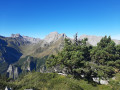
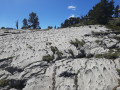
Another beautiful viewpoint over the Pic d’Anie and the Pic de Countendé. Please note: the climb via the Cheminée Ledormeur to the Col d’Oelharisse is difficult, with a risk of falling rocks: large groups should be avoided. A lovely walk across a sharp limestone pavement that requires a good sense of direction.

Details

n°107738858
Creation:
Last update:
Last review:
–
  • Walking
    Activity: Walking
  • ↔
    Distance: 6.61 mi
  • ◔
    Average duration: 5h 25 
  • ▲
    Difficulty: Very difficult

  • ⚐
    Back to start: Yes
  • ↗
    Ascent: + 2,762 ft
  • ↘
    Descent: - 2,769 ft

  • ▲
    Highest point: 6,673 ft
  • ▼
    Lowest point: 4,672 ft

Photos

Description of the walk

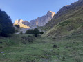
From Oloron-Sainte-Marie, head towards Spain (Jaca, Col du Somport), then turn right towards Lescun and finally Abérouat: there is a large car park before the Refuge de l’Abérouat.

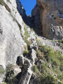
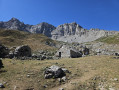
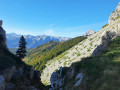
(S/E) Climb the grassy slopes above the car park (path), cross the scree to the left (cairns) towards a beech wood and climb up through it. Reach a ridge covered in thorny bushes; climb up it and cross to the right (cairn) towards a wide corridor of earth and stones, the Cheminée Ledormeur. Follow this up to the ridge to reach the Col d’Oelharisse.

(1) Take the path on the right to reach Pic Oelharisse, staying below the ridge.

(2) Return to the pass via the same route.

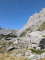
(1) Follow the ridge more or less closely (using the trail, cairns and your sense of direction): there are no particularly distinctive landmarks to help describe the route. Reach a first summit (1,905 m) then a second at an altitude of 2,041 m.

(3) Descend directly to the Pas d’Azuns: a steep descent following a faint track. Join the GR®10.

(4) Descend to the left via switchbacks to the Cabane du Cap de la Baitch.

(5) Continue left on the GR®10 to reach the Cabane d’Ardinet.

(6) Carry on to cross the Bois du Braca d’Azuns and reach the Refuge de l’Abérouat, then its car park (S/E).

Waypoints

  1. S/E : mi 0 - alt. 4,695 ft - Car park - Refuge de l'Abérouat
  2. 1 : mi 0.65 - alt. 6,289 ft - Pass
  3. 2 : mi 0.83 - alt. 6,375 ft - Pic Oelharisse
  4. 3 : mi 3.17 - alt. 6,617 ft - Les Tourelles
  5. 4 : mi 3.61 - alt. 6,142 ft - Pas d'Azuns (1873 m)
  6. 5 : mi 4.16 - alt. 5,515 ft - Cabane du Cap de la Baitch (1689 m)
  7. 6 : mi 4.73 - alt. 5,082 ft - Ardinet Hut
  8. S/E : mi 6.61 - alt. 4,695 ft - Car park - Refuge de l'Abérouat

Always be cautious and plan ahead when you're outdoors. Visorando and the author of this route cannot be held responsible for any accidents occurring on this route.

The GR® and PR® markings are the intellectual property of the Fédération Française de Randonnée Pédestre.

Other walks in the area

For more walks, use our search engine .

The GPS track and description are the property of this route's author. Please do not copy them without permission.