


 Country:

 City:
City:


(S) From the Col des Guérins, take the D19 towards Sigoyer. Continue until you reach a wayside shrine near Les Guérins.
(1) Turn right onto a path marked GRP®. Continue along this path, which runs along the hillside. Ignore two paths on the left and continue until you reach a road.
(2) Turn left on the descent to the RD 19, heading towards the hamlet of Au-delà du Pont.
(3) You can reach the village of Sigoyer by taking the D19 to the left. To do this, carry on straight ahead until you reach the village.
(4) Take in the village, then turn back towards the third stream at the hamlet of Au-delà du Pont.
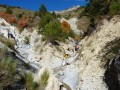
(3) Cross the gully. Turn left and quickly leave the D19 to climb, on the right, up a forest track through a beautiful beech forest. Follow this track towards La Saulce. Keep going straight ahead until you reach the road and the Col de Foureyssasse.
(5) Cross the D19 and carry on along the forest road, which is marked by a barrier. Follow the GRP® signpost towards La Saulce. Turn right at the first two junctions to reach a road near the telecoms masts. Carry on straight ahead until the next bend at the foot of the Serre Botier.
(6) Turn left onto an old tarmac road which continues as a footpath (yellow markings). Keep following the path downhill through a beech forest until you reach the hamlet of Tournoux.
(7) Continue along the road to cross the hamlet and, further on, follow the path on the right up the slope marked GR®93. At the road, first turn right then left then right again to rejoin the path leading to the Pont de Baudon.
(8) After the bridge, turn right onto Route des Chaumasses and continue along the D119 towards Tallard aerodrome until you reach the roundabout.
(9) Cross the Route Napoléon by taking the second exit, then turn right at the bend. Continue straight ahead and reach the centre of Tallard via the Chemin du Milieu, which crosses the airfield. At the end of the path, keep left onto the D942. Pass the post office and you will come to a monument. (E).

 Visorando Member

 Moderate
 Very difficult
 Easy
Easy 
