The Chemin de la Pia and the viewpoint over the Plaine d’Herbouilly

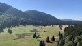
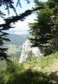
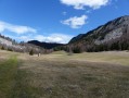
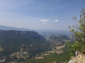
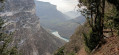
Enjoy crossing the unspoilt site of the magnificent Plaine d’Herbouilly. Then, from Roche Rousse on the Chemin de la Pia, admire the Vierge du Vercors and the Plaine de Saint-Martin. Next, as you pass by the Belvédère des Chaumes, take in the whole of the Plaine d’Herbouilly at a single glance.

Details

61054193
Creation:
Last update:
Last review:
  • Walking
    Activity: Walking
  • ↔
    Distance: 5.70 mi
  • ◔
    Average duration: 3h 20 
  • ▲
    Difficulty: Moderate

  • ⚐
    Back to start: Yes
  • ↗
    Ascent: + 820 ft
  • ↘
    Descent: - 837 ft

  • ▲
    Highest point: 4,672 ft
  • ▼
    Lowest point: 4,114 ft

Photos

Description of the walk

The walk starts from a car park alongside the D221, about 2 km north of the car park at the Herbouilly Nordic Centre.

(S/E) Head east, cross the D221 and take the path opposite. At the first junction, go straight on.

(1) At the next junction, cross theGRP® Tour du Vercors Dromois trail, continue straight on and reach the Herbouilly spring.

(2) After about thirty metres, turn right. Walk south-south-west along the edge of the forest until you reach the junction with theGRP® Tour du Vercors Dromois, which you crossed earlier.

(3) Follow theGRP® to the left (red and yellow markings).

(4) Cross the D221 and take the path heading west until you reach a T-junction.

(5) Then turn right (north). At the next junction, turn left. Continue straight on until you reach a paragliding launch site at the edge of the plateau.

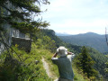
(6) Turn right (north-north-west) onto a path running along the edge of the plateau, the Chemin de la Pia. Pass a hut, move away from the edge of the plateau heading east, and reach a junction.

(7) Turn sharply left. After a hairpin bend to the right, you’ll reach a T-junction.

(8) Then turn left. Ignore a path branching off to the left and head north-east.

(9) At the junction, continue north along a wide forest track until you reach a wide forest path. Further on, the path turns north-east.

(10) At the next junction, take the hairpin bend to the right. After a hairpin bend to the left, at a Fork in the road, head off to the left. Continue northwards to the Col d’Herbouilly.

(11) Cross the D221 and turn sharply right to quickly reach the Font Froide spring. Join theGRP® Tour du Vercors Dromois and follow it to the right (red and yellow markings).

(12) At the first meadow, turn right at the edge of the forest. Carry on straight ahead to the viewpoint on the D221.

(13) Retrace your steps, follow the D221 for a few dozen metres, then turn right into the meadow. Head north-east until you rejoin theGRP® Tour du Vercors Dromois at an elevation of 1322.

(14) Follow it to the right (south).

(1) At the junction you passed at the start of the walk, turn right. Continue straight on, cross the D221 one last time and you’ll immediately reach the car park (S/E).

Waypoints

  1. S/E : mi 0 - alt. 4,308 ft - Car park – D221 road
  2. 1 : mi 0.27 - alt. 4,222 ft - Junction of the circular loop
  3. 2 : mi 0.38 - alt. 4,219 ft - Junction – Source d’Herbouilly
  4. 3 : mi 0.81 - alt. 4,193 ft - GRP junction
  5. 4 : mi 1.15 - alt. 4,245 ft - Crossing the D221
  6. 5 : mi 1.41 - alt. 4,373 ft - T-junction
  7. 6 : mi 1.74 - alt. 4,219 ft - Pas de Saint-Martin
  8. 7 : mi 2.06 - alt. 4,304 ft - Crossroads
  9. 8 : mi 2.36 - alt. 4,416 ft - T-junction
  10. 9 : mi 2.94 - alt. 4,511 ft - Junction – Forest track
  11. 10 : mi 3.64 - alt. 4,580 ft - Junction
  12. 11 : mi 4.01 - alt. 4,488 ft - Col d'Herbouilly (1370m)
  13. 12 : mi 4.45 - alt. 4,344 ft - Junction
  14. 13 : mi 4.68 - alt. 4,386 ft - Point de vue sur la Plaine d'Herbouilly
  15. 14 : mi 4.88 - alt. 4,324 ft - GRP junction
  16. S/E : mi 5.7 - alt. 4,308 ft - Car park – D221 road

Notes

On this route or nearby, there are several springs, including the Source d’Herbouilly, the Fontaine de Font Froide, the Fontaine des Scialets Mistri and the Ruisseau du Riou. Are they all safe to drink and always flowing? Regardless, for this hike lasting a few hours, it’s best to bring your own supply of water.

Between points ( 6) and (7), the route runs along the edge of a cliff; please remain vigilant.

This route passes through a protected area, which may be subject to special regulations:

Worth a visit

(6) The Pas de Saint-Martin paragliding launch site, with a beautiful view over the plain and the village of Saint-Martin-en-Vercors.

The Chemin de la Pia hut and a view of the Vierge du Vercors (a monolithic rock jutting out from the cliff).

(13) Viewpoint above the RD 220 overlooking the entire Plaine d’Herbouilly. The access point to the orientation table is 80 metres north and to the left of the RD 220.

Between (14) and (1) lie the ruins of the Herbouilly farm, which was burnt down in 1944.

The Roybon mountain inn is approximately 2.5 km south of S/E (the Herbouilly Nordic skiing site).

Reviews and comments

4.3 / 5
Based on 4 reviews

Reliability of the description
4.3 / 5
Ease of following the route
4.5 / 5
Route interest
4.3 / 5
User 22434695

Overall rating : 4.3 / 5

Date of your route : Jul 24, 2026
Reliability of the description : ★★★★☆ Good
Ease of following the route : ★★★★☆ Good
Route interest : ★★★★★ Very good
Very busy route : No

A magnificent plain. But the path at the edge of the woods is nowhere to be found. Stay in the middle of the plain.

Machine-translated

Jacques Pierre
Jacques Pierre

Overall rating : 4.7 / 5

Date of your route : May 26, 2026
Reliability of the description : ★★★★★ Very good
Ease of following the route : ★★★★★ Very good
Route interest : ★★★★☆ Good
Very busy route : No

A pleasant, partly shaded walk, presenting no difficulties.
A quick note: at marker 1 in the description, it is best to turn immediately right onto the GRP Tour du Vercors Dromois. If you continue straight ahead as indicated, it is impossible to turn right at the edge of the forest. There is no marked path and the route is difficult to follow. So I turned back.

Machine-translated

Dany14
Dany14

Overall rating : 4.7 / 5

Date of your route : Nov 10, 2025
Reliability of the description : ★★★★★ Very good
Ease of following the route : ★★★★★ Very good
Route interest : ★★★★☆ Good
Very busy route : Yes

Route that does not require any particular skills. Superb view from the lookout point.

Machine-translated

Elissalde
Elissalde

Overall rating : 3.7 / 5

Date of your route : Oct 07, 2024
Reliability of the description : ★★★☆☆ Average
Ease of following the route : ★★★★☆ Good
Route interest : ★★★★☆ Good
Very busy route : No

At point 6, the Chemin de la Pia runs along the cliff face and is not recommended for those who are prone to vertigo.

Machine-translated

Other walks in the area

For more walks, use our search engine .

The GPS track and description are the property of this route's author. Please do not copy them without permission.