Country:
 City:
City:


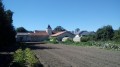
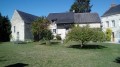
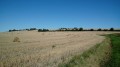
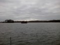
Start at Étang de Beuxes (spacious car park). From the village of Beuxes, follow the signs for ‘Étang de Beuxes’ or ‘Aire de loisirs’.
Yellow markings
Markers or arrows on small dedicated wooden signs at junctions (no markings away from junctions). The markings are one-way, in the direction of this description.
(S/E) Leave the car park by going back through the entrance gate and turn immediately right (north-north-east) onto a small tarmac road, following the sign for “Sentier des Crêtes”.
(1) As you approach a house, turn left, follow a stony track and walk alongside a poplar grove on your right.
(2) Just before a concrete bridge without a railing, turn left onto a grassy path (not shown on the IGN map) and walk alongside a stream on your right. After about 400m, turn right and cross the stream. Ignore a path branching off to the left (also not shown on the map) and, in open country, head up to the right of a hamlet.
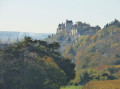
(3) When a path joins from the right, veer left and cross the hamlet of La Motte (view of the Château du Coudray-Montpensier on the right). At the end of Chemin de la Gravelle, make a zigzag turn and head towards La Grande Cour (a large complex of buildings on the left). Then turn left onto the road.
(4) After a few metres, at the start of a right-hand bend, leave the road and continue straight on. Walk past a large house on your right and continue downhill along a grassy path that begins with a hedge on the right-hand side. At the bottom, continue straight on (south-south-west) along a gravel path leading to the hamlet of La Rondière. At the fork in the road at the entrance, turn left onto a dirt track.
(5) You’ll come out onto a small road; follow it to the left. At the Fork in the road that appears shortly afterwards, turn left, then ignore a small lane on the right leading to a house. Staying on the tarmac, walk past a wood on your right, cross a road on the left, enter the wood and then cross a stream.
(6) At a left-hand bend (sign: ‘No vehicles over 19 tonnes’), leave the road and turn left onto a track at the edge of the woodland. Enter the woodland and continue along this pleasant track. Leave the woodland, ignore two track junctions on the left in succession (one of which is not shown on the map) and turn right with the track.
(7) At the end of the track, follow the small road to the left. Immediately ignore a track branching off to the right, stay on the tarmac, pass through the hamlet of Cufroy and reach the Étang de Beuxes (S/E).

 Visorando Member

 Moderate