The Washerwomen’s Walk in Rivière

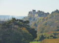
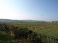
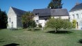
A pleasant little walk that allows you to discover a very pretty, typical village of the Touraine region.

Details

341627
Creation:
Last update:
Last review:
  • Walking
    Activity: Walking
  • ↔
    Distance: 3.03 mi
  • ◔
    Average duration: 1h 25 
  • ▲
    Difficulty: Easy

  • ⚐
    Back to start: Yes
  • ↗
    Ascent: + 16 ft
  • ↘
    Descent: - 16 ft

  • ▲
    Highest point: 125 ft
  • ▼
    Lowest point: 102 ft
  • ⚐ Country: France
  • ⚐ City: Rivière (37500)
  • ⚑
    Start/End: N 47.143242° / E 0.271453°
  • ❏
    IGN map(s): Ref. 1723ET, 1724SB
  • Hour-by-hour weather

Description of the walk

Park on the dirt track (several spaces available)
(S/E) Head towards the village via Rue du Gouffre, until you reach a three-way junction.

(1) Turn left and, at the town hall junction, turn left for 100m to reach the roundabout, the main entrance to the castle.

(2) Retrace your steps, heading down towards the Vienne, which you’ll find by taking the second street on the right.

(3) Walk past the church.

(4) Take the entrance to the small alleyway to the right of the pediment, go between the houses and immediately turn left into the alleyway. At the end of the alleyway, turn left until you reach the riverbank.

(5) Follow the river on the right until you reach the entrance to the next street. Turn right onto it and, at the end of Rue de la Vienne, turn left onto Rue de la Varanne and continue until you reach the cross marking the start of Rue d’Argenson, which you should also follow to the end.

Before reaching the D749, turn right onto Rue des Plantes, cross Rue du Port opposite towards Rue de la Berthaudière, which you will take on the right-hand side until you reach the small roundabout. Continue straight ahead.

At the corner of Rue de la Croix Mission, there are two options (see practical information).
Take the path on the left just after the barn at the crossroads. Follow it to the end of Rue du Bois de Rivière, alongside the grain silos, then turn right.

Follow the street all the way to the end, taking care at the junction with Rue des Lavandières, the village’s main street, and reach the starting point (S/E).

Waypoints

  1. S/E : mi 0 - alt. 118 ft - Bois de Rivière crossroads. Towards the - Veude (rivière)
  2. 1 : mi 0.3 - alt. 121 ft - Picnic table
  3. 2 : mi 0.4 - alt. 121 ft - Main entrance - Château de Rivière
  4. 3 : mi 0.53 - alt. 121 ft - Notre Dame Church - Eglise classée de RIvière
  5. 4 : mi 0.56 - alt. 125 ft - The Little Alley
  6. 5 : mi 0.62 - alt. 102 ft - Edge - Bord de Vienne
  7. S/E : mi 3.03 - alt. 118 ft - Bois de Rivière crossroads

Notes

Water point near the public toilets at the Salle des Fêtes opposite the main entrance to the castle (2).
Picnic table behind the town hall in the Jardin du Souvenir (1).

Shortened route: continue straight on between the castle wall and the cemetery wall to reach (2), then (1) and return to the starting point.

Worth a visit

Take a look at the details of the pretty houses in the old town (4).
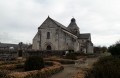
The listed Notre-Dame Church,::3::
The private Château de Rivière(2).
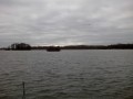
The banks of the River Vienne(5).

Reviews and comments

4.6 / 5
Based on 3 reviews

Reliability of the description
4.7 / 5
Ease of following the route
4.3 / 5
Route interest
4.7 / 5
bournigault
bournigault

Overall rating : 4.3 / 5

Date of your route : Nov 05, 2018
Reliability of the description : ★★★★★ Very good
Ease of following the route : ★★★☆☆ Average
Route interest : ★★★★★ Very good

On this route, you can visit the interior of the magnificent church in Rivière. It features some beautiful frescoes and recumbent statues.
A village on the banks of the Vienne, peaceful and with beautiful scenery along the riverbanks.

Machine-translated

CatherineGM
CatherineGM

You’re right, there are plenty of ways to follow the route along the waterfront and Rue d’Argenson, depending on your preference (unspoilt nature, historic buildings or a mix of both), but depending on the season, these aren’t always very accessible or may even be closed off.
But it’s impossible to get lost.

Machine-translated

CatherineGM
CatherineGM

Thank you for your comment. It’s true that starting from the town hall car park would be ideal, but given its small size, the council prefers to keep it for users of the town hall, the school and the library.

Alternatively, we could move the start point to the cemetery car park, but I found the reception there a bit odd.

Machine-translated

clubcyclosaintemaure

Overall rating : 5 / 5

Date of your route : Nov 07, 2016
Reliability of the description : ★★★★★ Very good
Ease of following the route : ★★★★★ Very good
Route interest : ★★★★★ Very good

An easy and very pleasant walk; it would be easier to start from the car park by the town hall.

Machine-translated

marieetmichel
marieetmichel

Overall rating : 4.3 / 5

Date of your route : Sep 18, 2016
Reliability of the description : ★★★★☆ Good
Ease of following the route : ★★★★★ Very good
Route interest : ★★★★☆ Good

The starting point is a bit tricky to find. In fact, it’s more of a three-way junction than a T-junction.
When you reach the crossroads by the town hall, turn right rather than left to reach the main entrance to the castle
The church is an absolute must-see! It’s beautiful!
Once you reach the riverbank, rather than heading back up to the start of the next street, I recommend following the path along the water – it’s just as pleasant and takes you to the junction with Rue d’Argenson.
Similarly, on Rue d’Argenson there is a small ‘sunken path’ that runs alongside a stream and also leads out before the D749. Then take Rue des Plantes. This path may not be suitable in all seasons.
Otherwise, enjoy your walk. The houses and narrow streets are lovely.

Machine-translated

Other walks in the area

For more walks, use our search engine .

The GPS track and description are the property of this route's author. Please do not copy them without permission.