Country:
 City:
City:


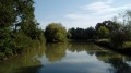

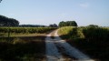
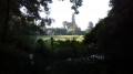
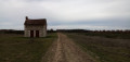
The walk starts at the Étang d’Arbonneau, situated to the north of the village of Ceaux-en-Loudun and accessible via a small road that ends in a stony track. Parking is available on two large grassy areas, to the left or right at the end of the track.
Yellow markings
Markings or arrows on small wooden signposts at junctions (no markings away from junctions). The markings are one-way, in the direction of this description.
(S/E) Set off north-west, i.e. along the stony track you arrived on by car.
(1) Leave the track when it bends to the right and turn left onto a wide path through the woods. Ignore a path on the right. Turn right with the path (bend not shown on the map) and come out at a T-junction.
(2) Then turn left (south; no signpost here). Cross a forest track, the left-hand branch of which leads to Château d’Artigny. Leave the woods, follow a hedge on your right-hand side, then head between the fields. Pass at the foot of a large oak tree and ignore the path leading off to the right towards a ruined house. Come out onto a small road and follow it to the left.
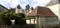
(3) At the junction (with a cross on the right), carry on straight ahead along the small road and pass through the hamlet of Bois Béranger. Shortly afterwards, before the top of a small ‘bump’, leave the road and turn left onto a farm track which skirts a field on the right. Then head north-east along the edge of the woodland on your right. Ignore a path leading to a group of buildings on the left; note the Château d’Artigny further on to the left and continue to the end of the track.
(4) At the T-junction, carry on straight ahead along a grassy track. Pass the Fontaine Chamaillard on your left (a small pond) and head north-north-east, with a hedge on your left and fenced meadows on your right, until you come out onto a small road (with a view of the Château de Basché on the right).
(5) Continue north-north-east along the small road. Just past the house at a place called La Judellière, turn left onto a grassy path. Cross a stream and, at the Fork in the road that appears immediately, turn left.
(6) At the next fork, take the path on the right (the one on the left is a shortcut; see the practical information). Cross a small wood, then walk along the edge of the wood on your left. Go round the Besnarderie property on the right (wall on your left). You’ll come out onto a small road; follow it to the left.
(7) When you reach a white gate on the left-hand side, leave the road and turn right (west-north-west) onto a grassy track (pass a ‘No vehicles over 3.5 tonnes’ sign on your left). At the crossroads, continue straight ahead. At the next junction, at the edge of a wood, turn left onto a farm track. At the next junction, veer slightly to the right. Then ignore a path coming from the right and reach the small road leading to the pond (oratory).
(8) Then turn sharply left and follow the road for about 150 metres. Before a row of trees, turn right (south-east) onto a grassy track between the fields. At the next junction, turn left and walk along the edge of the woodland on your right. At the next junction, turn right onto the stony track you took to reach the starting point by car. Turn right along the track and head towards the fork you took at the start of the walk.
(1) Stay on the track which turns left and soon leads to the car park by the pond (S/E).

 Visorando Member
 Moderate