Short circular loop around Saint-Mexant

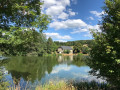
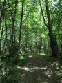
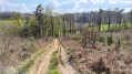
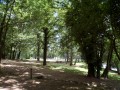
This walk is a short, family-friendly circular route through lush meadows, mainly along footpaths with only very short stretches of road.

Details

n°50368552
Creation:
Last update:
Last review:
  • Walking
    Activity: Walking
  • ↔
    Distance: 3.38 mi
  • ◔
    Average duration: 1h 50 
  • ▲
    Difficulty: Easy

  • ⚐
    Back to start: Yes
  • ↗
    Ascent: + 279 ft
  • ↘
    Descent: - 259 ft

  • ▲
    Highest point: 1,506 ft
  • ▼
    Lowest point: 1,306 ft

Photos

Description of the walk

At the start, you can park (two or even three vehicles) on the right-hand side of this small road, in a grassy area where the neighbourhood bins are located and where you’ll find the small yellow ‘C1’ sign marking the start.

This route is signposted in yellow all the way along.

(S/E) Head straight on towards Les Brochs. Very soon, turn left, following the yellow arrow on the small sign.

(1) After a few dozen metres, head down the path on the right.

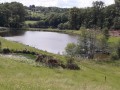
(2) At the bottom of this path, turn right and walk alongside a pond. Pass through the first wetland area.

(3) At the junction, turn left. Head north-west.

(4) Just before you reach a road, turn right. Walk alongside a woodland and then rejoin the tarmac road amongst a few houses.

(5) At the junction, follow a busy road to the right: take care.

(6) At a place called Les Pages, take a path on the right. Follow this path south-east through meadows. Continue along a short tarmac section.

(7) Cross the road carefully and turn onto the small track directly in front of you. You’ll soon rejoin the small road; follow it to the left for a few dozen metres.

(8) At the hamlet of Lacoste, turn sharply right and follow a path that is more open than the previous ones.

(3) At the junction you took on the way out, carry straight on. You’ll come back to the pond; this time, walk along its right-hand side.

(2) Turn left.

(1) Turn left again, then right to return to the starting point (S/E).

Waypoints

  1. S/E : mi 0 - alt. 1,391 ft - Car park
  2. 1 : mi 0.11 - alt. 1,411 ft - Junction
  3. 2 : mi 0.26 - alt. 1,365 ft - Pond
  4. 3 : mi 0.6 - alt. 1,339 ft - Junction of the circular loop
  5. 4 : mi 1.13 - alt. 1,440 ft - Junction
  6. 5 : mi 1.53 - alt. 1,493 ft - Crossroads
  7. 6 : mi 1.74 - alt. 1,470 ft - Les Pages – Start of the path
  8. 7 : mi 2.34 - alt. 1,424 ft - Crossing the road
  9. 8 : mi 2.46 - alt. 1,358 ft - Lacoste – Junction
  10. S/E : mi 3.38 - alt. 1,391 ft - Car park

Notes

In May 2024, the ground was soft following heavy rainfall in the preceding months. It’s no problem with good walking shoes or even wellies for the little ones.

Worth a visit

This walk will immerse you in the heart of the Corrèze countryside. Take in the scenery!

At (4), a farm rearing Cul Noir du Limousin pigs (a local breed covered by a conservation programme).

You’ll be able to admire some beautiful old buildings, some in need of restoration and others already renovated.

Reviews and comments

4.7 / 5
Based on 1 review

Reliability of the description
5 / 5
Ease of following the route
5 / 5
Route interest
4 / 5
Aurélie19
Aurélie19

Overall rating : 4.7 / 5

Date of your route : Aug 19, 2025
Reliability of the description : ★★★★★ Very good
Ease of following the route : ★★★★★ Very good
Route interest : ★★★★☆ Good
Very busy route : No

A short, easy loop. Very little road traffic. The route has some shaded sections.
The only drawbacks are that there is no parking at the start. I had to park on the side of the local road near the start sign. And you have to cross the D53 road at Les Pages, where there is some traffic. You need to be very careful.
Please note: the small path to take in the village of Les Chabanes is quite steep and slippery.
I recommend high walking shoes and walking sticks for this route.

Machine-translated

Other walks in the area

For more walks, use our search engine .

The GPS track and description are the property of this route's author. Please do not copy them without permission.