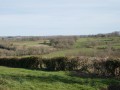
Short circular loop around Saint-Gilles

Suitable for walking, mountain biking or horse riding, this short circular route takes you along lovely paths and, in particular, runs alongside the River Abloux through a pleasant spot in the woods.

Details

n°12891280
Creation:
Last update:
Last review:
  • Walking
    Activity: Walking
  • ↔
    Distance: 3.41 mi
  • ◔
    Average duration: 1h 45 
  • ▲
    Difficulty: Easy

  • ⚐
    Back to start: Yes
  • ↗
    Ascent: + 184 ft
  • ↘
    Descent: - 174 ft

  • ▲
    Highest point: 807 ft
  • ▼
    Lowest point: 607 ft

Description of the walk

The start is in Saint-Gilles, at the bus shelter.

(S/E) From the bus shelter, cross the main road and take the road opposite (Allée des Acacias). At the end, turn left.

(1) At the next T-junction, turn right onto Rue de la Font. This becomes a track after a few dozen metres. Continue until you reach a Fork in the road.

(2) Keep to the right and follow the same path, which passes under some power lines, until you come to another road.

(3) Turn right and walk through the hamlet of La Villonnière. At the next bend, take the path on your right. You’ll soon reach a junction.

(4) Leave the main stony path on your left and take the grassy path opposite. Carry on until you soon reach a Fork in the road.

(5) Head slightly to the left, pass by a pond and begin a gentle climb. Pass under the power lines and shortly afterwards you’ll reach a road junction.

(6) Turn right onto the road towards Saint-Gilles to return to the bus shelter car park (S/E).

Waypoints

  1. S/E : mi 0 - alt. 781 ft - Saint-Gilles bus shelter
  2. 1 : mi 0.09 - alt. 768 ft - Rue de la Font
  3. 2 : mi 0.51 - alt. 696 ft - T-junction
  4. 3 : mi 1.62 - alt. 738 ft - La Villonière
  5. 4 : mi 2.09 - alt. 784 ft - Crossroads on the grassy path
  6. 5 : mi 2.36 - alt. 774 ft - T-junction
  7. 6 : mi 3.05 - alt. 807 ft - Road from Parnac to Saint-Gilles
  8. S/E : mi 3.41 - alt. 781 ft - Saint-Gilles bus shelter

Reviews and comments

5 / 5
Based on 1 review

Reliability of the description
5 / 5
Ease of following the route
5 / 5
Route interest
5 / 5
FrancoisD68
FrancoisD68

Overall rating : 5 / 5

Date of your route : May 13, 2024
Reliability of the description : ★★★★★ Very good
Ease of following the route : ★★★★★ Very good
Route interest : ★★★★★ Very good
Very busy route : No

A lovely route for a walk.

Machine-translated

Other walks in the area

For more walks, use our search engine .

The GPS track and description are the property of this route's author. Please do not copy them without permission.