Saint-Génard
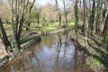
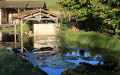
Saint-Génard, a French commune covering 1,200 hectares in the Deux-Sèvres department and the Poitou-Charentes region, comprises a scattered settlement of several small hamlets situated mainly along the watercourses: the Marseillaise, the Berlande, the Coudrière and the Légère.
The main village was originally called Nossay (Villa Nauciacus). It was the birthplace of a Poitou noble family well documented from the 12th century onwards, the Nossays, Lords of Mont (a ruined castle situated not far from the village).
The name Saint-Génard derives from the parish church: over the centuries, the name gradually evolved from ‘Nossay’ to Saint-Génard de Nossay and then simply to Saint-Génard.
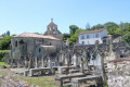
The church is situated in the heart of the countryside, about 500 metres from the village. It was probably originally a hermitage founded in the Merovingian period. A vast necropolis developed around this sanctuary during the Carolingian period. Later, a priory belonging to Nouaillé-Maupertuis Abbey was established in the middle of the old cemetery, next to the sanctuary. This priory was destroyed during the Wars of Religion.
The Church of Saint-Génard stands on or near the site of an important place of worship dating from the Merovingian period, as indicated by the discovery of sarcophagi.
This priory-parish, which was under the jurisdiction of Nouaillé Abbey, was merged in 1697 with the convent at Puyberland, a small village in the commune of Saint-Génard situated near the source of the Berlande.
At that time, the convent was home to 80 nuns. During the Revolution, when the parish was abolished, there were only 15 nuns and 6 lay sisters remaining. Alongside their contemplative life, the sisters carried out teaching and hospitality work.
Around 1878, the magnificent door that linked the convent church to the nuns’ oratory was reused in the chapel of the Melle hospice, where it can still be seen today.
The parish did not have a parish priest again until the end of the 19th century, owing to the existence of a religious school.
The present church, in the Romanesque style, probably dates from the 12th century and contains two 15th-century recumbent effigies.
The inhabitants of Saint-Génard are known as ‘Saint-Génardais’ and ‘Saint-Génardaises’
The archaeological site at Saint-Génard was discovered by chance in 2004, during works to extend the village cemetery. Since then, a series of excavations – initially emergency excavations, followed by planned ones – have taken place. An Early Medieval necropolis and the foundations of several buildings, forming part of a former priory, have been unearthed. The necropolis contains two types of burial: sarcophagus burials and so-called ‘rock-cut’ graves, hewn into the limestone. This might suggest a change in funeral practices over time, but the anthropological study (i.e. the analysis of the bones) tends to support the idea of a distinction between individuals within the same period. The sarcophagi all consist of a monolithic trapezoidal chamber. Most of the lids have not been found and were evidently reused for the foundations and walls of the priory. Those that have been preserved are decorated with variations on the traditional Poitevin pattern featuring three transverse bands. The rock-cut graves are not simply burials in the open ground: some of them suggest the use of wooden formwork, which has since disappeared. The existence of a priory at Saint-Génard, dependent on the Abbey of Nouaillé-Maupertuis, is suggested by sources from the second half of the 12th century, the period when the present Romanesque church was built. This would then have replaced an earlier place of worship, mentioned in 1118, and its construction may therefore have been contemporary with the priory. The north wall of the nave, the sole remnant of the original church, was incorporated into the new building. The first two monastic buildings were erected in the late 12th or early 13th century, and were subsequently partially demolished to make way for a new building. These alterations may have taken place in the late 13th or early 14th century, when the priory enjoyed the favour of the lords of Monts, who had their recumbent effigies placed in burial niches within the church’s nave. During the 15th and 16th centuries, this new building underwent several alterations, such as the addition of a vestibule featuring a spiral staircase, indicating the existence of an upper floor. The artefacts found (coins, pottery, etc.) bear witness to the abandonment of the site, followed by looting, in the second half of the 16th century. Several historical records attest to the destruction of the priory during the 17th century, following damage caused during the Wars of Religion.
Sources: the municipality’s official website and Parvis Catholique
Puyberland
The Convent of Puyberland
Built on the ruins of an ancient Gallo-Roman villa, which had been replaced by a feudal residence, the monastery of Puy-Berland – known as ‘the Convent’ – was founded in 1649 by Madame de Céris, who had renounced her Protestant faith. It was home to as many as 80 nuns; by the time of the Revolution, only 15 remained, teaching young girls from noble and middle-class families and taking in elderly or isolated women. The altarpiece from the monastery’s former church is the finest feature of Tillou Church, and the south side of the rood screen (or ‘great choir screen’) was bequeathed to the Melle hospice, which used it as the door to its chapel.
Although it was dismantled during the Revolution, the 17th-century complex still looks impressive and retains its coherence: arranged around several courtyards are the prior’s quarters, the chaplain’s quarters, the chapel, the refectory, the oven, the storeroom and, further away, the dovecote.
Chapels and churches in the Pays Mellois contain numerous elements reused from the priory: the rood screen served as a door for the chapel at Melle Hospital; part of the altarpiece can be found in Tillou Church; and an architectural ensemble was converted into an altarpiece for the chancel of Saint-Vincent-la-Châtre Church.
Source: walking guides ‘Les trois rivières’ published by the FFRandonnée des Deux-Sèvres and ‘Sur les pas de Chasseron’ published by the Syndicat Mixte du Pays Mellois.



 Country:
 City:


 Visorando Member


 Moderate